
Seller's Agent in 2025
Caitlin Gannon
RE/MAX
(401) 487-7946
5 in this area
35 Total Sales
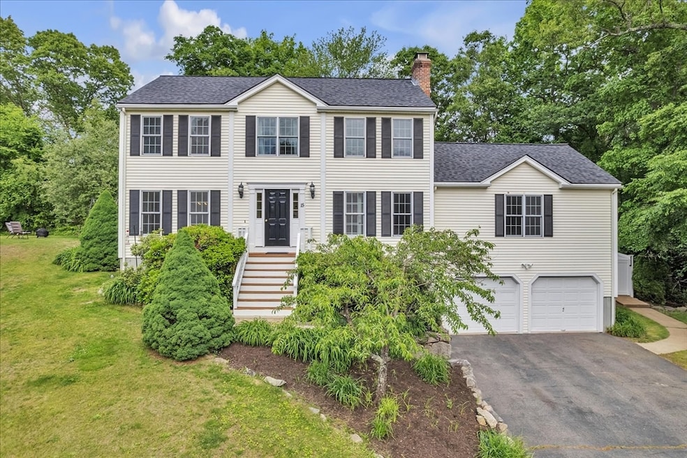
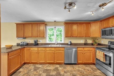
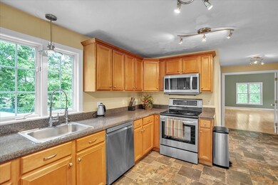
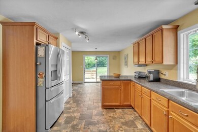
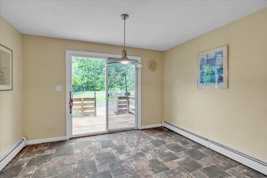
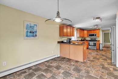

This warm and inviting colonial home offers the perfect blend of comfort, space, and charm in a cul-de-sac neighborhood. Step inside to find a cabinet-packed, eat-in kitchen, a formal dining room perfect for entertaining, and a spacious formal living room. The highlight of the first floor is the expansive great room, featuring hardwood floors and a stunning floor-to-ceiling wood-burning fireplace — a cozy gathering spot year-round. Upstairs, you’ll find four generously sized bedrooms, including a luxurious master suite complete with a large walk-in closet, master bath with a relaxing jacuzzi tub and separate shower. Convenience with first-floor laundry and plenty of storage throughout. Step outside to enjoy a heated inground pool — perfect for summer fun — and a flat, partially fenced side yard ideal for play, pets, or gardening. Enjoy your very own peach tree. High ceilings in basement allows for future expansion. This home has so much to offer both inside and out!
| Date | Type | Sale Price | Title Company |
|---|---|---|---|
| Quit Claim Deed | $720,000 | -- | |
| Quit Claim Deed | $720,000 | -- | |
| Deed | $417,500 | -- | |
| Deed | $417,500 | -- | |
| Deed | $417,500 | -- |
| Date | Status | Loan Amount | Loan Type |
|---|---|---|---|
| Open | $576,000 | New Conventional | |
| Closed | $576,000 | New Conventional | |
| Previous Owner | $215,700 | Purchase Money Mortgage |
| Date | Event | Price | List to Sale | Price per Sq Ft |
|---|---|---|---|---|
| 07/16/2025 07/16/25 | Sold | $720,000 | +5.1% | $294 / Sq Ft |
| 06/03/2025 06/03/25 | Pending | -- | -- | -- |
| 05/28/2025 05/28/25 | For Sale | $685,000 | -- | $280 / Sq Ft |
| Year | Tax Paid | Tax Assessment Tax Assessment Total Assessment is a certain percentage of the fair market value that is determined by local assessors to be the total taxable value of land and additions on the property. | Land | Improvement |
|---|---|---|---|---|
| 2025 | $7,844 | $598,300 | $153,000 | $445,300 |
| 2024 | $7,439 | $575,800 | $145,200 | $430,600 |
| 2023 | $7,091 | $508,300 | $125,600 | $382,700 |
| 2022 | $6,417 | $423,300 | $109,900 | $313,400 |
| 2021 | $6,659 | $420,900 | $107,500 | $313,400 |
| 2020 | $6,714 | $401,100 | $106,000 | $295,100 |
| 2019 | $6,642 | $382,800 | $106,000 | $276,800 |
| 2018 | $6,420 | $373,900 | $106,000 | $267,900 |
| 2017 | $6,270 | $369,700 | $103,600 | $266,100 |
| 2016 | $6,446 | $366,900 | $95,000 | $271,900 |
| 2015 | $6,295 | $361,800 | $95,000 | $266,800 |
Seller's Agent in 2025
Caitlin Gannon
RE/MAX
(401) 487-7946
5 in this area
35 Total Sales
Buyer's Agent in 2025
Dave Serpa
Coldwell Banker Realty - Franklin
(401) 639-2351
1 in this area
128 Total Sales
Source: MLS Property Information Network (MLS PIN)
MLS Number: 73381640
APN: UXBR-000410-001461
Disclaimer: Certain information contained herein is derived from information provided by parties other than Homes.com. All information provided is deemed reliable, but is not guaranteed to be accurate and should be independently verified.
![]() The property listing data and information, or the Images, set forth herein were provided to MLS Property Information Network, Inc. from third party sources, including sellers, lessors and public records, and were compiled by MLS Property Information Network, Inc. The property listing data and information, and the Images, are for the personal, non-commercial use of consumers having a good faith interest in purchasing or leasing listed properties of the type displayed to them and may not be used for any purpose other than to identify prospective properties which such consumers may have a good faith interest in purchasing or leasing. MLS Property Information Network, Inc. and its subscribers disclaim any and all representations and warranties as to the accuracy of the property listing data and information, or as to the accuracy of any of the Images, set forth herein.
The property listing data and information, or the Images, set forth herein were provided to MLS Property Information Network, Inc. from third party sources, including sellers, lessors and public records, and were compiled by MLS Property Information Network, Inc. The property listing data and information, and the Images, are for the personal, non-commercial use of consumers having a good faith interest in purchasing or leasing listed properties of the type displayed to them and may not be used for any purpose other than to identify prospective properties which such consumers may have a good faith interest in purchasing or leasing. MLS Property Information Network, Inc. and its subscribers disclaim any and all representations and warranties as to the accuracy of the property listing data and information, or as to the accuracy of any of the Images, set forth herein.