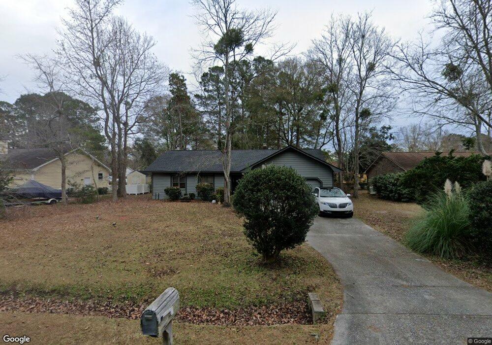
15 Shawnee Trail Myrtle Beach, SC 29588
Estimated Value: $309,020 - $318,000
3
Beds
2
Baths
1,722
Sq Ft
$181/Sq Ft
Est. Value
About This Home
This home is located at 15 Shawnee Trail, Myrtle Beach, SC 29588 and is currently estimated at $312,505, approximately $181 per square foot. 15 Shawnee Trail is a home located in Horry County with nearby schools including Socastee Elementary School, Forestbrook Middle School, and Socastee High School.
Ownership History
Date
Name
Owned For
Owner Type
Purchase Details
Closed on
Oct 21, 2005
Sold by
Thompson Herbert G and Thompson Pat Saidi
Bought by
Thompson Pat Saidi and Thompson Patricia
Current Estimated Value
Create a Home Valuation Report for This Property
The Home Valuation Report is an in-depth analysis detailing your home's value as well as a comparison with similar homes in the area
Home Values in the Area
Average Home Value in this Area
Purchase History
| Date | Buyer | Sale Price | Title Company |
|---|---|---|---|
| Thompson Pat Saidi | -- | -- |
Source: Public Records
Tax History Compared to Growth
Tax History
| Year | Tax Paid | Tax Assessment Tax Assessment Total Assessment is a certain percentage of the fair market value that is determined by local assessors to be the total taxable value of land and additions on the property. | Land | Improvement |
|---|---|---|---|---|
| 2024 | $664 | $11,833 | $4,000 | $7,833 |
| 2023 | $664 | $5,431 | $989 | $4,442 |
| 2021 | $603 | $6,137 | $989 | $5,148 |
| 2020 | $517 | $6,137 | $989 | $5,148 |
| 2019 | $517 | $6,137 | $989 | $5,148 |
| 2018 | $467 | $4,723 | $963 | $3,760 |
| 2017 | $452 | $4,723 | $963 | $3,760 |
| 2016 | -- | $4,723 | $963 | $3,760 |
| 2015 | $461 | $4,723 | $963 | $3,760 |
| 2014 | $427 | $4,723 | $963 | $3,760 |
Source: Public Records
Map
Nearby Homes
- 2 Sioux Trail
- 71 Plantation Rd
- 4 Plantation Rd
- 102 Plantation Rd
- 489 Wallingford Cir
- 209 Stonebrook Dr
- 215 Tibton Cir
- 5724 Dogwood Cir
- 424 Wallingford Cir
- 4008 Braid Ct
- 1017 Shem Creek Cir Unit Bridge Creek
- Parcel "A" Palmetto Pointe Blvd
- 389 Cattle Drive Cir
- 121 Olde Towne Way Unit 2
- 609 Glen Haven Dr
- 113 Olde Towne Way Unit 3
- 209 Foxpath Loop
- 2397 River Rd
- 109 Old Town Way Unit 4
- 313 Foxpath Loop
- 17 Shawnee Trail
- 13 Shawnee Trail
- 12 Sioux Trail
- 14 Sioux Trail
- 19 Shawnee Trail
- 11 Shawnee Trail
- 10 Sioux Trail
- 16 Sioux Trail
- 8 Sioux Trail
- 21 Shawnee Trail
- 9 Shawnee Trail
- 17 Cimerron Dr
- 23 Shawnee Trail
- 15 Sioux Trail
- 6 Sioux Trail Unit MB
- 19 Cimerron Dr
- 13 Sioux Trail
- 7 Shawnee Trail
- 11 Sioux Trail Unit MB
- 4 Sioux Trail