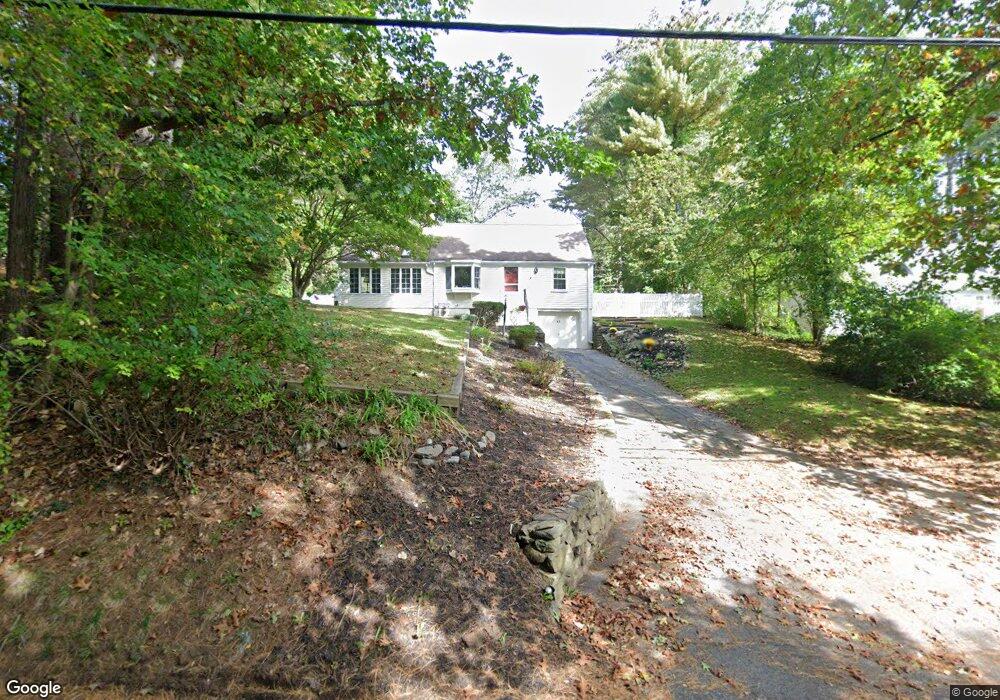
15 Sherman Bridge Rd Wayland, MA 01778
Estimated Value: $886,000 - $1,149,000
3
Beds
2
Baths
1,620
Sq Ft
$594/Sq Ft
Est. Value
About This Home
This home is located at 15 Sherman Bridge Rd, Wayland, MA 01778 and is currently estimated at $962,297, approximately $594 per square foot. 15 Sherman Bridge Rd is a home located in Middlesex County with nearby schools including Wayland High School, Willow Hill School, and Corwin-Russell School at Broccoli Hall.
Ownership History
Date
Name
Owned For
Owner Type
Purchase Details
Closed on
Aug 24, 2018
Sold by
Gove John B and Gove Ruth B
Bought by
Gove Ft
Current Estimated Value
Purchase Details
Closed on
Apr 12, 1977
Bought by
Gove John B and Gove Ruth B
Create a Home Valuation Report for This Property
The Home Valuation Report is an in-depth analysis detailing your home's value as well as a comparison with similar homes in the area
Home Values in the Area
Average Home Value in this Area
Purchase History
| Date | Buyer | Sale Price | Title Company |
|---|---|---|---|
| Gove Ft | -- | -- | |
| Gove John B | -- | -- | |
| Gove Ft | -- | -- |
Source: Public Records
Mortgage History
| Date | Status | Borrower | Loan Amount |
|---|---|---|---|
| Previous Owner | Gove John B | $170,000 |
Source: Public Records
Tax History Compared to Growth
Tax History
| Year | Tax Paid | Tax Assessment Tax Assessment Total Assessment is a certain percentage of the fair market value that is determined by local assessors to be the total taxable value of land and additions on the property. | Land | Improvement |
|---|---|---|---|---|
| 2025 | $11,723 | $750,000 | $480,900 | $269,100 |
| 2024 | $11,084 | $714,200 | $457,900 | $256,300 |
| 2023 | $10,769 | $646,800 | $416,300 | $230,500 |
| 2022 | $10,425 | $568,100 | $344,800 | $223,300 |
| 2021 | $9,940 | $536,700 | $313,400 | $223,300 |
| 2020 | $9,532 | $536,700 | $313,400 | $223,300 |
| 2019 | $9,162 | $501,200 | $298,500 | $202,700 |
| 2018 | $8,687 | $481,800 | $298,500 | $183,300 |
| 2017 | $8,431 | $464,800 | $284,200 | $180,600 |
| 2016 | $7,699 | $444,000 | $278,500 | $165,500 |
| 2015 | $7,987 | $434,300 | $278,500 | $155,800 |
Source: Public Records
Map
Nearby Homes
- 15 Lewis Path
- 12 Pine Ridge Rd
- 11 Grove St
- 134 Chestnut Cir
- 93 Old Sudbury Rd
- 224 Aspen Cir
- 244 Lincoln Rd
- 236 Lincoln Rd
- 25 Birchwood Ln
- 49 Birchwood Ln Unit 49
- 50 3 Ponds Rd
- 24 Claypit Hill Rd
- Lot 5 Sailaway Ln
- Lot 4 Sailaway Ln
- 2 Betts Way
- 8 Mina Way
- 0 Elm Unit 73282184
- Lot 9 Sailaway Ln
- 4 Betts Way
- 122 Sand Gully Rd N Unit B
- 17 Sherman Bridge Rd
- 13 Sherman Bridge Rd
- 7 Red Barn Rd
- 11 Sherman Bridge Rd
- 19 Sherman Bridge Rd
- 14 Tally Ho Ln
- 19 Sherman's Bridge Rd
- 12 Sherman Bridge Rd
- 18 Sherman Bridge Rd
- 18 Sherman's Bridge Rd
- 12 Tally Ho Ln
- 9 Sherman Bridge Rd
- 8 Red Barn Rd
- 10 Sherman Bridge Rd
- 8 Tally Ho Ln
- 5 Sherman Bridge Rd
- 13 Tally Ho Ln
- 24 Sherman Bridge Rd
- 12 Red Barn Rd
- 3 Sherman Bridge Rd