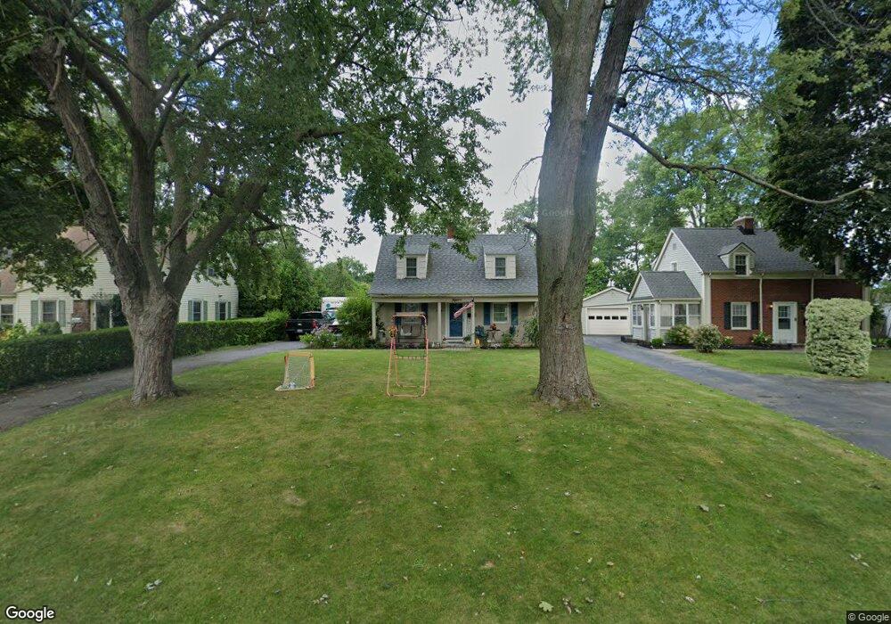
15 Sherwood Ave Webster, NY 14580
Estimated Value: $278,267 - $290,000
2
Beds
1
Bath
1,416
Sq Ft
$202/Sq Ft
Est. Value
About This Home
This home is located at 15 Sherwood Ave, Webster, NY 14580 and is currently estimated at $286,317, approximately $202 per square foot. 15 Sherwood Ave is a home located in Monroe County with nearby schools including State Road Elementary School, Spry Middle School, and Webster-Schroeder High School.
Ownership History
Date
Name
Owned For
Owner Type
Purchase Details
Closed on
Mar 24, 2025
Sold by
Christman James C
Bought by
Deninnis Laura and Thomas Scott
Current Estimated Value
Purchase Details
Closed on
Aug 13, 2007
Sold by
Laplant Gregory
Bought by
Christman James
Home Financials for this Owner
Home Financials are based on the most recent Mortgage that was taken out on this home.
Original Mortgage
$117,000
Interest Rate
6.67%
Mortgage Type
New Conventional
Purchase Details
Closed on
Jan 12, 2001
Sold by
Falker Cynthia Davidian
Bought by
Laplant Gregory S
Create a Home Valuation Report for This Property
The Home Valuation Report is an in-depth analysis detailing your home's value as well as a comparison with similar homes in the area
Home Values in the Area
Average Home Value in this Area
Purchase History
| Date | Buyer | Sale Price | Title Company |
|---|---|---|---|
| Deninnis Laura | -- | None Listed On Document | |
| Deninnis Laura | -- | None Listed On Document | |
| Christman James | $130,000 | Robert Blazak | |
| Laplant Gregory S | $88,000 | Michael G Grow |
Source: Public Records
Mortgage History
| Date | Status | Borrower | Loan Amount |
|---|---|---|---|
| Previous Owner | Christman James | $117,000 |
Source: Public Records
Tax History Compared to Growth
Tax History
| Year | Tax Paid | Tax Assessment Tax Assessment Total Assessment is a certain percentage of the fair market value that is determined by local assessors to be the total taxable value of land and additions on the property. | Land | Improvement |
|---|---|---|---|---|
| 2024 | $5,040 | $105,700 | $27,000 | $78,700 |
| 2023 | $4,816 | $105,700 | $27,000 | $78,700 |
| 2022 | $5,264 | $105,700 | $27,000 | $78,700 |
| 2021 | $5,222 | $105,700 | $27,000 | $78,700 |
| 2020 | $4,492 | $105,700 | $27,000 | $78,700 |
| 2019 | $4,027 | $105,700 | $27,000 | $78,700 |
| 2018 | $4,234 | $105,700 | $27,000 | $78,700 |
| 2017 | $3,994 | $105,700 | $27,000 | $78,700 |
| 2016 | $4,027 | $105,700 | $27,000 | $78,700 |
| 2015 | -- | $105,700 | $27,000 | $78,700 |
| 2014 | -- | $105,700 | $27,000 | $78,700 |
Source: Public Records
Map
Nearby Homes
- 79 South Ave
- 13 Ashwood Ln
- 1128 Ridge Rd
- 261 South Ave
- 171 Cranbrook Terrace
- 143 London Rd
- 178 Cranbrook Terrace
- 107 Cranbrook Terrace
- 130 Brannon Ln
- 32 Hawley Dr
- 1258 State Rd
- 61 Autumn Leaf Trail
- 224 Rayfield Cir
- 90 Hefner Dr
- 84 Autumn Leaf Trail
- 78 Cedarway Cir Unit 311
- 70 Cedarway Cir Unit 307
- 757 Bel Arbor Trail
- 109 Cedarway Cir Unit 409
- 105 Cedarway Cir Unit 411
- 17 Sherwood Ave
- 13 Sherwood Ave
- 19 Sherwood Ave
- 11 Sherwood Ave
- 21 Sherwood Ave
- 16 Sherwood Ave
- 18 Sherwood Ave
- 14 Sherwood Ave
- 25 Sherwood Ave
- 20 Sherwood Ave
- 12 Sherwood Ave
- 22 Sherwood Ave
- 144 W Main St
- 27 Sherwood Ave
- 24 Sherwood Ave
- 134 W Main St
- 26 Sherwood Ave
- 29 Sherwood Ave
- 152 W Main St
- 28 Sherwood Ave