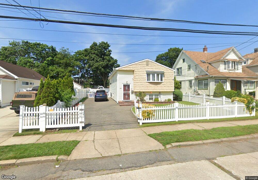
15 Shonnard Ave Freeport, NY 11520
Estimated Value: $679,000 - $706,443
5
Beds
2
Baths
1,073
Sq Ft
$646/Sq Ft
Est. Value
About This Home
This home is located at 15 Shonnard Ave, Freeport, NY 11520 and is currently estimated at $692,722, approximately $645 per square foot. 15 Shonnard Ave is a home located in Nassau County with nearby schools including Columbus Avenue School, Caroline G. Atkinson Intermediate School, and John W Dodd Middle School.
Ownership History
Date
Name
Owned For
Owner Type
Purchase Details
Closed on
Mar 1, 2021
Sold by
Duvall Janice
Bought by
Livingston Janoy and Livingston Joseph Shion
Current Estimated Value
Home Financials for this Owner
Home Financials are based on the most recent Mortgage that was taken out on this home.
Original Mortgage
$486,034
Outstanding Balance
$435,695
Interest Rate
2.7%
Mortgage Type
FHA
Estimated Equity
$257,027
Purchase Details
Closed on
Jan 8, 2015
Sold by
Vinas Dominga
Bought by
Duval Janice
Home Financials for this Owner
Home Financials are based on the most recent Mortgage that was taken out on this home.
Original Mortgage
$183,000
Interest Rate
3.96%
Mortgage Type
New Conventional
Purchase Details
Closed on
Jun 9, 2006
Sold by
White Heyward
Bought by
Vinas Dominga
Create a Home Valuation Report for This Property
The Home Valuation Report is an in-depth analysis detailing your home's value as well as a comparison with similar homes in the area
Home Values in the Area
Average Home Value in this Area
Purchase History
| Date | Buyer | Sale Price | Title Company |
|---|---|---|---|
| Livingston Janoy | $495,000 | Westcor Land Title | |
| Duval Janice | $235,000 | None Available | |
| Vinas Dominga | $396,000 | -- |
Source: Public Records
Mortgage History
| Date | Status | Borrower | Loan Amount |
|---|---|---|---|
| Open | Livingston Janoy | $486,034 | |
| Previous Owner | Duval Janice | $183,000 |
Source: Public Records
Tax History Compared to Growth
Tax History
| Year | Tax Paid | Tax Assessment Tax Assessment Total Assessment is a certain percentage of the fair market value that is determined by local assessors to be the total taxable value of land and additions on the property. | Land | Improvement |
|---|---|---|---|---|
| 2025 | $7,633 | $354 | $104 | $250 |
| 2024 | $757 | $354 | $104 | $250 |
| 2023 | $7,579 | $375 | $121 | $254 |
| 2022 | $7,579 | $354 | $104 | $250 |
| 2021 | $9,826 | $396 | $110 | $286 |
| 2020 | $8,162 | $544 | $272 | $272 |
| 2019 | $1,153 | $695 | $348 | $347 |
| 2018 | $1,861 | $695 | $0 | $0 |
| 2017 | $8,364 | $695 | $348 | $347 |
| 2016 | $9,407 | $695 | $348 | $347 |
| 2015 | $1,004 | $695 | $348 | $347 |
| 2014 | $1,004 | $695 | $348 | $347 |
| 2013 | $949 | $695 | $348 | $347 |
Source: Public Records
Map
Nearby Homes
- 26 Rosedale Ave
- 96 N Columbus Ave
- 98 N Columbus Ave
- 6 Frederick Ave
- 11 Mount Ave
- 182 Grand Ave
- 45 Lakeview Ave
- 268 Grand Ave
- 251 Grand Ave
- 47 Harding Place
- 78 Jesse St
- 221 E Dean St
- 70 S Main St Unit 307-PH
- 45 Dehnhoff Ave
- 67 E Dean St
- 70 N Grove St Unit 1R
- 101 Harris Ave
- 173 E Seaman Ave
- 112 E Seaman Ave
- 55 Harris Ave
- 7 Shonnard Ave
- 17 Shonnard Ave
- 5 Shonnard Ave
- 19 Shonnard Ave
- 22 Rutland Rd
- 26 Rutland Rd
- 18 Rutland Rd
- 143 Commercial St
- 30 Rutland Rd
- 25 Shonnard Ave
- 12 Shonnard Ave
- 16 Shonnard Ave
- 8 Shonnard Ave
- 34 Rutland Rd
- 133 Commercial St
- 151 Commercial St
- 22 Shonnard Ave
- 38 Rutland Rd
- 29 Shonnard Ave
- 121 Commercial St