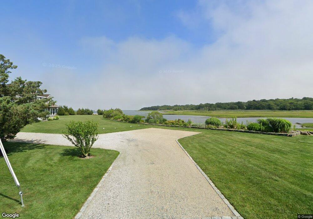
15 Shoreview Ave Mattapoisett, MA 02739
Estimated Value: $1,382,124 - $1,992,000
4
Beds
2
Baths
1,620
Sq Ft
$991/Sq Ft
Est. Value
About This Home
This home is located at 15 Shoreview Ave, Mattapoisett, MA 02739 and is currently estimated at $1,604,781, approximately $990 per square foot. 15 Shoreview Ave is a home located in Plymouth County with nearby schools including Center School, Old Hammondtown Elementary, and Old Rochester Regional High School.
Ownership History
Date
Name
Owned For
Owner Type
Purchase Details
Closed on
May 19, 2015
Sold by
Clark Lisa
Bought by
15 Shoreview Avenue Llc
Current Estimated Value
Purchase Details
Closed on
Jul 2, 1999
Sold by
15 Shoreview Ave Nt and Moura Alfred F
Bought by
White Clifford L and Farrell Mary K
Create a Home Valuation Report for This Property
The Home Valuation Report is an in-depth analysis detailing your home's value as well as a comparison with similar homes in the area
Home Values in the Area
Average Home Value in this Area
Purchase History
| Date | Buyer | Sale Price | Title Company |
|---|---|---|---|
| 15 Shoreview Avenue Llc | -- | -- | |
| 15 Shoreview Avenue Llc | -- | -- | |
| White Clifford L | $355,000 | -- | |
| 15 Shoreview Avenue Llc | -- | -- | |
| White Clifford L | $355,000 | -- |
Source: Public Records
Mortgage History
| Date | Status | Borrower | Loan Amount |
|---|---|---|---|
| Previous Owner | White Clifford L | $155,000 | |
| Previous Owner | White Clifford L | $25,000 | |
| Previous Owner | White Clifford L | $12,500 |
Source: Public Records
Tax History Compared to Growth
Tax History
| Year | Tax Paid | Tax Assessment Tax Assessment Total Assessment is a certain percentage of the fair market value that is determined by local assessors to be the total taxable value of land and additions on the property. | Land | Improvement |
|---|---|---|---|---|
| 2025 | $13,522 | $1,256,700 | $985,800 | $270,900 |
| 2024 | $13,177 | $1,253,800 | $985,800 | $268,000 |
| 2023 | $11,351 | $1,008,944 | $756,244 | $252,700 |
| 2022 | $10,595 | $854,404 | $629,804 | $224,600 |
| 2021 | $9,499 | $732,956 | $547,656 | $185,300 |
| 2020 | $9,253 | $685,900 | $521,600 | $164,300 |
| 2019 | $9,061 | $685,900 | $521,600 | $164,300 |
| 2018 | $9,193 | $706,100 | $554,000 | $152,100 |
| 2017 | $9,748 | $745,800 | $600,000 | $145,800 |
| 2016 | $9,379 | $710,500 | $577,200 | $133,300 |
| 2015 | $8,815 | $678,100 | $544,800 | $133,300 |
| 2014 | $8,664 | $681,100 | $554,000 | $127,100 |
Source: Public Records
Map
Nearby Homes
- 1 Starboard Way
- 41 Starboard Way
- 0 Whalers Way
- 0 Harbor Acres Ln - Lot B
- 7 Pearl St
- 12 Cannon St
- 6 Meadowbrook Ln
- 0 Marina Dr Unit 72497908
- 0 Marina Dr Unit 72497877
- 11 Captains Ln
- 8 Captains Ln
- 47 Fairhaven Rd
- 15 Ned's Point Rd
- 35 North St
- 83 Fairhaven Rd
- 9 Hitching Post Rd
- 7 Mattakiset Rd
- 3 Brandt Island Rd
- 28 Brandt Beach Ave
- 20 Forestview Dr
- 15 Shoreview Ave
- 6 Windward Way
- 57 Shoreview Ave
- 30 Windward Way
- 12 Shoreview Ave
- 11 Shoreview Ave
- 19 Shoreview Ave
- 18 Shoreview Ave
- 79 Mattapoisett Neck Rd
- 79 Mattapoisett Neck Rd Unit WINTER
- 79 Mattapoisett Neck Rd Unit Summer
- 79 Mattapoisett Neck Rd Unit 1
- 2 Windward Way
- 2 Windward Way Unit 1
- 9 Shoreview Ave
- 0 Starboard Way
- 37 Starboard Way
- 36 Starboard Way
- 8 Shoreview Ave
- 5 Shoreview Ave