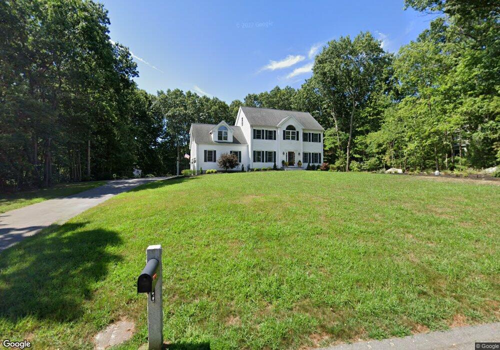
15 Stable Way Medway, MA 02053
Estimated Value: $1,092,054 - $1,352,000
4
Beds
3
Baths
4,053
Sq Ft
$293/Sq Ft
Est. Value
About This Home
This home is located at 15 Stable Way, Medway, MA 02053 and is currently estimated at $1,189,264, approximately $293 per square foot. 15 Stable Way is a home located in Norfolk County with nearby schools including John D. McGovern Elementary School, Burke-Memorial Elementary, and Medway Middle School.
Ownership History
Date
Name
Owned For
Owner Type
Purchase Details
Closed on
Aug 25, 1999
Sold by
Whelan Tr Greg
Bought by
Oconnor Kevin J and Oconnor Donna H
Current Estimated Value
Home Financials for this Owner
Home Financials are based on the most recent Mortgage that was taken out on this home.
Original Mortgage
$280,000
Interest Rate
7.53%
Mortgage Type
Purchase Money Mortgage
Create a Home Valuation Report for This Property
The Home Valuation Report is an in-depth analysis detailing your home's value as well as a comparison with similar homes in the area
Home Values in the Area
Average Home Value in this Area
Purchase History
| Date | Buyer | Sale Price | Title Company |
|---|---|---|---|
| Oconnor Kevin J | $389,900 | -- |
Source: Public Records
Mortgage History
| Date | Status | Borrower | Loan Amount |
|---|---|---|---|
| Open | Oconnor Kevin J | $100,000 | |
| Open | Oconnor Kevin J | $376,200 | |
| Closed | Oconnor Kevin J | $280,000 |
Source: Public Records
Tax History Compared to Growth
Tax History
| Year | Tax Paid | Tax Assessment Tax Assessment Total Assessment is a certain percentage of the fair market value that is determined by local assessors to be the total taxable value of land and additions on the property. | Land | Improvement |
|---|---|---|---|---|
| 2025 | $14,214 | $997,500 | $374,700 | $622,800 |
| 2024 | $14,364 | $997,500 | $374,700 | $622,800 |
| 2023 | $13,125 | $823,400 | $313,700 | $509,700 |
| 2022 | $12,315 | $727,400 | $231,000 | $496,400 |
| 2021 | $12,447 | $712,900 | $220,100 | $492,800 |
| 2020 | $12,318 | $703,900 | $222,300 | $481,600 |
| 2019 | $11,804 | $695,600 | $217,900 | $477,700 |
| 2018 | $12,141 | $687,500 | $217,900 | $469,600 |
| 2017 | $10,136 | $565,600 | $207,000 | $358,600 |
| 2016 | $10,440 | $576,500 | $217,900 | $358,600 |
| 2015 | $10,406 | $570,500 | $217,900 | $352,600 |
| 2014 | $10,266 | $544,900 | $215,700 | $329,200 |
Source: Public Records
Map
Nearby Homes
- 15 Broad Acres Farm Rd
- 12 Longmeadow Ln
- 78 Fisher St
- 56 Paul Rd
- 85 Fisher St
- 4 Deerfield Rd
- 116 Winthrop St
- 6 Rainbow Dr
- 6 Freedom Trail
- 19 Sycamore Way Unit L40
- 7 Hill St
- 5 Fales St
- 176 Main St Unit 3
- 39 West St
- 220 Main St Unit 220
- 14 Heritage Dr
- 22 Granite St
- 36 Lovering St
- 28 Wellington St
- 0 Hill St
- 13 Stable Way
- 24 Broad Acres Farm Rd
- 19 Stable Way
- 26 Broad Acres Farm Rd
- 14 Stable Way
- 16 Stable Way
- 22 Broad Acres Farm Rd
- 11 Stable Way
- 18 Stable Way
- 12 Stable Way
- 28 Broad Acres Farm Rd
- 23 Broad Acres Farm Rd
- 21 Stable Way
- 20 Stable Way
- 21 Broad Acres Farm Rd
- 20 Broad Acres Farm Rd
- 9 Stable Way
- 25 Broad Acres Farm Rd
- 10 Stable Way
- 22 Stable Way