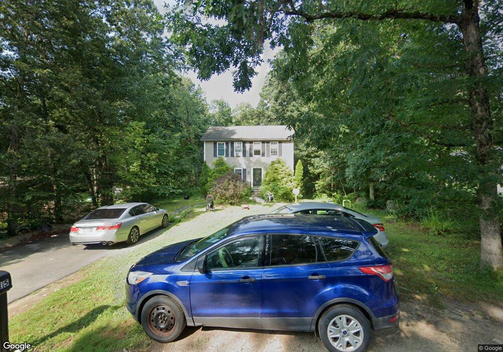
15 Staghead Dr Pascoag, RI 02859
Estimated Value: $447,000 - $517,000
3
Beds
2
Baths
1,560
Sq Ft
$301/Sq Ft
Est. Value
About This Home
This home is located at 15 Staghead Dr, Pascoag, RI 02859 and is currently estimated at $468,883, approximately $300 per square foot. 15 Staghead Dr is a home located in Providence County with nearby schools including Austin T. Levy School, Burrillville Middle School, and Burrillville High School.
Ownership History
Date
Name
Owned For
Owner Type
Purchase Details
Closed on
Nov 10, 2011
Sold by
Annon Michael J and Lenartowicz Joanna M
Bought by
Barry Lawrence A and Barry Shanna M
Current Estimated Value
Home Financials for this Owner
Home Financials are based on the most recent Mortgage that was taken out on this home.
Original Mortgage
$212,900
Outstanding Balance
$153,760
Interest Rate
4.01%
Mortgage Type
USDA
Estimated Equity
$315,123
Purchase Details
Closed on
Oct 19, 2009
Sold by
Accrington Realty Llc
Bought by
Annon Michael J and Lenartowicz Joanna M
Home Financials for this Owner
Home Financials are based on the most recent Mortgage that was taken out on this home.
Original Mortgage
$223,378
Interest Rate
5.14%
Mortgage Type
Purchase Money Mortgage
Create a Home Valuation Report for This Property
The Home Valuation Report is an in-depth analysis detailing your home's value as well as a comparison with similar homes in the area
Home Values in the Area
Average Home Value in this Area
Purchase History
| Date | Buyer | Sale Price | Title Company |
|---|---|---|---|
| Barry Lawrence A | $212,900 | -- | |
| Annon Michael J | $227,500 | -- | |
| Barry Lawrence A | $212,900 | -- |
Source: Public Records
Mortgage History
| Date | Status | Borrower | Loan Amount |
|---|---|---|---|
| Open | Barry Lawrence A | $212,900 | |
| Closed | Annon Michael J | $212,900 | |
| Previous Owner | Annon Michael J | $223,378 |
Source: Public Records
Tax History
| Year | Tax Paid | Tax Assessment Tax Assessment Total Assessment is a certain percentage of the fair market value that is determined by local assessors to be the total taxable value of land and additions on the property. | Land | Improvement |
|---|---|---|---|---|
| 2025 | $5,029 | $422,600 | $80,100 | $342,500 |
| 2024 | $4,821 | $321,800 | $64,100 | $257,700 |
| 2023 | $4,631 | $321,800 | $64,100 | $257,700 |
| 2022 | $4,476 | $321,800 | $64,100 | $257,700 |
| 2021 | $4,222 | $257,100 | $66,400 | $190,700 |
| 2020 | $4,116 | $257,100 | $66,400 | $190,700 |
| 2019 | $4,114 | $257,100 | $66,400 | $190,700 |
| 2018 | $4,064 | $223,300 | $59,600 | $163,700 |
| 2017 | $3,921 | $223,300 | $59,600 | $163,700 |
| 2016 | $3,883 | $223,300 | $59,600 | $163,700 |
| 2015 | $3,831 | $202,900 | $60,200 | $142,700 |
| 2014 | $3,231 | $202,900 | $60,200 | $142,700 |
Source: Public Records
Map
Nearby Homes
- 75 Staghead Dr
- 50 Round Lake Dr
- 0 Stag Head Dr Unit 1380191
- 0 Wallum Lake Rd
- 32 Avery Ln
- 27 Avery Ln
- 2535 Wallum Lake Rd
- 74 Crystal Terrace
- 14 Indian Run Dr
- 121 New Rd
- 597 E Thompson Rd Unit Lot 10C
- 117 New Rd
- 11 Wrightson Dr
- 151 Brandy Hill Rd
- 31 Marion Ave
- 75 Marion Ave
- 43 Laurel Hill Ave
- 248-252 Church St
- 248 Church St
- 156 Broad St
Your Personal Tour Guide
Ask me questions while you tour the home.