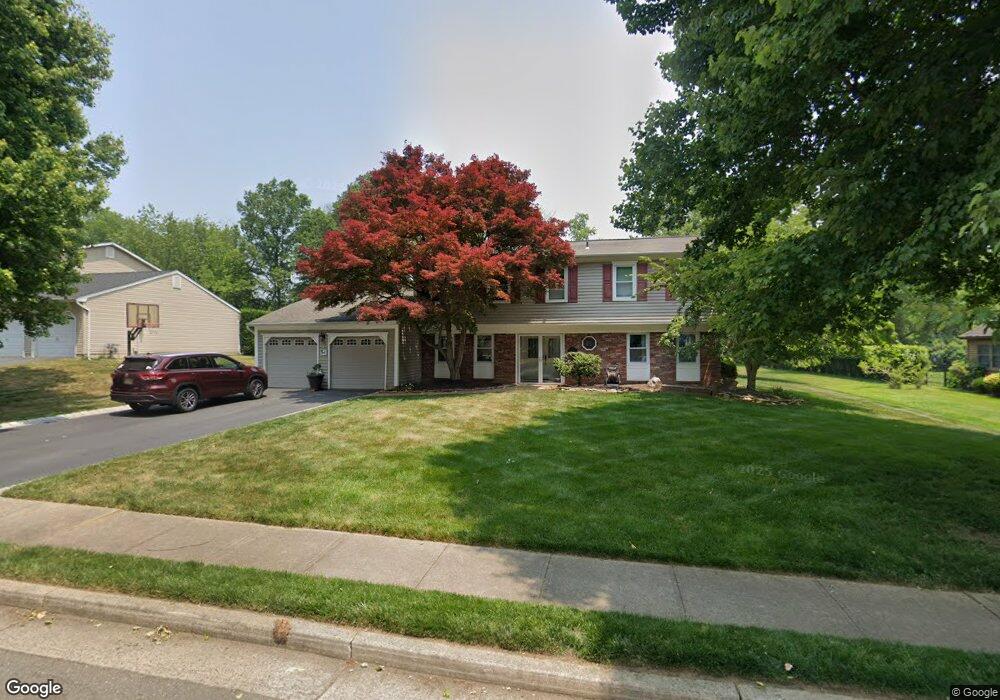
15 Stone Ln Marlboro, NJ 07746
Estimated Value: $878,239 - $1,042,000
4
Beds
2
Baths
2,676
Sq Ft
$358/Sq Ft
Est. Value
About This Home
This home is located at 15 Stone Ln, Marlboro, NJ 07746 and is currently estimated at $958,810, approximately $358 per square foot. 15 Stone Ln is a home located in Monmouth County with nearby schools including Frank J. Dugan Elementary School, Marlboro Middle School, and Marlboro High School.
Ownership History
Date
Name
Owned For
Owner Type
Purchase Details
Closed on
Jun 30, 1999
Sold by
Budka Kenneth
Bought by
Journick Kevin and Journick Anne
Current Estimated Value
Home Financials for this Owner
Home Financials are based on the most recent Mortgage that was taken out on this home.
Original Mortgage
$220,000
Outstanding Balance
$59,824
Interest Rate
7.19%
Estimated Equity
$898,986
Purchase Details
Closed on
Mar 30, 1994
Sold by
Chang Peter
Bought by
Budka Kenneth and Budka Cynthia Curtis
Home Financials for this Owner
Home Financials are based on the most recent Mortgage that was taken out on this home.
Original Mortgage
$202,000
Interest Rate
7.27%
Create a Home Valuation Report for This Property
The Home Valuation Report is an in-depth analysis detailing your home's value as well as a comparison with similar homes in the area
Home Values in the Area
Average Home Value in this Area
Purchase History
| Date | Buyer | Sale Price | Title Company |
|---|---|---|---|
| Journick Kevin | $281,900 | -- | |
| Budka Kenneth | $238,000 | -- |
Source: Public Records
Mortgage History
| Date | Status | Borrower | Loan Amount |
|---|---|---|---|
| Open | Journick Kevin | $220,000 | |
| Previous Owner | Budka Kenneth | $202,000 |
Source: Public Records
Tax History Compared to Growth
Tax History
| Year | Tax Paid | Tax Assessment Tax Assessment Total Assessment is a certain percentage of the fair market value that is determined by local assessors to be the total taxable value of land and additions on the property. | Land | Improvement |
|---|---|---|---|---|
| 2025 | $11,687 | $468,600 | $160,700 | $307,900 |
| 2024 | $11,171 | $468,600 | $160,700 | $307,900 |
| 2023 | $11,171 | $468,600 | $160,700 | $307,900 |
| 2022 | $10,886 | $468,600 | $160,700 | $307,900 |
| 2021 | $10,778 | $468,600 | $160,700 | $307,900 |
| 2020 | $10,773 | $468,600 | $160,700 | $307,900 |
| 2019 | $10,778 | $468,600 | $160,700 | $307,900 |
| 2018 | $10,595 | $468,600 | $160,700 | $307,900 |
| 2017 | $10,389 | $468,600 | $160,700 | $307,900 |
| 2016 | $10,347 | $468,600 | $160,700 | $307,900 |
| 2015 | $10,190 | $468,500 | $160,700 | $307,800 |
| 2014 | $9,999 | $454,900 | $160,700 | $294,200 |
Source: Public Records
Map
Nearby Homes
- 5 Homestead Cir
- 126 Wyncrest Rd
- 34 Brookside Cir
- 39 Homestead Cir
- 1 Weathervane Way
- 57 Coventry Terrace
- 69 Caldwell Terrace
- 48 Coventry Terrace
- 102 Murray Hill Terrace
- 40 Caldwell Terrace
- 4 Terrace Dr
- 54 Tracy Dr
- 69 School Rd W
- 26 Lansdale Dr
- 11 Liberty Rd
- 7 Bishop Ct
- 41 Longstreet Rd
- 39 Longstreet Rd
- 308 Pilot St
- 102 Pilot St