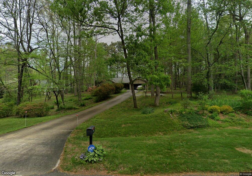
15 Stonecreek Ln E Dawsonville, GA 30534
Dawson County NeighborhoodEstimated Value: $340,467 - $366,000
3
Beds
2
Baths
1,288
Sq Ft
$272/Sq Ft
Est. Value
About This Home
This home is located at 15 Stonecreek Ln E, Dawsonville, GA 30534 and is currently estimated at $350,617, approximately $272 per square foot. 15 Stonecreek Ln E is a home located in Dawson County with nearby schools including Black's Mill Elementary School, Dawson County Middle School, and Dawson County Junior High School.
Ownership History
Date
Name
Owned For
Owner Type
Purchase Details
Closed on
Jun 6, 1994
Sold by
Laurie J
Bought by
Wentworth Andrew D
Current Estimated Value
Purchase Details
Closed on
Apr 25, 1994
Sold by
Laurie J
Bought by
Wentworth Andrew D
Purchase Details
Closed on
Apr 2, 1993
Sold by
Gina
Bought by
Holtzclaw David S
Purchase Details
Closed on
Dec 11, 1989
Sold by
Largen Construction
Bought by
Holtzclaw David S
Purchase Details
Closed on
May 18, 1989
Sold by
Pendley Lamar Loyd
Bought by
Largen Construction
Create a Home Valuation Report for This Property
The Home Valuation Report is an in-depth analysis detailing your home's value as well as a comparison with similar homes in the area
Home Values in the Area
Average Home Value in this Area
Purchase History
| Date | Buyer | Sale Price | Title Company |
|---|---|---|---|
| Wentworth Andrew D | -- | -- | |
| Wentworth Andrew D | $77,500 | -- | |
| Holtzclaw David S | -- | -- | |
| Holtzclaw David S | $76,000 | -- | |
| Largen Construction | $27,000 | -- |
Source: Public Records
Tax History Compared to Growth
Tax History
| Year | Tax Paid | Tax Assessment Tax Assessment Total Assessment is a certain percentage of the fair market value that is determined by local assessors to be the total taxable value of land and additions on the property. | Land | Improvement |
|---|---|---|---|---|
| 2024 | $1,142 | $117,720 | $14,000 | $103,720 |
| 2023 | $1,882 | $74,000 | $12,898 | $61,102 |
| 2022 | $1,542 | $74,000 | $12,898 | $61,102 |
| 2021 | $1,499 | $80,320 | $14,000 | $66,320 |
| 2020 | $1,804 | $78,240 | $14,000 | $64,240 |
| 2019 | $1,557 | $67,240 | $14,000 | $53,240 |
| 2018 | $1,319 | $67,240 | $14,000 | $53,240 |
| 2017 | $1,276 | $55,352 | $10,240 | $45,112 |
| 2016 | $1,204 | $52,327 | $10,240 | $42,087 |
| 2015 | $943 | $40,189 | $10,240 | $29,949 |
| 2014 | $796 | $33,224 | $8,704 | $24,520 |
| 2013 | -- | $27,616 | $7,168 | $20,448 |
Source: Public Records
Map
Nearby Homes
- 27 Wesley Way N
- 127 Riley Cir
- 64 Hughes Place Dr Unit 60
- 68 Hughes Place Dr
- 68 Hughes Place Dr Unit 59
- 72 Hughes Place Dr
- 72 Hughes Place Dr Unit 58
- 59 Hughes Place Dr
- 65 Hughes Place Dr
- 69 Hughes Place Dr
- 73 Hughes Place Dr
- 63 Meadowlark Way
- 55 Caboose Ln
- 0 Whitmire Dr Unit 10454771
- 0 Whitmire Dr Unit 10431935
- 115 Thimbleberry Dr
- 34 Sassafras Grove
- 277 Sequoia Ln
- 9 Stonecreek Ln E
- 39 Stonecreek Ln E
- 12 Laurel Dr E
- 12 Laurel Dr E
- 18 Laurel Dr E
- 24 Laurel Dr E
- 16 Stonecreek Ln W
- 30 Laurel Dr E
- 14 Ruthie Ln S
- 332 Sunshine Ct
- 36 Laurel Dr E
- 102 Mansie Park Dr
- 102 Mansie Park Dr
- 8 Ruthie Ln S
- 80 Shelter Ln E
- 101 Mansie Park Dr
- 42 Laurel Dr E
- 5 Ruthie Ln N
- 5 Ruthie Ln N
- 96 Mansie Park Dr