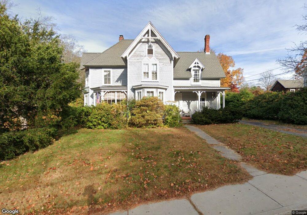
15 Summit St East Hampton, CT 06424
Estimated Value: $386,000 - $566,000
4
Beds
2
Baths
2,424
Sq Ft
$183/Sq Ft
Est. Value
About This Home
This home is located at 15 Summit St, East Hampton, CT 06424 and is currently estimated at $444,344, approximately $183 per square foot. 15 Summit St is a home located in Middlesex County with nearby schools including Memorial School, Center Elementary School, and East Hampton Middle School.
Ownership History
Date
Name
Owned For
Owner Type
Purchase Details
Closed on
Aug 7, 1987
Sold by
Halpin Gerald H
Bought by
Dagle Thomas J
Current Estimated Value
Home Financials for this Owner
Home Financials are based on the most recent Mortgage that was taken out on this home.
Original Mortgage
$75,000
Interest Rate
10.37%
Mortgage Type
Purchase Money Mortgage
Create a Home Valuation Report for This Property
The Home Valuation Report is an in-depth analysis detailing your home's value as well as a comparison with similar homes in the area
Home Values in the Area
Average Home Value in this Area
Purchase History
| Date | Buyer | Sale Price | Title Company |
|---|---|---|---|
| Dagle Thomas J | $199,500 | -- |
Source: Public Records
Mortgage History
| Date | Status | Borrower | Loan Amount |
|---|---|---|---|
| Closed | Dagle Thomas J | $82,000 | |
| Closed | Dagle Thomas J | $75,000 |
Source: Public Records
Tax History
| Year | Tax Paid | Tax Assessment Tax Assessment Total Assessment is a certain percentage of the fair market value that is determined by local assessors to be the total taxable value of land and additions on the property. | Land | Improvement |
|---|---|---|---|---|
| 2025 | $7,023 | $176,850 | $40,050 | $136,800 |
| 2024 | $6,727 | $176,850 | $40,050 | $136,800 |
| 2023 | $6,377 | $176,850 | $40,050 | $136,800 |
| 2022 | $6,130 | $176,850 | $40,050 | $136,800 |
| 2021 | $6,107 | $176,850 | $40,050 | $136,800 |
| 2020 | $5,682 | $171,450 | $39,350 | $132,100 |
| 2019 | $5,328 | $160,760 | $42,160 | $118,600 |
| 2018 | $5,035 | $160,760 | $42,160 | $118,600 |
| 2017 | $5,035 | $160,760 | $42,160 | $118,600 |
| 2016 | $4,733 | $160,760 | $42,160 | $118,600 |
| 2015 | $5,007 | $180,220 | $53,730 | $126,490 |
| 2014 | $4,356 | $180,220 | $53,730 | $126,490 |
Source: Public Records
Map
Nearby Homes
- 1 Watrous St
- 4 Watrous St
- 29 Watrous St
- 14 Main St
- 24 N Main St
- 2 Dogwood Dr
- 10 Fairlawn Ave
- 104 Lake Vista Dr Unit 104
- 1 Young St
- 95 Tarragon Dr
- 68 Colchester Ave
- 0002-6 Edgewater Cir
- 0002-5 Edgewater Cir
- 0002-7 Edgewater Cir
- 00023 Edgewater Cir
- 0002-3 Edgewater Cir
- 00025 Edgewater Cir
- 00026 Edgewater Cir
- 18 Lake Blvd
- 141 E High St
- 17 Summit St
- 2 Bevin Ct
- 19 Summit St
- 16 Summit St
- 18 Summit St
- 1 Starr Place
- 20 Summit St
- 25 Summit St
- 3 Starr Place
- 22 Summit St
- 1 Watrous St
- 1 Watrous St Unit F
- 1 Watrous St
- 24 Summit St
- 5 Starr Place
- 9 Starr Place
- 4 Starr Place
- 4 Starr Place Unit 2nd/3rd Floor
- 4 Starr Place Unit 1st Floor
- 7 Starr Place
Your Personal Tour Guide
Ask me questions while you tour the home.