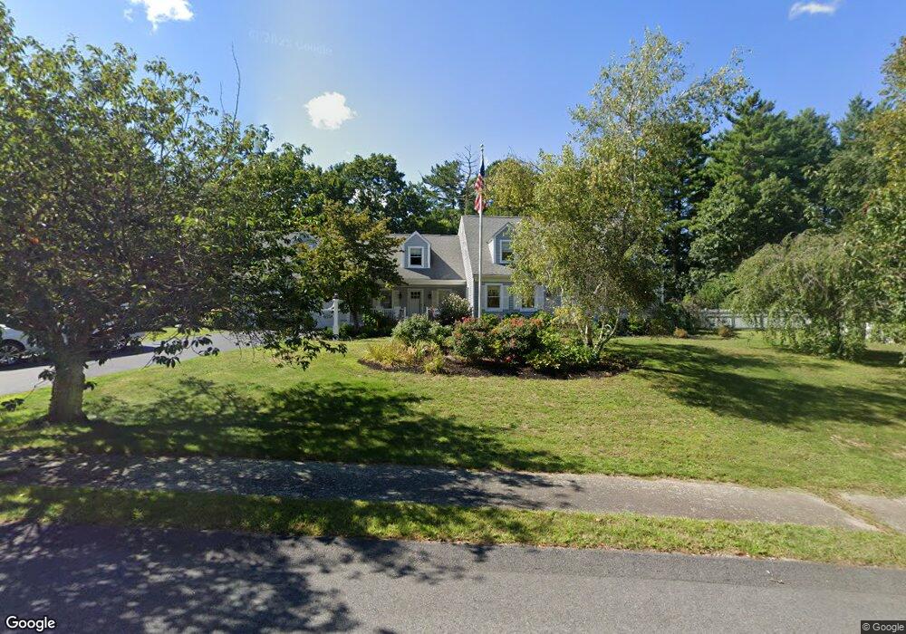
15 Tack Factory Pond Dr Scituate, MA 02066
Estimated Value: $1,433,000 - $1,606,000
4
Beds
3
Baths
3,317
Sq Ft
$458/Sq Ft
Est. Value
About This Home
This home is located at 15 Tack Factory Pond Dr, Scituate, MA 02066 and is currently estimated at $1,519,710, approximately $458 per square foot. 15 Tack Factory Pond Dr is a home located in Plymouth County with nearby schools including Cushing Elementary School, Lester J. Gates Middle School, and Scituate High School.
Ownership History
Date
Name
Owned For
Owner Type
Purchase Details
Closed on
Jun 5, 2023
Sold by
Ridge William G and Ridge Lisa T
Bought by
Ridge Asset Protection Re and Ridge
Current Estimated Value
Create a Home Valuation Report for This Property
The Home Valuation Report is an in-depth analysis detailing your home's value as well as a comparison with similar homes in the area
Home Values in the Area
Average Home Value in this Area
Purchase History
| Date | Buyer | Sale Price | Title Company |
|---|---|---|---|
| Ridge Asset Protection Re | -- | None Available |
Source: Public Records
Tax History Compared to Growth
Tax History
| Year | Tax Paid | Tax Assessment Tax Assessment Total Assessment is a certain percentage of the fair market value that is determined by local assessors to be the total taxable value of land and additions on the property. | Land | Improvement |
|---|---|---|---|---|
| 2025 | $12,791 | $1,280,400 | $488,900 | $791,500 |
| 2024 | $12,647 | $1,220,800 | $444,500 | $776,300 |
| 2023 | $11,880 | $1,067,400 | $367,300 | $700,100 |
| 2022 | $11,487 | $910,200 | $322,200 | $588,000 |
| 2021 | $10,711 | $803,500 | $306,900 | $496,600 |
| 2020 | $10,379 | $768,800 | $295,100 | $473,700 |
| 2019 | $10,203 | $742,600 | $289,300 | $453,300 |
| 2018 | $10,041 | $719,800 | $286,400 | $433,400 |
| 2017 | $9,974 | $707,900 | $274,500 | $433,400 |
| 2016 | $9,840 | $695,900 | $262,500 | $433,400 |
| 2015 | $9,116 | $695,900 | $262,500 | $433,400 |
Source: Public Records
Map
Nearby Homes
- 116 Old Forge Rd
- 131 Maple St
- 2 Webster Farm Way
- 575 First Parish Rd
- 25 Webster Farm Way
- 23 Webster Farm Way
- 252 Winter St
- 3 Webster Farm Way
- 5 Webster Farm Way
- 16 Cranberry Ln
- 17 Old Oaken Bucket Rd
- 12 Sassamon Rd
- 49 Cornet Stetson Rd
- 293 Cross St
- 115 Elm St
- 25 Gendarme Place
- 110 Parker St
- 111 Elm St
- 19 Ford Place Unit 3
- 19 Ford Place Unit 1
- 33 Tack Factory Pond Dr
- 20 Tack Factory Pond Dr
- 214 Old Oaken Bucket Rd
- 246 Old Oaken Bucket Rd
- 219 Old Oaken Bucket Rd
- 208 Old Oaken Bucket Rd
- 34 Tack Factory Pond Dr
- 23 Alewife Ln
- 248 Old Oaken Bucket Rd
- 215 Old Oaken Bucket Rd
- 227 Old Oaken Bucket Rd
- 57 Tack Factory Pond Dr
- 213 Old Oaken Bucket Rd
- 202 Old Oaken Bucket Rd Unit 204
- 233 Old Oaken Bucket Rd
- 50 Tack Factory Pond Dr
- 20 Alewife Ln
- 250 Old Oaken Bucket Rd
- 7 Alewife Ln
- 207 Old Oaken Bucket Rd