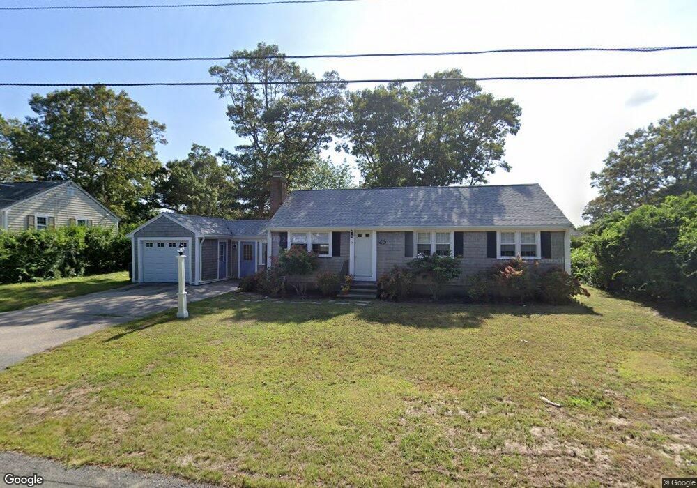
15 Terry Rd West Dennis, MA 02670
West Dennis NeighborhoodEstimated Value: $633,000 - $705,000
3
Beds
1
Bath
1,152
Sq Ft
$583/Sq Ft
Est. Value
About This Home
This home is located at 15 Terry Rd, West Dennis, MA 02670 and is currently estimated at $671,098, approximately $582 per square foot. 15 Terry Rd is a home located in Barnstable County with nearby schools including Dennis-Yarmouth Regional High School and St. Pius X. School.
Ownership History
Date
Name
Owned For
Owner Type
Purchase Details
Closed on
Jul 22, 2014
Sold by
Cravedi Richard E and Cravedi James
Bought by
Zarkadas Demetrios A and Zarkadas Heather
Current Estimated Value
Purchase Details
Closed on
Jul 14, 2008
Sold by
Apollo Int and Apollo Grady
Bought by
Cardinali Julie A and Brackett Lisa M
Home Financials for this Owner
Home Financials are based on the most recent Mortgage that was taken out on this home.
Original Mortgage
$144,000
Interest Rate
6.13%
Mortgage Type
Purchase Money Mortgage
Create a Home Valuation Report for This Property
The Home Valuation Report is an in-depth analysis detailing your home's value as well as a comparison with similar homes in the area
Home Values in the Area
Average Home Value in this Area
Purchase History
| Date | Buyer | Sale Price | Title Company |
|---|---|---|---|
| Zarkadas Demetrios A | $285,000 | -- | |
| Cardinali Julie A | $180,000 | -- | |
| Cardinali Julie A | $180,000 | -- |
Source: Public Records
Mortgage History
| Date | Status | Borrower | Loan Amount |
|---|---|---|---|
| Previous Owner | Cardinali Julie A | $135,000 | |
| Previous Owner | Cardinali Julie A | $144,000 | |
| Closed | Zarkadas Demetrios A | $0 |
Source: Public Records
Tax History Compared to Growth
Tax History
| Year | Tax Paid | Tax Assessment Tax Assessment Total Assessment is a certain percentage of the fair market value that is determined by local assessors to be the total taxable value of land and additions on the property. | Land | Improvement |
|---|---|---|---|---|
| 2025 | $2,732 | $631,000 | $220,400 | $410,600 |
| 2024 | $2,578 | $587,300 | $211,900 | $375,400 |
| 2023 | $1,227 | $534,000 | $192,700 | $341,300 |
| 2022 | $1,187 | $403,400 | $150,400 | $253,000 |
| 2021 | $2,156 | $357,500 | $147,500 | $210,000 |
| 2020 | $2,035 | $333,600 | $158,800 | $174,800 |
| 2019 | $1,987 | $322,100 | $166,800 | $155,300 |
| 2018 | $1,823 | $287,500 | $148,200 | $139,300 |
| 2017 | $1,740 | $283,000 | $148,200 | $134,800 |
| 2016 | $1,727 | $264,400 | $153,500 | $110,900 |
| 2015 | $1,692 | $264,400 | $153,500 | $110,900 |
| 2014 | $1,679 | $264,400 | $153,500 | $110,900 |
Source: Public Records
Map
Nearby Homes
- 61 Trotters Ln
- 15 Woodside Park Rd
- 467 Main St
- 401 Main St Unit 201
- 401 Main St Unit 101
- 12 Spoonbill Rd
- 3 Pinefield Ln
- 178 School St
- 26 Center St
- 80 Michaels Ave
- 23 Doric Ave
- 6 Baker Way
- 95 Center St
- 71 Main St
- 14 Schoolhouse Ln
- 209 Main St Unit 3
- 209 Main St Unit 6
- 209 Main St Unit 1
- 209 Main St Unit 2
- 209 Main St Unit 4