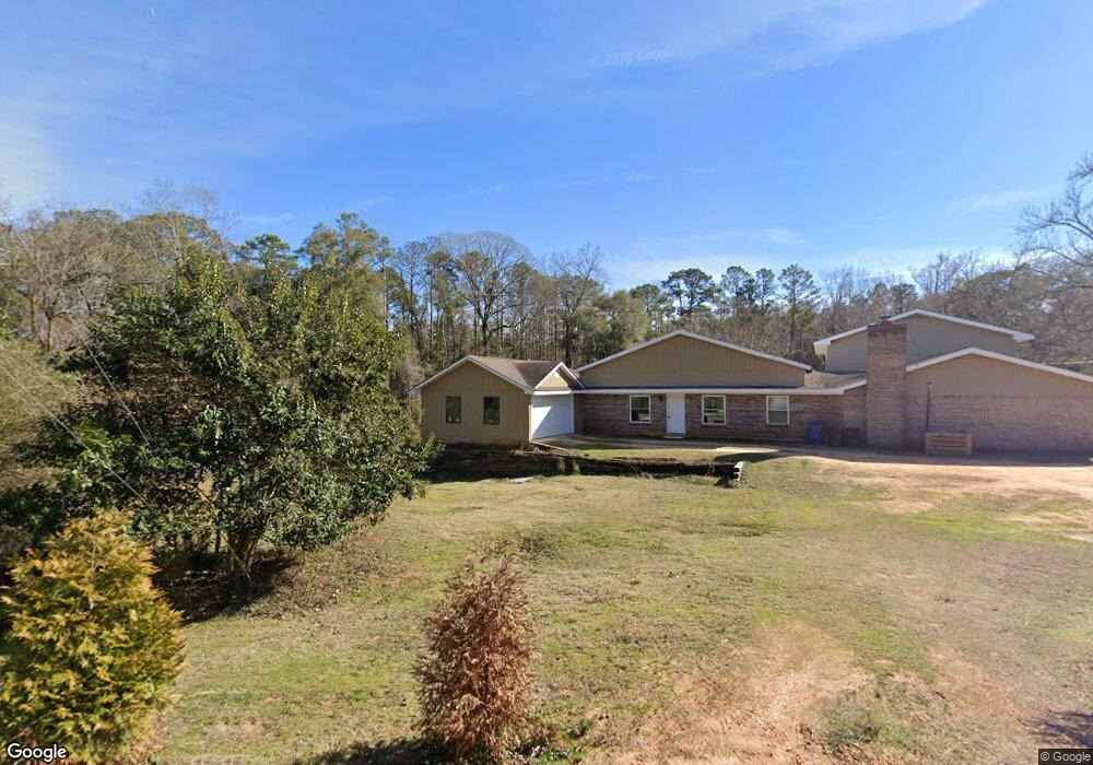
15 Thomas St Monroeville, AL 36460
Estimated Value: $249,000 - $293,000
--
Bed
1
Bath
3,605
Sq Ft
$74/Sq Ft
Est. Value
About This Home
This home is located at 15 Thomas St, Monroeville, AL 36460 and is currently estimated at $266,582, approximately $73 per square foot. 15 Thomas St is a home located in Monroe County with nearby schools including Monroeville Elementary School, Monroeville Middle School, and Monroe County High School.
Ownership History
Date
Name
Owned For
Owner Type
Purchase Details
Closed on
Mar 17, 2017
Sold by
Hoffman James W
Bought by
Padgett Ronald Thomas and Padgett Kaley M
Current Estimated Value
Home Financials for this Owner
Home Financials are based on the most recent Mortgage that was taken out on this home.
Original Mortgage
$107,000
Outstanding Balance
$88,829
Interest Rate
4.21%
Mortgage Type
New Conventional
Estimated Equity
$177,753
Purchase Details
Closed on
Jul 27, 2011
Bought by
Hoffman James William
Create a Home Valuation Report for This Property
The Home Valuation Report is an in-depth analysis detailing your home's value as well as a comparison with similar homes in the area
Home Values in the Area
Average Home Value in this Area
Purchase History
| Date | Buyer | Sale Price | Title Company |
|---|---|---|---|
| Padgett Ronald Thomas | $121,000 | Attorney Only | |
| Hoffman James William | $46,000 | -- |
Source: Public Records
Mortgage History
| Date | Status | Borrower | Loan Amount |
|---|---|---|---|
| Open | Padgett Ronald Thomas | $107,000 |
Source: Public Records
Tax History Compared to Growth
Tax History
| Year | Tax Paid | Tax Assessment Tax Assessment Total Assessment is a certain percentage of the fair market value that is determined by local assessors to be the total taxable value of land and additions on the property. | Land | Improvement |
|---|---|---|---|---|
| 2024 | $793 | $21,380 | $0 | $0 |
| 2023 | $793 | $19,920 | $0 | $0 |
| 2022 | $682 | $18,680 | $0 | $0 |
| 2021 | $682 | $18,680 | $0 | $0 |
| 2020 | $600 | $16,680 | $0 | $0 |
| 2019 | $600 | $16,680 | $0 | $0 |
| 2018 | $595 | $16,560 | $0 | $0 |
| 2017 | $595 | $33,092 | $2,150 | $30,942 |
| 2016 | $547 | $0 | $0 | $0 |
| 2015 | $547 | $153,950 | $0 | $0 |
| 2014 | $633 | $174,710 | $0 | $0 |
| 2013 | $633 | $174,710 | $0 | $0 |
Source: Public Records
Map
Nearby Homes
- 422 W Wiggins St
- 905 Taylor St
- 52 Ratcliffe St
- 188 Lazenby St
- 163 Lazenby St
- 679 Taylor St
- 375 Broughton St
- 733 Pineville Rd
- 60 Bigger St
- 59 Stephens Rd
- 60 Stephens Rd
- 500 Clausell Rd
- 26 Slash Rd
- 98 E Pine St
- 0 Pecan Dr
- 615 Fore Ave
- 120 Walker St
- 47 Chestnut St
- 104 George H Preyear Rd
- 141 Blue Ridge Dr
- 22 Thomas St
- 110 McDonald St
- 145 McDonald St
- 197 McDonald St
- 826 N Mount Pleasant Ave
- 826 N Mount Pleasant Ave
- 850 N Mount Pleasant Ave
- 810 N Mount Pleasant Ave
- 262 McDonald St
- 262 McDonald St
- 302 McDonald St
- 282 McDonald St
- 746 N Mount Pleasant Ave
- 785 N Mount Pleasant Ave
- 730 N Mount Pleasant Ave
- 786 N Mount Pleasant Ave
- N N Mount Pleasant Ave
- 779 N Mount Pleasant Ave
- 687 N Mount Pleasant Ave
- 674 N Mount Pleasant Ave