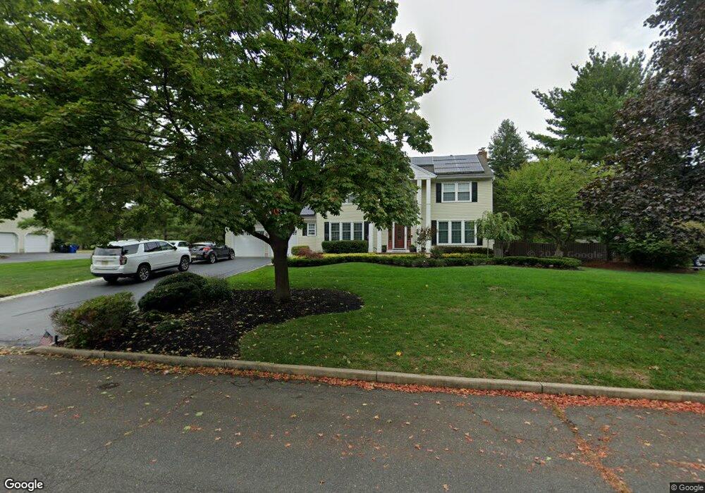
15 Todd Dr Red Bank, NJ 07701
New Monmouth NeighborhoodEstimated Value: $997,000 - $1,161,000
4
Beds
3
Baths
2,225
Sq Ft
$482/Sq Ft
Est. Value
About This Home
This home is located at 15 Todd Dr, Red Bank, NJ 07701 and is currently estimated at $1,072,587, approximately $482 per square foot. 15 Todd Dr is a home located in Monmouth County with nearby schools including River Plaza Elementary School, Thompson Middle School, and Middletown - South High School.
Ownership History
Date
Name
Owned For
Owner Type
Purchase Details
Closed on
Jul 29, 2020
Sold by
Mcgee James A and Mcgee Paula A
Bought by
Gruosso Michael B and Gruosso Samantha
Current Estimated Value
Home Financials for this Owner
Home Financials are based on the most recent Mortgage that was taken out on this home.
Original Mortgage
$603,000
Outstanding Balance
$535,891
Interest Rate
3.1%
Mortgage Type
New Conventional
Estimated Equity
$536,696
Purchase Details
Closed on
Nov 15, 1983
Bought by
Mcgee James A and Mcgee Paula A
Create a Home Valuation Report for This Property
The Home Valuation Report is an in-depth analysis detailing your home's value as well as a comparison with similar homes in the area
Home Values in the Area
Average Home Value in this Area
Purchase History
| Date | Buyer | Sale Price | Title Company |
|---|---|---|---|
| Gruosso Michael B | $670,000 | Commonwealth Ttl Monmouth Ag | |
| Mcgee James A | $132,900 | -- |
Source: Public Records
Mortgage History
| Date | Status | Borrower | Loan Amount |
|---|---|---|---|
| Open | Gruosso Michael B | $603,000 |
Source: Public Records
Tax History Compared to Growth
Tax History
| Year | Tax Paid | Tax Assessment Tax Assessment Total Assessment is a certain percentage of the fair market value that is determined by local assessors to be the total taxable value of land and additions on the property. | Land | Improvement |
|---|---|---|---|---|
| 2025 | $14,955 | $957,000 | $485,000 | $472,000 |
| 2024 | $13,991 | $909,100 | $440,000 | $469,100 |
| 2023 | $13,991 | $805,000 | $363,000 | $442,000 |
| 2022 | $13,703 | $761,500 | $330,000 | $431,500 |
| 2021 | $13,703 | $658,800 | $275,000 | $383,800 |
| 2020 | $13,997 | $654,700 | $275,000 | $379,700 |
| 2019 | $13,783 | $652,600 | $275,000 | $377,600 |
| 2018 | $13,856 | $639,400 | $275,000 | $364,400 |
| 2017 | $13,345 | $628,300 | $275,000 | $353,300 |
| 2016 | $13,202 | $619,500 | $300,000 | $319,500 |
| 2015 | $12,192 | $570,800 | $280,000 | $290,800 |
| 2014 | $11,726 | $535,700 | $270,000 | $265,700 |
Source: Public Records
Map
Nearby Homes
- 28 Todd Dr
- 11 Manchester Ct
- 165 Lexington Ct
- 7 Lexington Ct
- 143 Lexington Ct
- 8 Cherry St
- 115 Hill Terrace
- 43 Roosevelt Cir W
- 102 Berkshire Ct
- 18 Claremont Ct
- 79 Lake Shore Dr
- 25 Claremont Ct
- 31 Claremont Ct
- 11 Buchhop Ln
- 11 Buchhop Ln Unit 5
- 37 Delaware Ave
- 833 Lincoln St
- 6 Buchhop Ln
- 351 Buchanan Blvd
- 90 Friendship Ct