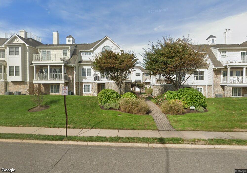
15 Tower Rd Long Branch, NJ 07740
Estimated Value: $1,175,990 - $1,498,000
4
Beds
3
Baths
2,484
Sq Ft
$523/Sq Ft
Est. Value
About This Home
This home is located at 15 Tower Rd, Long Branch, NJ 07740 and is currently estimated at $1,300,248, approximately $523 per square foot. 15 Tower Rd is a home located in Monmouth County with nearby schools including Long Branch High School, Holy Trinity School, and Ma'or Yeshiva High School for Boys.
Ownership History
Date
Name
Owned For
Owner Type
Purchase Details
Closed on
May 12, 2021
Sold by
Adams Jonathan C
Bought by
Adams Marina I
Current Estimated Value
Purchase Details
Closed on
Sep 3, 2013
Sold by
Adams Jonathan C
Bought by
Adams Marina I
Purchase Details
Closed on
Nov 22, 2005
Sold by
Olsen John
Bought by
Adams Jonathan C and Adams Marina I
Home Financials for this Owner
Home Financials are based on the most recent Mortgage that was taken out on this home.
Original Mortgage
$519,900
Interest Rate
6.16%
Purchase Details
Closed on
Jun 27, 2003
Sold by
Excelsior Al Mare Llc
Bought by
Olsen John and Olsen Gail
Home Financials for this Owner
Home Financials are based on the most recent Mortgage that was taken out on this home.
Original Mortgage
$346,000
Interest Rate
5.27%
Create a Home Valuation Report for This Property
The Home Valuation Report is an in-depth analysis detailing your home's value as well as a comparison with similar homes in the area
Home Values in the Area
Average Home Value in this Area
Purchase History
| Date | Buyer | Sale Price | Title Company |
|---|---|---|---|
| Adams Marina I | -- | Chicago Title Insurance Co | |
| Adams Marina I | -- | None Listed On Document | |
| Adams Jonathan C | $649,000 | -- | |
| Olsen John | $479,000 | -- |
Source: Public Records
Mortgage History
| Date | Status | Borrower | Loan Amount |
|---|---|---|---|
| Previous Owner | Adams Jonathan C | $519,900 | |
| Previous Owner | Olsen John | $346,000 |
Source: Public Records
Tax History
| Year | Tax Paid | Tax Assessment Tax Assessment Total Assessment is a certain percentage of the fair market value that is determined by local assessors to be the total taxable value of land and additions on the property. | Land | Improvement |
|---|---|---|---|---|
| 2025 | $14,231 | $1,085,500 | $635,000 | $450,500 |
| 2024 | $13,921 | $925,900 | $495,000 | $430,900 |
| 2023 | $13,921 | $896,400 | $480,000 | $416,400 |
| 2022 | $14,827 | $781,200 | $410,000 | $371,200 |
| 2021 | $14,827 | $741,300 | $390,000 | $351,300 |
| 2020 | $14,264 | $682,500 | $325,000 | $357,500 |
| 2019 | $14,079 | $669,800 | $325,000 | $344,800 |
| 2018 | $13,971 | $660,900 | $325,000 | $335,900 |
| 2017 | $13,153 | $638,200 | $305,000 | $333,200 |
| 2016 | $12,797 | $633,200 | $305,000 | $328,200 |
| 2015 | $11,511 | $516,900 | $175,000 | $341,900 |
| 2014 | $11,829 | $559,800 | $230,000 | $329,800 |
Source: Public Records
Map
Nearby Homes
- 448 Ocean Ave Unit 3A
- 448 Ocean Ave N Unit 8B
- 392 Ocean Ave N Unit 1203
- 392 Ocean Ave N Unit 1502
- 392 Ocean Ave N Unit 1703
- 392 Ocean Ave N Unit 1804
- 480 Ocean Ave Unit 2K
- 392 Ocean Ave Unit 1608
- 392 Ocean Ave Unit 1203
- 392 Ocean Ave Unit 1406
- 392 Ocean Ave Unit 1412
- 392 Ocean Ave Unit 1309
- 392 Ocean Ave Unit 1502
- 392 Ocean Ave Unit 1505
- 392 Ocean Ave Unit 1310
- 392 Ocean Ave Unit 1705
- 392 Ocean Ave Unit 1804
- 392 Ocean Ave Unit 1603
- 392 Ocean Ave Unit 1509
- 392 Ocean Ave Unit 1803
Your Personal Tour Guide
Ask me questions while you tour the home.