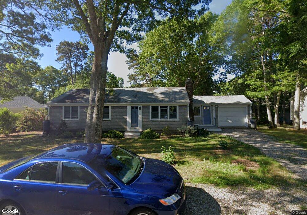
15 Uncle Stanleys Way South Dennis, MA 02660
South Dennis NeighborhoodEstimated Value: $561,000 - $615,000
2
Beds
3
Baths
1,201
Sq Ft
$488/Sq Ft
Est. Value
About This Home
This home is located at 15 Uncle Stanleys Way, South Dennis, MA 02660 and is currently estimated at $585,838, approximately $487 per square foot. 15 Uncle Stanleys Way is a home located in Barnstable County with nearby schools including Dennis-Yarmouth Regional High School.
Ownership History
Date
Name
Owned For
Owner Type
Purchase Details
Closed on
Mar 17, 2003
Sold by
Pacheco Robert J
Bought by
Curry David W and Curry Marcella M
Current Estimated Value
Home Financials for this Owner
Home Financials are based on the most recent Mortgage that was taken out on this home.
Original Mortgage
$230,375
Outstanding Balance
$99,472
Interest Rate
5.94%
Mortgage Type
Purchase Money Mortgage
Estimated Equity
$486,366
Create a Home Valuation Report for This Property
The Home Valuation Report is an in-depth analysis detailing your home's value as well as a comparison with similar homes in the area
Home Values in the Area
Average Home Value in this Area
Purchase History
| Date | Buyer | Sale Price | Title Company |
|---|---|---|---|
| Curry David W | $237,500 | -- |
Source: Public Records
Mortgage History
| Date | Status | Borrower | Loan Amount |
|---|---|---|---|
| Open | Curry David W | $230,375 |
Source: Public Records
Tax History Compared to Growth
Tax History
| Year | Tax Paid | Tax Assessment Tax Assessment Total Assessment is a certain percentage of the fair market value that is determined by local assessors to be the total taxable value of land and additions on the property. | Land | Improvement |
|---|---|---|---|---|
| 2025 | $2,356 | $544,100 | $131,100 | $413,000 |
| 2024 | $2,298 | $523,500 | $126,100 | $397,400 |
| 2023 | $2,222 | $475,900 | $114,600 | $361,300 |
| 2022 | $2,129 | $380,100 | $114,700 | $265,400 |
| 2021 | $2,000 | $331,700 | $112,500 | $219,200 |
| 2020 | $1,899 | $311,300 | $112,500 | $198,800 |
| 2019 | $1,838 | $297,900 | $121,300 | $176,600 |
| 2018 | $0 | $263,400 | $105,000 | $158,400 |
| 2017 | $1,589 | $258,300 | $105,000 | $153,300 |
| 2016 | $1,420 | $217,500 | $110,200 | $107,300 |
| 2015 | $1,376 | $215,000 | $110,200 | $104,800 |
| 2014 | $1,383 | $217,800 | $94,500 | $123,300 |
Source: Public Records
Map
Nearby Homes
- 11 Uncle Stanleys Way
- 15 Captain Jud Rd
- 153 Bayridge Dr
- 4 Ebb Rd
- 17 Margate Ln
- 13 Covey Dr
- 118 Driftwood Ln
- 111 Merchant Ave
- 10 Joanne Dr
- 17 Fairmount Rd
- 17 Fairmount Rd
- 129 Driftwood Ln
- 32 Captain Walsh Dr
- 25 Skerry Rd
- 7 Vinland Dr
- 6 Nimble Hill Dr
- 59 Main St Unit 19-2
- 59 Route 6a Unit 29-4
- 1 Norseman Dr
- 268 Main St
- 16 Uncle Bobs Way
- 19 Uncle Stanleys Way
- 25 Uncle Stanley
- 12 Uncle Bobs Way
- 19 Uncle Stanley
- 20 Uncle Bobs Way
- 20 Uncle Stanleys Way
- 14 Uncle Stanleys Way
- 8 Uncle Bobs Way
- 5 Uncle Stanleys Way
- 25 Uncle Stanleys Way
- 12 Uncle Bob's Way
- 15 Uncle Bobs Way
- 24 Uncle Bob's Way
- 11 Uncle Bobs Way
- 24 Uncle Bobs Way
- 10 Uncle Stanleys Way
- 26 Uncle Stanleys Way
- 19 Uncle Bobs Way
- 25 Hazelwood Rd