Estimated Value: $209,424 - $230,000
Studio
2
Baths
1,512
Sq Ft
$146/Sq Ft
Est. Value
About This Home
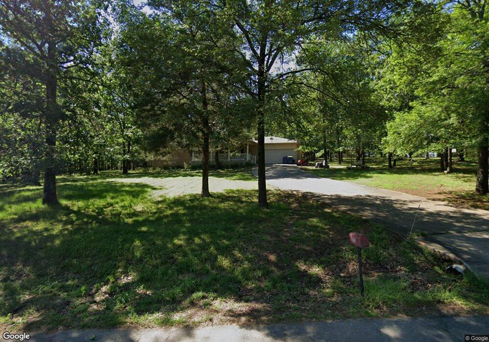
This home is located at 15 View Dr, Cabot, AR 72023 and is currently estimated at $220,356, approximately $145 per square foot. 15 View Dr is a home located in Lonoke County with nearby schools including Mountain Springs Elementary School, Cabot Junior High North, and Cabot Middle School North.
Ownership History
Date
Name
Owned For
Owner Type
Purchase Details
Closed on
Oct 17, 2016
Sold by
Deutsche Bank National Trust Company
Bought by
Tatom Larry E and Tatom Ramona A
Current Estimated Value
Purchase Details
Closed on
May 26, 2016
Sold by
Ameriquest Mortgage Company and Wright Roy J
Bought by
Deutsche Bank National Trust Company and Ameriquest Mortgage Securities Inc
Purchase Details
Closed on
May 24, 2004
Bought by
Wright and Wright Wf
Purchase Details
Closed on
May 14, 2004
Bought by
Wright and Wright Wf
Purchase Details
Closed on
May 7, 2004
Bought by
Cendant Mobility
Purchase Details
Closed on
Nov 26, 2003
Bought by
Cendant Mobility
Purchase Details
Closed on
Oct 16, 1992
Bought by
Barks and Wife Cheryl
Purchase Details
Closed on
Oct 4, 1982
Bought by
Plat Plat B and Plat 131
Create a Home Valuation Report for This Property
The Home Valuation Report is an in-depth analysis detailing your home's value as well as a comparison with similar homes in the area
Purchase History
| Date | Buyer | Sale Price | Title Company |
|---|---|---|---|
| Tatom Larry E | $86,000 | None Available | |
| Deutsche Bank National Trust Company | -- | None Available | |
| Wright | $105,000 | -- | |
| Wright | $105,000 | -- | |
| Cendant Mobility | $105,000 | -- | |
| Cendant Mobility | $105,000 | -- | |
| Barks | $23,500 | -- | |
| Plat Plat B | -- | -- |
Source: Public Records
Tax History
| Year | Tax Paid | Tax Assessment Tax Assessment Total Assessment is a certain percentage of the fair market value that is determined by local assessors to be the total taxable value of land and additions on the property. | Land | Improvement |
|---|---|---|---|---|
| 2025 | $1,286 | $25,270 | $2,500 | $22,770 |
| 2024 | $1,286 | $25,270 | $2,500 | $22,770 |
| 2023 | $1,286 | $25,270 | $2,500 | $22,770 |
| 2022 | $1,286 | $25,270 | $2,500 | $22,770 |
| 2021 | $1,286 | $25,270 | $2,500 | $22,770 |
| 2020 | $1,307 | $25,680 | $2,500 | $23,180 |
| 2019 | $1,307 | $25,680 | $2,500 | $23,180 |
| 2018 | $1,269 | $25,680 | $2,500 | $23,180 |
| 2017 | $919 | $0 | $0 | $0 |
| 2016 | $919 | $25,680 | $2,500 | $23,180 |
| 2015 | $1,131 | $24,640 | $2,500 | $22,140 |
| 2014 | $867 | $24,640 | $2,500 | $22,140 |
Source: Public Records
Map
Nearby Homes
- 218 N Summit Dr
- 222 N Summit Dr
- 15 Blanchard Dr
- 21 Blanchard Dr
- 18 Suncrest Dr
- 35 N Sunland Dr
- 723 Mountain Springs Rd
- 24 Sunset Ln
- 41 Sunset Ln
- 1711 Pioneer Dr
- 505 Sweet Gum Ct
- 504 Sweet Gum Ct
- 509 Crepe Myrtle Loop
- 519 Crepe Myrtle Loop
- 0 N Rockwood Rd Unit W. Main Street
- 0 Tract F Hwy 89
- 0 Tract G Hwy 89
- 0 Tract E Hwy 89
- 0 Tract C Hwy 89
- 3A W Main St
Your Personal Tour Guide
Ask me questions while you tour the home.