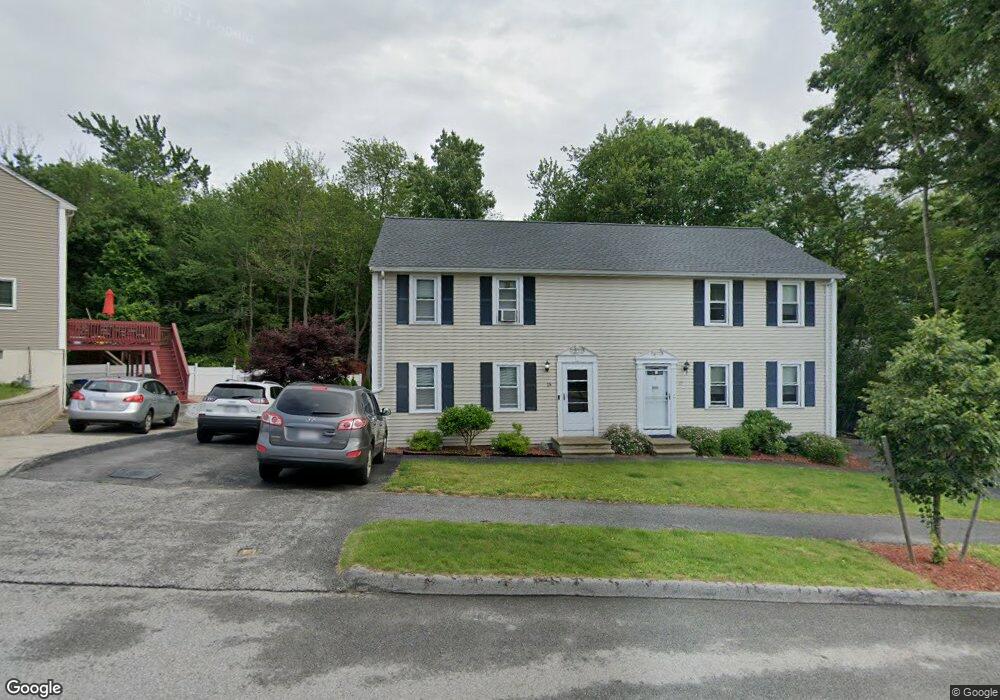
15 Vincent Cir Worcester, MA 01604
Broadmeadow Brook NeighborhoodEstimated Value: $387,000 - $410,000
3
Beds
2
Baths
1,248
Sq Ft
$318/Sq Ft
Est. Value
About This Home
This home is located at 15 Vincent Cir, Worcester, MA 01604 and is currently estimated at $396,730, approximately $317 per square foot. 15 Vincent Cir is a home located in Worcester County with nearby schools including Jacob Hiatt Magnet School, Chandler Magnet, and Rice Square Elementary School.
Ownership History
Date
Name
Owned For
Owner Type
Purchase Details
Closed on
Oct 27, 2000
Sold by
Lapomardo Paul and Mcglinn-Lapomard Terri
Bought by
Barbour Daniel D and Barbour Rachel A
Current Estimated Value
Purchase Details
Closed on
Aug 30, 1994
Sold by
Monte David A and Monte Kathleen
Bought by
Lapomardo Paul and Lapomardo Terrie
Purchase Details
Closed on
May 26, 1989
Sold by
Javelin West Rlty
Bought by
Monte David
Create a Home Valuation Report for This Property
The Home Valuation Report is an in-depth analysis detailing your home's value as well as a comparison with similar homes in the area
Home Values in the Area
Average Home Value in this Area
Purchase History
| Date | Buyer | Sale Price | Title Company |
|---|---|---|---|
| Barbour Daniel D | $119,900 | -- | |
| Lapomardo Paul | $81,500 | -- | |
| Monte David | $113,500 | -- |
Source: Public Records
Mortgage History
| Date | Status | Borrower | Loan Amount |
|---|---|---|---|
| Open | Monte David | $117,738 | |
| Closed | Monte David | $118,042 | |
| Closed | Monte David | $118,181 |
Source: Public Records
Tax History Compared to Growth
Tax History
| Year | Tax Paid | Tax Assessment Tax Assessment Total Assessment is a certain percentage of the fair market value that is determined by local assessors to be the total taxable value of land and additions on the property. | Land | Improvement |
|---|---|---|---|---|
| 2025 | $4,260 | $323,000 | $96,000 | $227,000 |
| 2024 | $4,066 | $295,700 | $96,000 | $199,700 |
| 2023 | $3,915 | $273,000 | $83,500 | $189,500 |
| 2022 | $3,512 | $230,900 | $66,800 | $164,100 |
| 2021 | $3,297 | $202,500 | $53,500 | $149,000 |
| 2020 | $3,230 | $190,000 | $53,500 | $136,500 |
| 2019 | $3,103 | $172,400 | $48,100 | $124,300 |
| 2018 | $3,116 | $164,800 | $48,100 | $116,700 |
| 2017 | $2,964 | $154,200 | $48,100 | $106,100 |
| 2016 | $2,877 | $139,600 | $35,800 | $103,800 |
| 2015 | $2,802 | $139,600 | $35,800 | $103,800 |
| 2014 | $2,728 | $139,600 | $35,800 | $103,800 |
Source: Public Records
Map
Nearby Homes
- 7 Lorraine Rd
- 266 Massasoit Rd
- 256 Massasoit Rd
- 259 Massasoit Rd
- 46 Vincent Cir
- 25 Stoneham Rd
- 53 Denver Terrace
- 44 Greencourt St
- 330 Sunderland Rd Unit 78
- 330 Sunderland Rd Unit 87
- 270 Sunderland Rd Unit 37
- 270 Sunderland Rd Unit 77
- 270 Sunderland Rd Unit 67
- 62 Allston Ave
- 340 Sunderland Rd Unit 23
- 4 Crest Ave
- 94 Massasoit Rd
- 65 Progressive St
- 21-23 Maranda St
- 25-27 Maranda St
- 17 Vincent Cir
- 9 Lorraine Rd
- 19 Vincent Cir
- 14 Vincent Cir
- 14 Vincent Cir Unit 4101
- 16 Vincent Cir
- 16 Vincent Cir Unit A
- 25 Vincent Cir
- 12 Vincent Cir
- 23 Vincent Cir
- 10 Vincent Cir
- 98 Vincent Cir
- 8 Lorraine Rd
- 18 Vincent Cir
- 8 Vincent Cir
- 6 Lorraine Rd
- 20 Vincent Cir
- 22 Vincent Cir
- 6 Vincent Cir
- 94 Vincent Cir