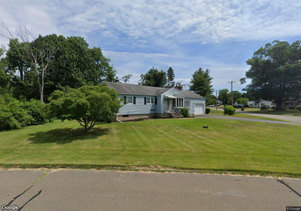
15 Virginia Rd East Haven, CT 06512
Estimated Value: $382,000 - $388,000
3
Beds
1
Bath
1,368
Sq Ft
$282/Sq Ft
Est. Value
About This Home
This home is located at 15 Virginia Rd, East Haven, CT 06512 and is currently estimated at $386,181, approximately $282 per square foot. 15 Virginia Rd is a home located in New Haven County with nearby schools including Deer Run School, East Haven High School, and East Shoreline Catholic Academy.
Ownership History
Date
Name
Owned For
Owner Type
Purchase Details
Closed on
Jul 1, 2020
Sold by
Montesano Theresa Est
Bought by
Mcfarland Robert
Current Estimated Value
Home Financials for this Owner
Home Financials are based on the most recent Mortgage that was taken out on this home.
Original Mortgage
$139,918
Outstanding Balance
$124,300
Interest Rate
3.2%
Mortgage Type
Purchase Money Mortgage
Estimated Equity
$261,881
Create a Home Valuation Report for This Property
The Home Valuation Report is an in-depth analysis detailing your home's value as well as a comparison with similar homes in the area
Home Values in the Area
Average Home Value in this Area
Purchase History
| Date | Buyer | Sale Price | Title Company |
|---|---|---|---|
| Mcfarland Robert | $142,500 | None Available |
Source: Public Records
Mortgage History
| Date | Status | Borrower | Loan Amount |
|---|---|---|---|
| Open | Mcfarland Robert | $139,918 |
Source: Public Records
Tax History Compared to Growth
Tax History
| Year | Tax Paid | Tax Assessment Tax Assessment Total Assessment is a certain percentage of the fair market value that is determined by local assessors to be the total taxable value of land and additions on the property. | Land | Improvement |
|---|---|---|---|---|
| 2025 | $5,936 | $177,520 | $56,910 | $120,610 |
| 2024 | $5,936 | $177,520 | $56,910 | $120,610 |
| 2023 | $5,539 | $177,520 | $56,910 | $120,610 |
| 2022 | $5,539 | $177,520 | $56,910 | $120,610 |
| 2021 | $5,052 | $147,490 | $55,470 | $92,020 |
| 2020 | $5,052 | $147,490 | $55,470 | $92,020 |
| 2019 | $4,782 | $147,490 | $55,470 | $92,020 |
| 2018 | $4,786 | $147,490 | $55,470 | $92,020 |
| 2017 | $4,653 | $147,490 | $55,470 | $92,020 |
| 2016 | $4,545 | $144,070 | $51,570 | $92,500 |
| 2015 | $4,545 | $144,070 | $51,570 | $92,500 |
| 2014 | $4,617 | $144,070 | $51,570 | $92,500 |
Source: Public Records
Map
Nearby Homes
- 8 Circle Dr
- 11 Williams Rd
- 71 Hilltop Dr
- 21 Katherine St
- 379 Brushy Plain Rd
- 9 Warwick Ln
- 47 Jerimoth Dr Unit 47
- 19 Rolling Hills Dr
- 75 Redwood Dr Unit 609
- 7 Jeffrey Rd
- 12 Corbin Rd
- 15 Cedar Ct Unit G
- 372 Old Rock Rd
- 1192 N High St
- 118 Hellstrom Rd
- 9 Birch Ln Unit K
- 8 Birch Ln Unit A
- 30 Thompson St
- 7 Oak Hill Dr
- 113 Island View Terrace