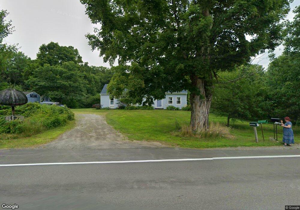
15 W Waldo Rd Belfast, ME 04915
Estimated Value: $309,000 - $372,000
2
Beds
3
Baths
768
Sq Ft
$456/Sq Ft
Est. Value
About This Home
This home is located at 15 W Waldo Rd, Belfast, ME 04915 and is currently estimated at $350,466, approximately $456 per square foot. 15 W Waldo Rd is a home located in Waldo County with nearby schools including Cornerspring Children's House and The School At Sweetser - Belfast.
Ownership History
Date
Name
Owned For
Owner Type
Purchase Details
Closed on
Aug 15, 2006
Sold by
Desilvey Dennis L and Desilvey Kathleen S
Bought by
Cobbey Anne M
Current Estimated Value
Home Financials for this Owner
Home Financials are based on the most recent Mortgage that was taken out on this home.
Original Mortgage
$140,000
Outstanding Balance
$84,236
Interest Rate
6.8%
Mortgage Type
Commercial
Estimated Equity
$266,230
Create a Home Valuation Report for This Property
The Home Valuation Report is an in-depth analysis detailing your home's value as well as a comparison with similar homes in the area
Home Values in the Area
Average Home Value in this Area
Purchase History
| Date | Buyer | Sale Price | Title Company |
|---|---|---|---|
| Cobbey Anne M | -- | -- |
Source: Public Records
Mortgage History
| Date | Status | Borrower | Loan Amount |
|---|---|---|---|
| Open | Cobbey Anne M | $140,000 |
Source: Public Records
Tax History Compared to Growth
Tax History
| Year | Tax Paid | Tax Assessment Tax Assessment Total Assessment is a certain percentage of the fair market value that is determined by local assessors to be the total taxable value of land and additions on the property. | Land | Improvement |
|---|---|---|---|---|
| 2024 | $4,578 | $297,300 | $63,000 | $234,300 |
| 2023 | $4,060 | $202,000 | $51,200 | $150,800 |
| 2022 | $4,156 | $194,200 | $51,200 | $143,000 |
| 2021 | $4,272 | $194,200 | $51,200 | $143,000 |
| 2020 | $4,140 | $177,700 | $51,200 | $126,500 |
| 2019 | $4,035 | $176,200 | $51,200 | $125,000 |
| 2018 | $3,546 | $176,200 | $51,200 | $125,000 |
| 2017 | $3,859 | $176,200 | $51,200 | $125,000 |
| 2016 | $3,495 | $152,600 | $26,200 | $126,400 |
| 2015 | $3,418 | $152,600 | $26,200 | $126,400 |
| 2014 | $3,304 | $152,600 | $26,200 | $126,400 |
| 2013 | $3,174 | $152,600 | $26,200 | $126,400 |
Source: Public Records
Map
Nearby Homes
- 050-C-1 W Waldo Rd
- 243 Waterville Rd
- 99 Waterville Rd
- 62 City Point Rd
- 86 Oak Hill Rd
- 17 Marsh Rd
- 128 Shepard Rd
- 000 Merriam Rd
- 0 Robbins Rd Unit 1634953
- 388 High St
- 20 Springbrook Dr Unit TH-6
- 225 Waldo Ave
- 0 Patterson Hill Rd Unit Lot 2 1614981
- 159 Waldo Ave
- 55 Londonderry Ln
- 100 Belmont Ave Unit 2
- 37 Jacobs Rd
- 452 Moosehead Trail Hwy
- 51 Bridge St
- 6 Daniel Dr
- 16 W Waldo Rd
- 12 W Waldo Rd
- 9 W Waldo Rd
- 21 W Waldo Rd
- 27 W Waldo Rd
- 24 W Waldo Rd
- 5 W Waldo Rd
- 5 W Waldo Rd
- 4 W Waldo Rd
- 40 Homestead Close
- 25 W Waldo Rd
- 42 Head of the Tide Rd
- 46 Head of the Tide Rd
- 38 Homestead Close
- 3 Moose Ln
- 8 W Waldo Rd
- 50 Head of the Tide Rd
- 38 Head of the Tide Rd
- 39 Homestead Close
- 52 Head of the Tide Rd