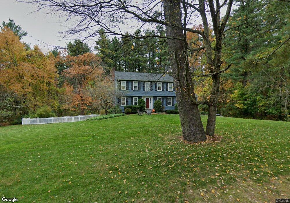
15 Wake Robin Rd Sudbury, MA 01776
Estimated Value: $1,077,000 - $1,399,000
4
Beds
3
Baths
2,532
Sq Ft
$494/Sq Ft
Est. Value
About This Home
This home is located at 15 Wake Robin Rd, Sudbury, MA 01776 and is currently estimated at $1,250,061, approximately $493 per square foot. 15 Wake Robin Rd is a home located in Middlesex County with nearby schools including General John Nixon Elementary School, Ephraim Curtis Middle School, and Lincoln-Sudbury Regional High School.
Ownership History
Date
Name
Owned For
Owner Type
Purchase Details
Closed on
May 26, 2000
Sold by
Strohbehn Kris and Strohbehn Judith
Bought by
Gorman Timothy P and Gorman Kathleen A
Current Estimated Value
Purchase Details
Closed on
Jan 21, 1997
Sold by
Durant Robert H and Durant Colleen M
Bought by
Strohbehn Kris and Strohbehn Judith
Purchase Details
Closed on
Jan 18, 1994
Sold by
Roberts Timothy A and Roberts Wendy K
Bought by
Durant Robert H and Durant Colleen M
Create a Home Valuation Report for This Property
The Home Valuation Report is an in-depth analysis detailing your home's value as well as a comparison with similar homes in the area
Home Values in the Area
Average Home Value in this Area
Purchase History
| Date | Buyer | Sale Price | Title Company |
|---|---|---|---|
| Gorman Timothy P | $495,000 | -- | |
| Strohbehn Kris | $393,000 | -- | |
| Durant Robert H | $346,400 | -- |
Source: Public Records
Mortgage History
| Date | Status | Borrower | Loan Amount |
|---|---|---|---|
| Open | Durant Robert H | $100,000 | |
| Open | Durant Robert H | $330,000 | |
| Closed | Durant Robert H | $303,000 |
Source: Public Records
Tax History Compared to Growth
Tax History
| Year | Tax Paid | Tax Assessment Tax Assessment Total Assessment is a certain percentage of the fair market value that is determined by local assessors to be the total taxable value of land and additions on the property. | Land | Improvement |
|---|---|---|---|---|
| 2025 | $17,146 | $1,171,200 | $509,800 | $661,400 |
| 2024 | $16,540 | $1,132,100 | $495,400 | $636,700 |
| 2023 | $15,396 | $976,300 | $443,400 | $532,900 |
| 2022 | $14,944 | $827,900 | $407,400 | $420,500 |
| 2021 | $14,290 | $758,900 | $407,400 | $351,500 |
| 2020 | $14,002 | $758,900 | $407,400 | $351,500 |
| 2019 | $13,592 | $758,900 | $407,400 | $351,500 |
| 2018 | $13,503 | $753,100 | $433,000 | $320,100 |
| 2017 | $13,241 | $746,400 | $429,400 | $317,000 |
| 2016 | $12,834 | $721,000 | $413,400 | $307,600 |
| 2015 | $12,375 | $703,100 | $401,800 | $301,300 |
| 2014 | $12,354 | $685,200 | $390,200 | $295,000 |
Source: Public Records
Map
Nearby Homes
- 63 Canterbury Dr
- 427 Concord Rd
- 24 Goodnow Rd
- 55 Widow Rites Ln
- 45 Widow Rites Ln
- 14 Frost Ln
- 36 Old Forge Ln
- 12 Camperdown Ln
- 54 Phillips Rd
- 4 Elderberry Cir
- 5 Taintor Dr
- 47 Fairbank Rd
- 42 Dakin Rd
- 270 Old Lancaster Rd
- 941 Concord Rd
- 57 Longfellow Rd
- 166 Parker St Unit 4
- 16 Blacksmith Dr
- Lot 5 Sailaway Ln
- 45 N Crescent Cir