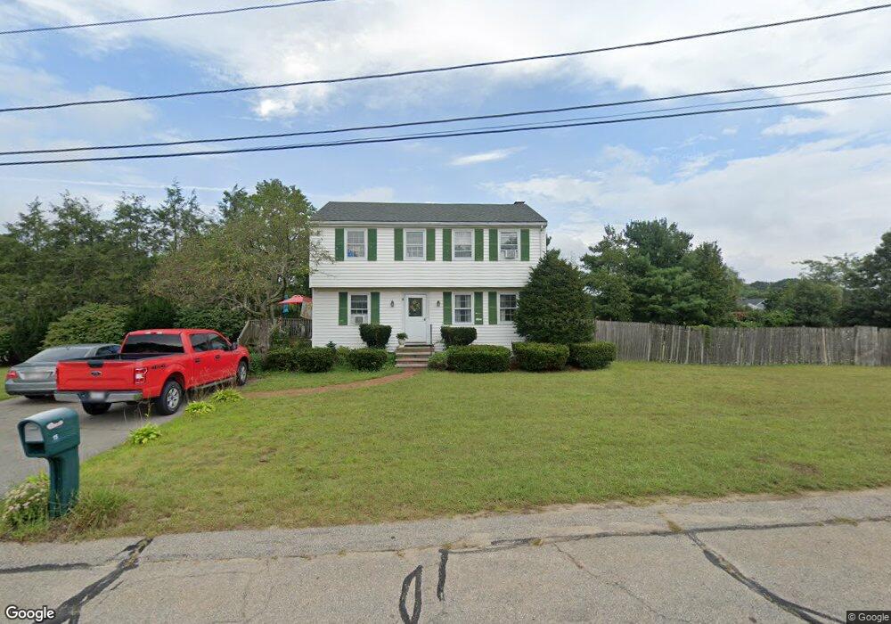
15 Wares Ln Wrentham, MA 02093
Estimated Value: $530,000 - $906,000
4
Beds
2
Baths
1,600
Sq Ft
$416/Sq Ft
Est. Value
About This Home
This home is located at 15 Wares Ln, Wrentham, MA 02093 and is currently estimated at $665,741, approximately $416 per square foot. 15 Wares Ln is a home located in Norfolk County with nearby schools including Delaney Elementary School and Charles E Roderick.
Ownership History
Date
Name
Owned For
Owner Type
Purchase Details
Closed on
Jan 9, 1987
Sold by
Antone Fred K
Bought by
Hayes Robert J
Current Estimated Value
Home Financials for this Owner
Home Financials are based on the most recent Mortgage that was taken out on this home.
Original Mortgage
$95,000
Interest Rate
9.49%
Mortgage Type
Purchase Money Mortgage
Create a Home Valuation Report for This Property
The Home Valuation Report is an in-depth analysis detailing your home's value as well as a comparison with similar homes in the area
Home Values in the Area
Average Home Value in this Area
Purchase History
| Date | Buyer | Sale Price | Title Company |
|---|---|---|---|
| Hayes Robert J | $174,900 | -- |
Source: Public Records
Mortgage History
| Date | Status | Borrower | Loan Amount |
|---|---|---|---|
| Open | Hayes Robert J | $262,400 | |
| Closed | Hayes Robert J | $158,000 | |
| Closed | Hayes Robert J | $128,500 | |
| Closed | Hayes Robert J | $95,000 |
Source: Public Records
Tax History Compared to Growth
Tax History
| Year | Tax Paid | Tax Assessment Tax Assessment Total Assessment is a certain percentage of the fair market value that is determined by local assessors to be the total taxable value of land and additions on the property. | Land | Improvement |
|---|---|---|---|---|
| 2025 | $6,212 | $536,000 | $289,200 | $246,800 |
| 2024 | $6,038 | $503,200 | $289,200 | $214,000 |
| 2023 | $5,645 | $447,300 | $262,900 | $184,400 |
| 2022 | $5,483 | $401,100 | $245,400 | $155,700 |
| 2021 | $5,030 | $357,500 | $214,200 | $143,300 |
| 2020 | $4,936 | $346,400 | $190,500 | $155,900 |
| 2019 | $4,791 | $339,300 | $190,500 | $148,800 |
| 2018 | $4,749 | $333,500 | $190,600 | $142,900 |
| 2017 | $4,484 | $314,700 | $186,900 | $127,800 |
| 2016 | $4,403 | $308,300 | $181,500 | $126,800 |
| 2015 | $4,281 | $285,800 | $174,500 | $111,300 |
| 2014 | $4,210 | $275,000 | $167,800 | $107,200 |
Source: Public Records
Map
Nearby Homes
- 246 Forest Grove Ave
- 570 Franklin St
- 10 Nature View Dr
- 15 Nature View Dr
- 270 Dedham St
- 50 Reed Fulton Ave Unit Lot 61
- 45 Joshua Rd
- 1 Lorraine Metcalf Dr
- 3 Oak Rd
- 131 Creek St Unit 7
- 0 W Birch Rd
- 10 W Birch Rd
- 45 King St
- 11 Earle Stewart Ln
- 362 East St
- Lot 3 - 14 Earle Stewart Ln
- 3 Sparrow Rd
- Lot 1 - Blueberry 2 Car Plan at King Philip Estates
- Lot 8 - Blueberry 2 Car Plan at King Philip Estates
- Lot 6 - Blueberry 3 Car Plan at King Philip Estates