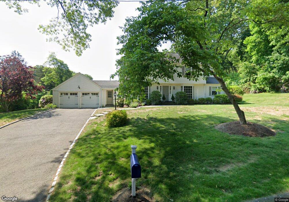
15 Warner Hill Rd Southport, CT 06890
Estimated Value: $1,684,000 - $1,821,000
4
Beds
3
Baths
3,003
Sq Ft
$583/Sq Ft
Est. Value
About This Home
This home is located at 15 Warner Hill Rd, Southport, CT 06890 and is currently estimated at $1,749,524, approximately $582 per square foot. 15 Warner Hill Rd is a home located in Fairfield County with nearby schools including Mill Hill School, Roger Ludlowe Middle School, and Fairfield Ludlowe High School.
Ownership History
Date
Name
Owned For
Owner Type
Purchase Details
Closed on
Apr 16, 2008
Sold by
Gottschalk Edward M
Bought by
Ryan William J and Ryan Alisa R
Current Estimated Value
Purchase Details
Closed on
Jun 22, 2007
Sold by
Day Jeffrey and Day Wendy
Bought by
Gottschak Edward M
Purchase Details
Closed on
Jul 15, 1993
Sold by
Visconti Robert K and Viconti Patricia
Bought by
Day Jeffrey and Day Wendy
Create a Home Valuation Report for This Property
The Home Valuation Report is an in-depth analysis detailing your home's value as well as a comparison with similar homes in the area
Home Values in the Area
Average Home Value in this Area
Purchase History
| Date | Buyer | Sale Price | Title Company |
|---|---|---|---|
| Ryan William J | $1,062,000 | -- | |
| Ryan William J | $1,062,000 | -- | |
| Gottschak Edward M | $980,000 | -- | |
| Gottschak Edward M | $980,000 | -- | |
| Day Jeffrey | $350,000 | -- | |
| Day Jeffrey | $350,000 | -- |
Source: Public Records
Mortgage History
| Date | Status | Borrower | Loan Amount |
|---|---|---|---|
| Open | Day Jeffrey | $100,000 | |
| Open | Day Jeffrey | $750,000 |
Source: Public Records
Tax History Compared to Growth
Tax History
| Year | Tax Paid | Tax Assessment Tax Assessment Total Assessment is a certain percentage of the fair market value that is determined by local assessors to be the total taxable value of land and additions on the property. | Land | Improvement |
|---|---|---|---|---|
| 2025 | $21,811 | $768,250 | $450,310 | $317,940 |
| 2024 | $20,149 | $722,190 | $450,310 | $271,880 |
| 2023 | $19,867 | $722,190 | $450,310 | $271,880 |
| 2022 | $19,672 | $722,190 | $450,310 | $271,880 |
| 2021 | $19,485 | $722,190 | $450,310 | $271,880 |
| 2020 | $19,482 | $727,230 | $445,760 | $281,470 |
| 2019 | $19,482 | $727,230 | $445,760 | $281,470 |
| 2018 | $19,170 | $727,230 | $445,760 | $281,470 |
| 2017 | $18,777 | $727,230 | $445,760 | $281,470 |
| 2016 | $18,508 | $727,230 | $445,760 | $281,470 |
| 2015 | $17,993 | $725,830 | $468,300 | $257,530 |
| 2014 | $17,710 | $725,830 | $468,300 | $257,530 |
Source: Public Records
Map
Nearby Homes
- 232 Pell Meadow Dr
- 1135 Mill Hill Rd
- 254 Sherwood Farm Rd
- 360 Duck Farm Rd
- 105 Charter Oak Rd
- 647 Bronson Rd
- 476 Mill Hill Terrace
- 56 Drake Ln
- 44 Deer Run Rd
- 646 Mill Hill Terrace
- 33 Middlebrook Place
- 844 Mill Hill Terrace
- 53 Hilltop Dr
- 2683 Bronson Rd
- 25 Millspaugh Dr
- 179 Verna Hill Rd
- 338 Orchard Hill Ln
- 688 Hulls Farm Rd
- 28 Mill Hill Rd Unit 28
- 153 Pease Ave
- 30 Warner Hill Rd
- 1450 Bronson Rd
- 73 Warner Hill Rd
- 1498 Bronson Rd
- 1482 Bronson Rd
- 1444 Bronson Rd
- 1375 Bronson Rd
- 1446 Bronson Rd
- 1400 Bronson Rd
- 105 Warner Hill Rd
- 1519 Bronson Rd
- 11 Twin Brooks Ln
- 116 Warner Hill Rd
- 10 Twin Brooks Ln
- 1371 Bronson Rd
- 1372 Bronson Rd
- 1327 Bronson Rd
- 1327 Bronson Rd Unit 1
- 25 Twin Brooks Ln
- 57 Warner Hill Rd