Estimated Value: $1,147,000 - $1,244,000
4
Beds
3
Baths
2,633
Sq Ft
$451/Sq Ft
Est. Value
About This Home
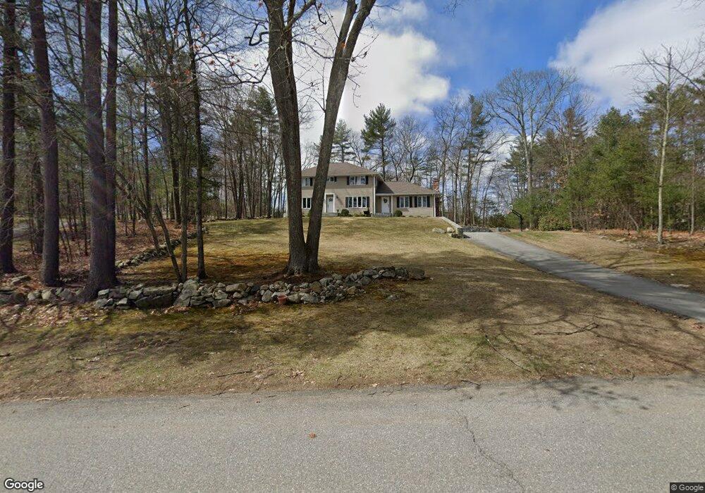
This home is located at 15 Washington Dr Unit A, Acton, MA 01720 and is currently estimated at $1,186,385, approximately $450 per square foot. 15 Washington Dr Unit A is a home located in Middlesex County with nearby schools including Acton-Boxborough Regional High School.
Ownership History
Date
Name
Owned For
Owner Type
Purchase Details
Closed on
Aug 12, 2022
Sold by
Ogrady Desmond and Ogrady Ciara
Bought by
Ogrady Dermot
Current Estimated Value
Purchase Details
Closed on
May 28, 1997
Sold by
Murphy Randall E
Bought by
Ogrady Dermot and Ogrady Ann
Create a Home Valuation Report for This Property
The Home Valuation Report is an in-depth analysis detailing your home's value as well as a comparison with similar homes in the area
Home Values in the Area
Average Home Value in this Area
Purchase History
| Date | Buyer | Sale Price | Title Company |
|---|---|---|---|
| Ogrady Dermot | -- | None Available | |
| Ogrady Dermot | $175,000 | -- | |
| Ogrady Dermot | $175,000 | -- |
Source: Public Records
Mortgage History
| Date | Status | Borrower | Loan Amount |
|---|---|---|---|
| Previous Owner | Ogrady Dermot | $140,000 |
Source: Public Records
Tax History
| Year | Tax Paid | Tax Assessment Tax Assessment Total Assessment is a certain percentage of the fair market value that is determined by local assessors to be the total taxable value of land and additions on the property. | Land | Improvement |
|---|---|---|---|---|
| 2025 | $19,006 | $1,108,200 | $406,400 | $701,800 |
| 2024 | $17,727 | $1,063,400 | $406,400 | $657,000 |
| 2023 | $17,304 | $985,400 | $369,800 | $615,600 |
| 2022 | $16,334 | $839,800 | $320,800 | $519,000 |
| 2021 | $16,194 | $800,500 | $297,300 | $503,200 |
| 2020 | $15,294 | $794,900 | $297,300 | $497,600 |
| 2019 | $14,597 | $753,600 | $297,300 | $456,300 |
| 2018 | $14,324 | $739,100 | $297,300 | $441,800 |
| 2017 | $14,244 | $747,300 | $297,300 | $450,000 |
| 2016 | $13,940 | $724,900 | $297,300 | $427,600 |
| 2015 | $13,375 | $702,100 | $297,300 | $404,800 |
| 2014 | $12,886 | $662,500 | $297,300 | $365,200 |
Source: Public Records
Map
Nearby Homes
- 11 Braebrook
- 18 Hayward Rd
- 33 Meadowbrook Rd
- 79 Charter Rd
- 46 Taylor Rd
- 491 Main St
- 524 Main St
- 5 Perkins Ln
- 709 Main St
- 20 Joseph Reed Ln
- 27 Forest Rd
- 246 Main St Unit 2
- 7 Kelley Rd
- 60 Nashoba Rd
- 95 Concord Rd
- 235 Arlington St
- 184 Main St Unit 3
- 4 Littlefield Rd
- 159 Skyline Dr Unit 159
- 25 Nylander Way
- 15 Washington Dr
- 15 Washington Dr
- 15 Washington Dr Unit 15
- 2 Jackson Dr
- 3 Coolidge Dr
- 5 Coolidge Dr
- 3 Roosevelt Dr
- 19 Washington Dr
- 4 Jackson Dr
- 7 Coolidge Dr
- 17 Washington Dr
- 13 Washington Dr
- 4 Coolidge Dr
- 6 Coolidge Dr
- 9 Coolidge Dr
- 18 Washington Dr
- 22 Washington Dr
- 22 Washington Dr Unit 1
- 20 Washington Dr
- 8 Coolidge Dr
Your Personal Tour Guide
Ask me questions while you tour the home.