Estimated Value: $527,737 - $567,000
3
Beds
2
Baths
2,224
Sq Ft
$245/Sq Ft
Est. Value
About This Home
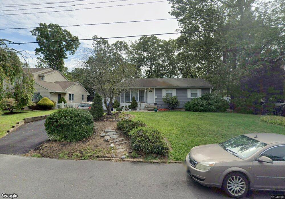
This home is located at 15 Wayside Dr, Brick, NJ 08724 and is currently estimated at $544,434, approximately $244 per square foot. 15 Wayside Dr is a home located in Ocean County with nearby schools including Midstreams Elementary School, Veterans Memorial Middle School, and Brick Township Memorial High School.
Ownership History
Date
Name
Owned For
Owner Type
Purchase Details
Closed on
Nov 1, 1995
Sold by
Castaldo Ralph
Bought by
Macchia Robert and Macchia Patricia
Current Estimated Value
Home Financials for this Owner
Home Financials are based on the most recent Mortgage that was taken out on this home.
Original Mortgage
$45,000
Outstanding Balance
$631
Interest Rate
7.62%
Estimated Equity
$543,803
Create a Home Valuation Report for This Property
The Home Valuation Report is an in-depth analysis detailing your home's value as well as a comparison with similar homes in the area
Home Values in the Area
Average Home Value in this Area
Purchase History
| Date | Buyer | Sale Price | Title Company |
|---|---|---|---|
| Macchia Robert | $125,000 | -- |
Source: Public Records
Mortgage History
| Date | Status | Borrower | Loan Amount |
|---|---|---|---|
| Open | Macchia Robert | $45,000 |
Source: Public Records
Tax History
| Year | Tax Paid | Tax Assessment Tax Assessment Total Assessment is a certain percentage of the fair market value that is determined by local assessors to be the total taxable value of land and additions on the property. | Land | Improvement |
|---|---|---|---|---|
| 2025 | $7,337 | $281,100 | $165,600 | $115,500 |
| 2024 | $6,963 | $281,100 | $165,600 | $115,500 |
| 2023 | $6,862 | $281,100 | $165,600 | $115,500 |
| 2022 | $6,862 | $281,100 | $165,600 | $115,500 |
| 2021 | $6,717 | $281,100 | $165,600 | $115,500 |
| 2020 | $6,631 | $281,100 | $165,600 | $115,500 |
| 2019 | $6,513 | $281,100 | $165,600 | $115,500 |
| 2018 | $6,364 | $281,100 | $165,600 | $115,500 |
| 2017 | $6,193 | $281,100 | $165,600 | $115,500 |
| 2016 | $6,159 | $281,100 | $165,600 | $115,500 |
| 2015 | $5,999 | $281,100 | $165,600 | $115,500 |
| 2014 | $5,948 | $281,100 | $165,600 | $115,500 |
Source: Public Records
Map
Nearby Homes
- 74 Fairview Ave
- 13 Golden Rod Ct
- 94 Sleepy Hollow Dr
- 1 Princeton Pines Place
- 4 East Trail
- 24 Davos Rd
- 3 C Trail
- 17 East Trail
- 36 Sleepy Hollow Dr
- 313 Shawnee Dr
- 315 Shawnee Dr
- 23 Island Dr
- 140 Meridian Dr
- 0 Island Ct
- 3 Metedeconk Rd
- 49 N Cherokee Ln
- 36 Lenape Trail
- 354 Rancocas Dr
- 769 Pine Dr
- 209 Winchester Dr
- 13 Wayside Dr
- 17 Wayside Dr
- 14 Greenhill Dr
- 16 Greenhill Dr
- 11 Wayside Dr
- 18 Wayside Dr
- 10 Greenhill Dr
- 12 Wayside Dr
- 21 Wayside Dr
- 20 Greenhill Dr
- 20 Wayside Dr
- 9 Wayside Dr
- 11 Fieldcrest Ln
- 15 Greenhill Dr
- 13 Greenhill Dr
- 10 Wayside Dr
- 22 Wayside Dr
- 7 Fieldcrest Ln
- 17 Fieldcrest Ln
- 17 Greenhill Dr
Your Personal Tour Guide
Ask me questions while you tour the home.