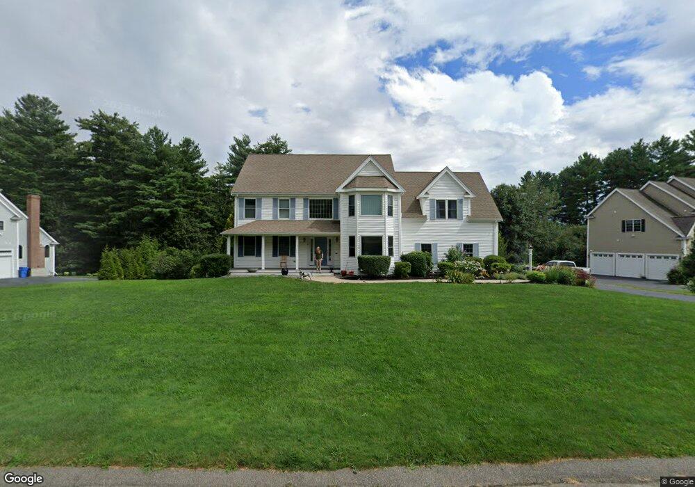
15 Wesley Dr Wrentham, MA 02093
West Wrentham NeighborhoodEstimated Value: $937,000 - $1,154,000
4
Beds
4
Baths
4,073
Sq Ft
$257/Sq Ft
Est. Value
About This Home
This home is located at 15 Wesley Dr, Wrentham, MA 02093 and is currently estimated at $1,044,945, approximately $256 per square foot. 15 Wesley Dr is a home located in Norfolk County with nearby schools including Delaney Elementary School, Charles E Roderick, and Rise Prep Mayoral Academy Middle School.
Ownership History
Date
Name
Owned For
Owner Type
Purchase Details
Closed on
Feb 25, 2011
Sold by
Bruner Leon H and Bruner Jacqueline A
Bought by
Ragan Daniel J and Ranga Christene M
Current Estimated Value
Home Financials for this Owner
Home Financials are based on the most recent Mortgage that was taken out on this home.
Original Mortgage
$477,000
Interest Rate
4.75%
Mortgage Type
Purchase Money Mortgage
Purchase Details
Closed on
Nov 30, 2000
Sold by
Pare Leo A
Bought by
Bruner Leon H and Bruner Jacqueline A
Home Financials for this Owner
Home Financials are based on the most recent Mortgage that was taken out on this home.
Original Mortgage
$411,550
Interest Rate
7.76%
Mortgage Type
Purchase Money Mortgage
Create a Home Valuation Report for This Property
The Home Valuation Report is an in-depth analysis detailing your home's value as well as a comparison with similar homes in the area
Home Values in the Area
Average Home Value in this Area
Purchase History
| Date | Buyer | Sale Price | Title Company |
|---|---|---|---|
| Ragan Daniel J | $530,000 | -- | |
| Bruner Leon H | $514,484 | -- |
Source: Public Records
Mortgage History
| Date | Status | Borrower | Loan Amount |
|---|---|---|---|
| Open | Bruner Leon H | $417,000 | |
| Closed | Ragan Daniel J | $477,000 | |
| Previous Owner | Bruner Leon H | $363,000 | |
| Previous Owner | Bruner Leon H | $411,550 |
Source: Public Records
Tax History
| Year | Tax Paid | Tax Assessment Tax Assessment Total Assessment is a certain percentage of the fair market value that is determined by local assessors to be the total taxable value of land and additions on the property. | Land | Improvement |
|---|---|---|---|---|
| 2025 | $10,286 | $887,500 | $217,800 | $669,700 |
| 2024 | $9,640 | $803,300 | $217,800 | $585,500 |
| 2023 | $9,581 | $759,200 | $198,700 | $560,500 |
| 2022 | $9,419 | $689,000 | $193,400 | $495,600 |
| 2021 | $8,961 | $636,900 | $181,200 | $455,700 |
| 2020 | $9,126 | $640,400 | $140,100 | $500,300 |
| 2019 | $8,718 | $617,400 | $140,100 | $477,300 |
| 2018 | $7,933 | $557,100 | $115,200 | $441,900 |
| 2017 | $7,662 | $537,700 | $113,000 | $424,700 |
| 2016 | $7,581 | $530,900 | $109,700 | $421,200 |
| 2015 | $8,296 | $553,800 | $154,800 | $399,000 |
| 2014 | $8,228 | $537,400 | $148,900 | $388,500 |
Source: Public Records
Map
Nearby Homes
- 9 Pebble Cir Unit 9
- 23 Palmetto Dr Unit 23
- 21 Palmetto Dr Unit 21
- 24 Palmetto Dr Unit 24
- 9 Brookfield Ln
- 25 Nature View Dr
- 20 Nature View Dr
- 925 Washington St
- 900 Washington St Lot 2
- 365 W Wrentham Rd
- 180 Pine Swamp Rd
- 56 Pine Swamp Rd
- 172 Pine Swamp Rd
- 101 Pine Grove Ave
- 352 Lake St
- 10 Follett Dr
- 66 Newland Ave
- 202 Paine St
- 21 Irving St
- 194 Paine St
Your Personal Tour Guide
Ask me questions while you tour the home.