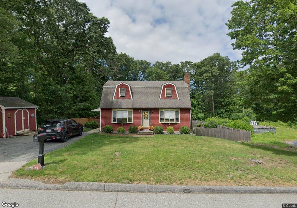
15 Westview Ave Millbury, MA 01527
Estimated Value: $478,000 - $594,000
3
Beds
2
Baths
1,632
Sq Ft
$320/Sq Ft
Est. Value
About This Home
This home is located at 15 Westview Ave, Millbury, MA 01527 and is currently estimated at $522,297, approximately $320 per square foot. 15 Westview Ave is a home located in Worcester County with nearby schools including Elmwood Street Elementary School, Raymond E. Shaw Elementary School, and Millbury Junior/Senior High School.
Ownership History
Date
Name
Owned For
Owner Type
Purchase Details
Closed on
Jan 18, 2013
Sold by
Gordish Andrew
Bought by
Gordish Andrew M
Current Estimated Value
Purchase Details
Closed on
Nov 29, 1991
Sold by
Utter David A
Bought by
Gordish Andrew G and Gordish Angela
Home Financials for this Owner
Home Financials are based on the most recent Mortgage that was taken out on this home.
Original Mortgage
$114,180
Interest Rate
8.72%
Mortgage Type
Purchase Money Mortgage
Create a Home Valuation Report for This Property
The Home Valuation Report is an in-depth analysis detailing your home's value as well as a comparison with similar homes in the area
Home Values in the Area
Average Home Value in this Area
Purchase History
| Date | Buyer | Sale Price | Title Company |
|---|---|---|---|
| Gordish Andrew M | -- | -- | |
| Gordish Andrew M | -- | -- | |
| Gordish Andrew G | $120,000 | -- | |
| Gordish Andrew G | $120,000 | -- |
Source: Public Records
Mortgage History
| Date | Status | Borrower | Loan Amount |
|---|---|---|---|
| Previous Owner | Gordish Andrew G | $114,180 |
Source: Public Records
Tax History Compared to Growth
Tax History
| Year | Tax Paid | Tax Assessment Tax Assessment Total Assessment is a certain percentage of the fair market value that is determined by local assessors to be the total taxable value of land and additions on the property. | Land | Improvement |
|---|---|---|---|---|
| 2025 | $5,679 | $424,100 | $111,800 | $312,300 |
| 2024 | $5,214 | $394,100 | $103,600 | $290,500 |
| 2023 | $4,796 | $331,900 | $72,700 | $259,200 |
| 2022 | $4,319 | $287,900 | $72,700 | $215,200 |
| 2021 | $5,240 | $276,800 | $72,700 | $204,100 |
| 2020 | $13,110 | $273,200 | $72,700 | $200,500 |
| 2019 | $7,592 | $256,900 | $66,000 | $190,900 |
| 2018 | $12,244 | $247,700 | $66,000 | $181,700 |
| 2017 | $3,800 | $231,300 | $66,000 | $165,300 |
| 2016 | $3,615 | $219,600 | $66,000 | $153,600 |
| 2015 | $3,567 | $216,700 | $70,200 | $146,500 |
| 2014 | $3,338 | $195,200 | $70,200 | $125,000 |
Source: Public Records
Map
Nearby Homes
- 11 Westview Ave
- 12 Irene Ct
- 2 Diane St
- 1 Pineland Ave
- 86 Wheelock Ave
- 3 May St
- 1 Broadmeadow Ave
- 330 Millbury Ave
- 497 Massasoit Rd
- 12 Alstead Path
- 27 A-B Grafton St
- 3 Stidsen Way
- 232 Weatherstone Dr
- 76 Weatherstone Dr
- 11 Maplewood Rd
- 90 Macarthur Dr
- 1203 Grafton St Unit 38
- 1201 Grafton St Unit 73
- 1195 Grafton St Unit 3
- 11 Margin St
- 73 Westview Ave
- Lot 0 Westview Ave
- 17 Westview Ave
- Lot 68 Westview Ave
- Lot 65 Westview Ave
- Lot 96 Westview Ave
- Lot 98 Westview Ave
- Lot 97 Westview Ave
- Lot 66 Westview Ave
- Lot 63 Westview Ave
- Lot 64 Westview Ave
- Lot 67 Westview Ave
- Lot 94 Westview Ave
- Lot 91 Westview Ave
- Lot 72 Westview Ave
- Lot 71 Westview Ave
- Lot 70 Westview Ave
- Lot 69 Westview Ave
- 55 Oak Pond Ave
- 16 Westview Ave