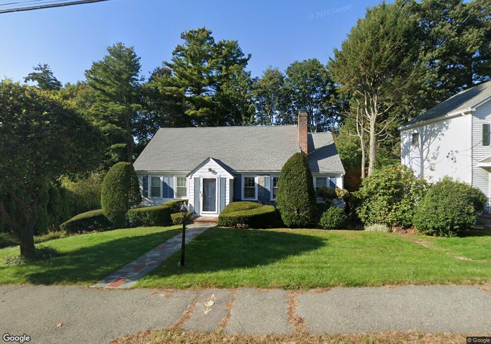
15 White Pine Rd Newton Upper Falls, MA 02464
Newton Upper Falls NeighborhoodEstimated Value: $1,240,000 - $1,371,740
3
Beds
2
Baths
1,850
Sq Ft
$697/Sq Ft
Est. Value
About This Home
This home is located at 15 White Pine Rd, Newton Upper Falls, MA 02464 and is currently estimated at $1,289,185, approximately $696 per square foot. 15 White Pine Rd is a home located in Middlesex County with nearby schools including Zervas Elementary School, Angier Elementary School, and Charles E Brown Middle School.
Ownership History
Date
Name
Owned For
Owner Type
Purchase Details
Closed on
Aug 17, 2007
Sold by
Benjamin Coralie Wendy and Benjamin Richard J
Bought by
Yee Bryant C and Yee Christina G
Current Estimated Value
Home Financials for this Owner
Home Financials are based on the most recent Mortgage that was taken out on this home.
Original Mortgage
$397,000
Interest Rate
6.67%
Mortgage Type
Purchase Money Mortgage
Purchase Details
Closed on
Aug 7, 1997
Sold by
Guccione Andrew A and Guccione Nancy Z
Bought by
Benjamin Richard J and Benjamin Coralie W
Home Financials for this Owner
Home Financials are based on the most recent Mortgage that was taken out on this home.
Original Mortgage
$247,125
Interest Rate
7.5%
Mortgage Type
Purchase Money Mortgage
Create a Home Valuation Report for This Property
The Home Valuation Report is an in-depth analysis detailing your home's value as well as a comparison with similar homes in the area
Home Values in the Area
Average Home Value in this Area
Purchase History
| Date | Buyer | Sale Price | Title Company |
|---|---|---|---|
| Yee Bryant C | $622,000 | -- | |
| Benjamin Richard J | $329,500 | -- |
Source: Public Records
Mortgage History
| Date | Status | Borrower | Loan Amount |
|---|---|---|---|
| Open | Benjamin Richard J | $376,000 | |
| Closed | Yee Bryant C | $397,000 | |
| Previous Owner | Benjamin Richard J | $294,000 | |
| Previous Owner | Benjamin Richard J | $247,125 |
Source: Public Records
Tax History
| Year | Tax Paid | Tax Assessment Tax Assessment Total Assessment is a certain percentage of the fair market value that is determined by local assessors to be the total taxable value of land and additions on the property. | Land | Improvement |
|---|---|---|---|---|
| 2025 | $10,110 | $1,031,600 | $953,500 | $78,100 |
| 2024 | $9,776 | $1,001,600 | $925,700 | $75,900 |
| 2023 | $9,183 | $902,100 | $704,200 | $197,900 |
| 2022 | $8,787 | $835,300 | $652,000 | $183,300 |
| 2021 | $8,479 | $788,000 | $615,100 | $172,900 |
| 2020 | $8,227 | $788,000 | $615,100 | $172,900 |
| 2019 | $7,784 | $744,900 | $597,200 | $147,700 |
| 2018 | $7,423 | $686,000 | $537,700 | $148,300 |
| 2017 | $7,197 | $647,200 | $507,300 | $139,900 |
| 2016 | $6,884 | $604,900 | $474,100 | $130,800 |
| 2015 | $6,563 | $565,300 | $443,100 | $122,200 |
Source: Public Records
Map
Nearby Homes
- 5 Summer St
- 29 Cottage St Unit 29
- 51 Pettee St Unit 31
- 1003 Chestnut St
- 30 Circuit Ave Unit 30
- 1077 Boylston St Unit 1
- 304 Elliot St Carriage House S Unit 4
- 302 Elliot St Carriage House N Unit 3
- 300 Elliot St Unit 2
- 873 Chestnut St
- 18 Josselyn Place Unit 18
- 16-18 Josselyn Place Unit 16
- 16-18 Josselyn Place Unit 18
- 12 Bemuth Rd
- 829 Chestnut St
- 10 Pennsylvania Ave Unit 1
- 20 Pennsylvania Ave
- 20 Pennsylvania Ave Unit 20
- 27 Hamilton Place
- 54 Indiana Terrace
- 19 White Pine Rd
- 7 White Pine Rd
- 1174 Boylston St
- 16 White Pine Rd
- 27 Hickory Cliff Rd
- 23 White Pine Rd
- 1190 Boylston St Unit B
- 1190 Boylston St Unit A
- 5 Hickory Cliff Rd
- 34 White Pine Rd
- 29 White Pine Rd
- 33 Hickory Cliff Rd
- 24 Hickory Cliff Rd
- 1160 Boylston St Unit 2
- 6 Roundwood Rd
- 40 White Pine Rd
- 11 Tamarac Rd
- 1156 Boylston St
- 32 Hickory Cliff Rd
- 18 Rockland Place
Your Personal Tour Guide
Ask me questions while you tour the home.