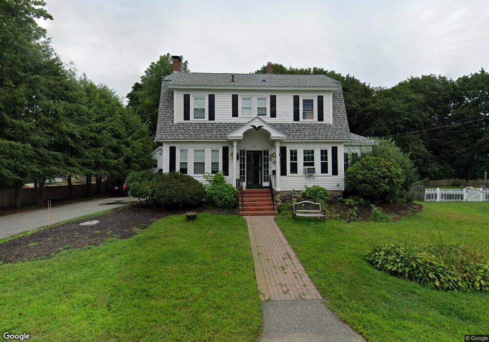
15 Whiting St Billerica, MA 01821
Estimated Value: $588,760 - $721,000
3
Beds
2
Baths
1,734
Sq Ft
$378/Sq Ft
Est. Value
About This Home
This home is located at 15 Whiting St, Billerica, MA 01821 and is currently estimated at $654,690, approximately $377 per square foot. 15 Whiting St is a home located in Middlesex County with nearby schools including Billerica Memorial High School.
Ownership History
Date
Name
Owned For
Owner Type
Purchase Details
Closed on
Jun 30, 1998
Sold by
Suprey Walter
Bought by
Aiken Elizabeth A and Costello Mary E
Current Estimated Value
Home Financials for this Owner
Home Financials are based on the most recent Mortgage that was taken out on this home.
Original Mortgage
$150,000
Interest Rate
7.09%
Mortgage Type
Purchase Money Mortgage
Create a Home Valuation Report for This Property
The Home Valuation Report is an in-depth analysis detailing your home's value as well as a comparison with similar homes in the area
Purchase History
| Date | Buyer | Sale Price | Title Company |
|---|---|---|---|
| Aiken Elizabeth A | $217,500 | -- |
Source: Public Records
Mortgage History
| Date | Status | Borrower | Loan Amount |
|---|---|---|---|
| Open | Aiken Elizabeth A | $175,000 | |
| Closed | Aiken Elizabeth A | $110,000 | |
| Closed | Aiken Elizabeth A | $150,000 |
Source: Public Records
Tax History
| Year | Tax Paid | Tax Assessment Tax Assessment Total Assessment is a certain percentage of the fair market value that is determined by local assessors to be the total taxable value of land and additions on the property. | Land | Improvement |
|---|---|---|---|---|
| 2025 | $6,182 | $543,700 | $281,800 | $261,900 |
| 2024 | $5,940 | $526,100 | $272,900 | $253,200 |
| 2023 | $5,766 | $485,800 | $248,300 | $237,500 |
| 2022 | $5,179 | $409,700 | $212,200 | $197,500 |
| 2021 | $4,934 | $379,500 | $186,300 | $193,200 |
| 2020 | $4,835 | $372,200 | $179,000 | $193,200 |
| 2019 | $4,761 | $353,200 | $177,400 | $175,800 |
| 2018 | $4,568 | $321,900 | $157,500 | $164,400 |
| 2017 | $4,338 | $307,900 | $152,500 | $155,400 |
| 2016 | $4,307 | $304,600 | $149,200 | $155,400 |
| 2015 | $4,277 | $304,600 | $149,200 | $155,400 |
| 2014 | $4,263 | $298,300 | $142,900 | $155,400 |
Source: Public Records
Map
Nearby Homes
- 5 Kenmar Dr Unit 9
- 405 Boston Rd Unit 6
- 10 Kenmar Dr Unit 40
- 20 Kenmar Dr Unit 189
- 19 Porter St
- 24 Friendship St
- 2 Perreault Ave
- 36 Allen Rd
- 23 Floyd St
- 39 Sycamore Ln
- 15 Blades Cir
- 81 Salem Rd Unit 74
- 81 Salem Rd Unit 102
- 24 Holly St
- 36 Webb Brook Rd Unit 3
- 18 Fox Hill Rd
- 25 Wyman Rd
- 32 Marshall St
- 30 Wyman Rd
- 133 Salem Rd
- 13 Whiting St
- 22 Richardson St
- 16 Richardson St
- 16 Whiting St
- 18 Whiting St
- 14 Whiting St
- 11 Whiting St
- 14 Richardson St
- 10 Whiting St Unit 12
- 21 Richardson St
- 4 Dickinson St
- 17 Richardson St
- 12 Richardson St
- 26 Richardson St
- 12 Whiting St
- 23 Richardson St
- 6 Dickinson St
- 15 Richardson St
- 13 Richardson St
- 5 Whiting St
Your Personal Tour Guide
Ask me questions while you tour the home.