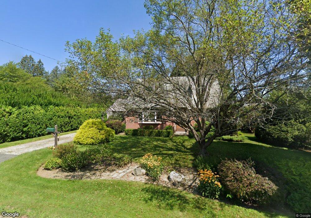
15 Whitman St Pittsfield, MA 01201
Estimated Value: $307,757 - $629,000
3
Beds
2
Baths
1,956
Sq Ft
$229/Sq Ft
Est. Value
About This Home
This home is located at 15 Whitman St, Pittsfield, MA 01201 and is currently estimated at $447,689, approximately $228 per square foot. 15 Whitman St is a home located in Berkshire County with nearby schools including Crosby Elementary School, John T. Reid Middle School, and Taconic High School.
Ownership History
Date
Name
Owned For
Owner Type
Purchase Details
Closed on
Mar 15, 2021
Sold by
Young Charles F
Bought by
15 Whitman Street Nt
Current Estimated Value
Purchase Details
Closed on
Aug 13, 1987
Sold by
Goldsmith D Roy
Bought by
Young Charles F
Home Financials for this Owner
Home Financials are based on the most recent Mortgage that was taken out on this home.
Original Mortgage
$85,400
Interest Rate
10.4%
Mortgage Type
Purchase Money Mortgage
Create a Home Valuation Report for This Property
The Home Valuation Report is an in-depth analysis detailing your home's value as well as a comparison with similar homes in the area
Home Values in the Area
Average Home Value in this Area
Purchase History
| Date | Buyer | Sale Price | Title Company |
|---|---|---|---|
| 15 Whitman Street Nt | -- | None Available | |
| Young Charles F | $122,000 | -- |
Source: Public Records
Mortgage History
| Date | Status | Borrower | Loan Amount |
|---|---|---|---|
| Previous Owner | Young Charles F | $94,000 | |
| Previous Owner | Young Charles F | $10,000 | |
| Previous Owner | Young Charles F | $85,400 | |
| Previous Owner | Young Charles F | $35,000 |
Source: Public Records
Tax History Compared to Growth
Tax History
| Year | Tax Paid | Tax Assessment Tax Assessment Total Assessment is a certain percentage of the fair market value that is determined by local assessors to be the total taxable value of land and additions on the property. | Land | Improvement |
|---|---|---|---|---|
| 2025 | $4,817 | $268,500 | $64,700 | $203,800 |
| 2024 | $4,565 | $247,400 | $64,700 | $182,700 |
| 2023 | $4,281 | $233,700 | $64,700 | $169,000 |
| 2022 | $3,792 | $204,300 | $57,300 | $147,000 |
| 2021 | $3,486 | $181,100 | $57,300 | $123,800 |
| 2020 | $3,731 | $189,300 | $69,700 | $119,600 |
| 2019 | $3,534 | $182,000 | $64,700 | $117,300 |
| 2018 | $3,579 | $179,600 | $64,700 | $114,900 |
| 2017 | $3,541 | $180,400 | $69,700 | $110,700 |
| 2016 | $3,394 | $180,900 | $69,700 | $111,200 |
| 2015 | $3,267 | $180,900 | $69,700 | $111,200 |
Source: Public Records
Map
Nearby Homes
- 51 Churchill Crest Unit 51
- 26 Churchill Crest
- 44 Churchill Crest Unit 44
- 46 Churchill Crest Unit 46
- 40 Churchill St
- 149 Fort Hill Ave
- 2 Amy Ct Unit 2
- 144 Eastbrook Ln
- 0 Eastbrook Ln
- 8 Northbrook Ln
- 122 Blythewood Dr
- Lot 144 Eastbrook Ln
- 36 Roberta Rd
- Lot 140 Westbrook Terrace
- LOT #6 Cascade St
- 0 Westbrook Terrace
- 140 Westbrook Terrace
- 36 Old Farm Ln
- 18 Old Farm Ln
- 32 Mead Ave
- 67 Whitman St
- 5 Whitman St
- 15 Mountainview Dr
- 1207 West St
- 2 Meadow Ridge Dr
- 1201 West St
- 18 Whitman St
- 12 Whitman St
- 6 Whitman St
- 4 Meadow Ridge Dr
- 16 Mountainview Dr
- 4 Jackson St
- 1193 West St
- 35 Mountainview Dr
- 6 Meadow Ridge Dr
- 1189 West St
- 1 Meadow Ridge Dr
- 1233 West St
- 7 Jackson St
- 12 Jackson St