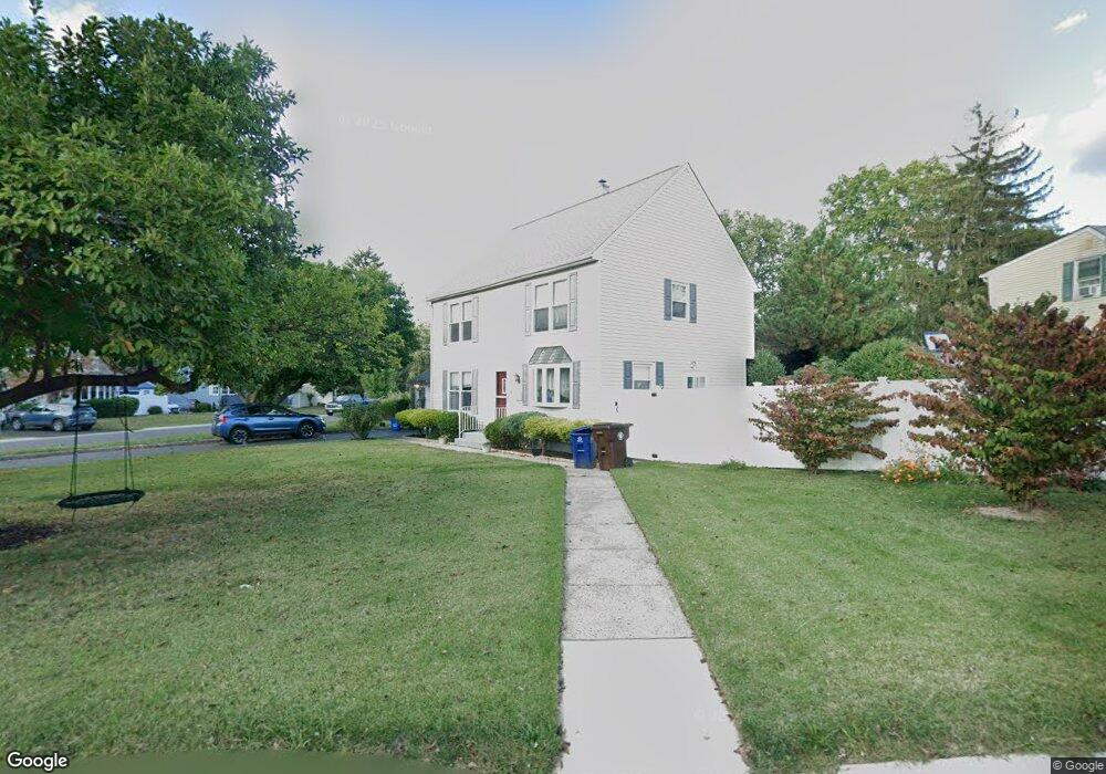
15 Wilcox Rd New Brunswick, NJ 08901
Estimated Value: $546,747 - $583,000
4
Beds
2
Baths
1,600
Sq Ft
$349/Sq Ft
Est. Value
About This Home
This home is located at 15 Wilcox Rd, New Brunswick, NJ 08901 and is currently estimated at $557,937, approximately $348 per square foot. 15 Wilcox Rd is a home located in Middlesex County with nearby schools including New Brunswick High School.
Ownership History
Date
Name
Owned For
Owner Type
Purchase Details
Closed on
Sep 7, 2018
Sold by
Keefe Michael and The Estate Of Ursula Drott
Bought by
Garcia Jimenez Alberto
Current Estimated Value
Home Financials for this Owner
Home Financials are based on the most recent Mortgage that was taken out on this home.
Original Mortgage
$297,140
Outstanding Balance
$259,147
Interest Rate
4.6%
Mortgage Type
New Conventional
Estimated Equity
$298,790
Purchase Details
Closed on
Sep 19, 2014
Sold by
Kahn Richard and Kahn Kimberly
Bought by
Drott Ursula
Purchase Details
Closed on
Apr 30, 2001
Sold by
Garthe Joseph
Bought by
Kahn Richard
Home Financials for this Owner
Home Financials are based on the most recent Mortgage that was taken out on this home.
Original Mortgage
$127,200
Interest Rate
7.03%
Create a Home Valuation Report for This Property
The Home Valuation Report is an in-depth analysis detailing your home's value as well as a comparison with similar homes in the area
Home Values in the Area
Average Home Value in this Area
Purchase History
| Date | Buyer | Sale Price | Title Company |
|---|---|---|---|
| Garcia Jimenez Alberto | $332,000 | Trident Abstract Title Agenc | |
| Drott Ursula | $332,500 | Multiple | |
| Kahn Richard | $133,900 | -- |
Source: Public Records
Mortgage History
| Date | Status | Borrower | Loan Amount |
|---|---|---|---|
| Open | Garcia Jimenez Alberto | $297,140 | |
| Previous Owner | Kahn Richard | $127,200 |
Source: Public Records
Tax History Compared to Growth
Tax History
| Year | Tax Paid | Tax Assessment Tax Assessment Total Assessment is a certain percentage of the fair market value that is determined by local assessors to be the total taxable value of land and additions on the property. | Land | Improvement |
|---|---|---|---|---|
| 2025 | $7,352 | $280,700 | $143,900 | $136,800 |
| 2024 | $7,138 | $280,700 | $143,900 | $136,800 |
| 2023 | $7,138 | $280,700 | $143,900 | $136,800 |
| 2022 | $6,987 | $280,700 | $143,900 | $136,800 |
| 2021 | $5,183 | $280,700 | $143,900 | $136,800 |
| 2020 | $6,933 | $280,700 | $143,900 | $136,800 |
| 2019 | $6,801 | $280,700 | $143,900 | $136,800 |
| 2018 | $6,647 | $280,700 | $143,900 | $136,800 |
| 2017 | $6,133 | $280,700 | $143,900 | $136,800 |
| 2016 | $8,817 | $150,300 | $52,900 | $97,400 |
| 2015 | $8,606 | $150,300 | $52,900 | $97,400 |
| 2014 | $8,453 | $150,300 | $52,900 | $97,400 |
Source: Public Records
Map
Nearby Homes
- 63 Pennington Rd
- 88 Fox Rd Unit 4B
- 104 S Pennington Rd
- 66 Fox Rd Unit 9B
- 106 S Pennington Rd
- 60 Fox Rd
- 37 York Dr Unit 6A
- 15 York Dr Unit 1B
- 31 York Dr Unit 3A
- 11 Cotter Dr
- 53 Patton Dr
- 396 S 7th Ave
- 49 Player Ave
- 500 Grove Ave
- 523 Sadie Cir
- 628 Sadie Cir
- 602 Sadie Cir
- 521 Sadie Cir
- 257 S 6th Ave
- 513 Sadie Cir