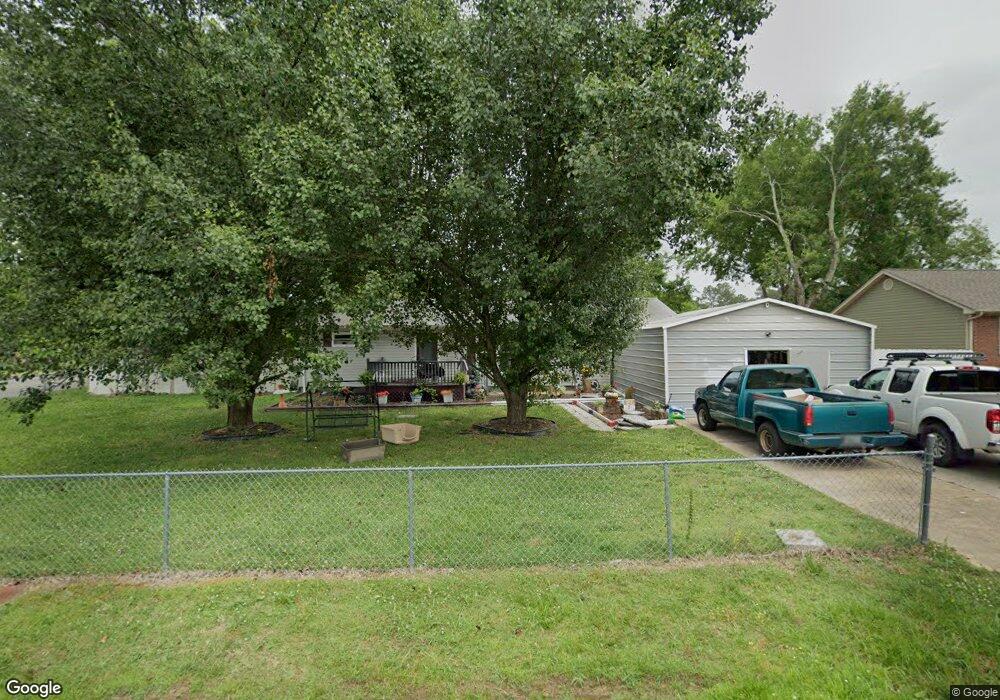
15 Wofford St Rossville, GA 30741
Westside NeighborhoodEstimated Value: $179,632 - $250,000
3
Beds
2
Baths
1,300
Sq Ft
$162/Sq Ft
Est. Value
About This Home
This home is located at 15 Wofford St, Rossville, GA 30741 and is currently estimated at $210,408, approximately $161 per square foot. 15 Wofford St is a home located in Catoosa County with nearby schools including West Side Elementary School, Lakeview Middle School, and Lakeview-Fort Oglethorpe High School.
Ownership History
Date
Name
Owned For
Owner Type
Purchase Details
Closed on
Jun 20, 2011
Sold by
Huddleston Leann M
Bought by
Russell Leann M
Current Estimated Value
Home Financials for this Owner
Home Financials are based on the most recent Mortgage that was taken out on this home.
Original Mortgage
$94,437
Outstanding Balance
$65,831
Interest Rate
4.87%
Mortgage Type
FHA
Estimated Equity
$144,577
Create a Home Valuation Report for This Property
The Home Valuation Report is an in-depth analysis detailing your home's value as well as a comparison with similar homes in the area
Home Values in the Area
Average Home Value in this Area
Purchase History
| Date | Buyer | Sale Price | Title Company |
|---|---|---|---|
| Russell Leann M | -- | -- |
Source: Public Records
Mortgage History
| Date | Status | Borrower | Loan Amount |
|---|---|---|---|
| Open | Russell Leann M | $94,437 |
Source: Public Records
Tax History Compared to Growth
Tax History
| Year | Tax Paid | Tax Assessment Tax Assessment Total Assessment is a certain percentage of the fair market value that is determined by local assessors to be the total taxable value of land and additions on the property. | Land | Improvement |
|---|---|---|---|---|
| 2024 | $953 | $44,700 | $6,907 | $37,793 |
| 2023 | $793 | $35,420 | $6,907 | $28,513 |
| 2022 | $642 | $28,692 | $6,907 | $21,785 |
| 2021 | $600 | $28,692 | $6,907 | $21,785 |
| 2020 | $546 | $23,611 | $5,131 | $18,480 |
| 2019 | $552 | $23,611 | $5,131 | $18,480 |
| 2018 | $583 | $23,611 | $5,131 | $18,480 |
| 2017 | $586 | $23,714 | $5,131 | $18,583 |
| 2016 | $577 | $22,194 | $5,131 | $17,063 |
| 2015 | -- | $22,194 | $5,131 | $17,063 |
| 2014 | -- | $22,194 | $5,131 | $17,063 |
| 2013 | -- | $22,193 | $5,130 | $17,062 |
Source: Public Records
Map
Nearby Homes
- 599 Steele Rd
- 521 Steele Rd
- 767 Steele Rd
- 81 Idle Place Cir
- 396 Idle Place Cir
- 378 Idle Place Cir
- 390 Idle Place Cir
- 210 Honeyberry Ln
- 344 Flagstone Dr
- 164 Idle Place Cir
- 146 Idle Place Cir
- 372 Idle Place Cir
- 420 Flagstone Dr
- 57 Idle Place Cir
- 211 Idle Place Cir
- 239 Flagstone Dr
- 631 N Peppercorn Ln
- 64 Yellow Brick Rd
- 196 Flagstone Dr
- 66 Yellow Brick Rd
- 31 Wofford St
- 12 Wofford St
- 12 Wofford St Unit 14/15
- 18 Rathbun Cir
- 40 Rathbun Cir
- 47 Wofford St
- 34 Wofford St
- 14 Honeyberry Ln
- 635 Steele Rd
- 48 Wofford St
- 19 Honeyberry Ln
- 63 Wofford St
- 17 Rathbun Cir
- 38 Cedar Tree Ln
- 24 Honeyberry Ln
- 728 Steele Rd
- 64 Rathbun Cir
- 41 Patsy Ln
- 78 Cedar Tree Ln
- 540 Steele Rd