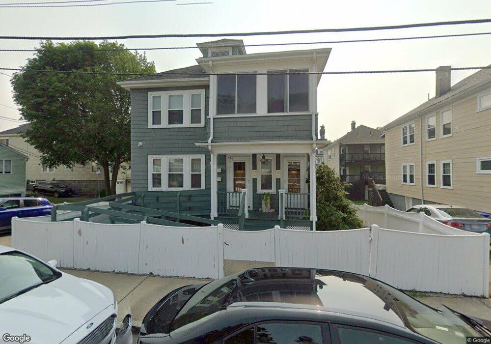
15 Woodfield St Unit 17 Dorchester, MA 02122
Neponset-Port Norfolk NeighborhoodEstimated Value: $926,773 - $993,000
6
Beds
3
Baths
2,288
Sq Ft
$418/Sq Ft
Est. Value
About This Home
This home is located at 15 Woodfield St Unit 17, Dorchester, MA 02122 and is currently estimated at $957,193, approximately $418 per square foot. 15 Woodfield St Unit 17 is a home located in Suffolk County with nearby schools including Conservatory Lab Upper School, St Brendan School, and Epiphany School.
Ownership History
Date
Name
Owned For
Owner Type
Purchase Details
Closed on
Dec 21, 2020
Sold by
Wood Patricia A
Bought by
Peverly Hill Llc
Current Estimated Value
Purchase Details
Closed on
Jan 31, 2011
Sold by
Wood John L and Wood Patricia A
Bought by
Boston City Of
Purchase Details
Closed on
Dec 2, 2005
Sold by
Woodfield St Rt
Bought by
Wood John L and Wood Patricia A
Home Financials for this Owner
Home Financials are based on the most recent Mortgage that was taken out on this home.
Original Mortgage
$199,000
Interest Rate
6.14%
Mortgage Type
Purchase Money Mortgage
Create a Home Valuation Report for This Property
The Home Valuation Report is an in-depth analysis detailing your home's value as well as a comparison with similar homes in the area
Home Values in the Area
Average Home Value in this Area
Purchase History
| Date | Buyer | Sale Price | Title Company |
|---|---|---|---|
| Peverly Hill Llc | -- | None Available | |
| Boston City Of | $2,041 | -- | |
| Wood John L | $450,000 | -- |
Source: Public Records
Mortgage History
| Date | Status | Borrower | Loan Amount |
|---|---|---|---|
| Previous Owner | Wood John L | $199,000 |
Source: Public Records
Tax History Compared to Growth
Tax History
| Year | Tax Paid | Tax Assessment Tax Assessment Total Assessment is a certain percentage of the fair market value that is determined by local assessors to be the total taxable value of land and additions on the property. | Land | Improvement |
|---|---|---|---|---|
| 2025 | $9,059 | $782,300 | $290,100 | $492,200 |
| 2024 | $8,062 | $739,600 | $237,500 | $502,100 |
| 2023 | $7,709 | $717,800 | $230,500 | $487,300 |
| 2022 | $7,296 | $670,600 | $215,400 | $455,200 |
| 2021 | $6,815 | $638,700 | $205,100 | $433,600 |
| 2020 | $5,995 | $567,700 | $191,900 | $375,800 |
| 2019 | $5,541 | $525,700 | $151,200 | $374,500 |
| 2018 | $5,245 | $500,500 | $151,200 | $349,300 |
| 2017 | $5,048 | $476,700 | $151,200 | $325,500 |
| 2016 | $4,855 | $441,400 | $151,200 | $290,200 |
| 2015 | $4,364 | $360,400 | $137,300 | $223,100 |
| 2014 | $4,160 | $330,700 | $137,300 | $193,400 |
Source: Public Records
Map
Nearby Homes
- 107 Minot St
- 103 Minot St
- 25 Crockett Ave
- 45 Chickatawbut St Unit 1
- 45 Chickatawbut St Unit 2
- 97 Oakton Ave Unit two
- 43 Chickatawbut St
- 667 Adams St
- 102 Milton St
- 61 Hill Top St
- 40 Westmoreland St Unit 5
- 37 Westmoreland St
- 80 Beaumont St Unit 101
- 251 Minot St Unit 6
- 22 Chickatawbut St Unit 2
- 51 Coffey St Unit 51C
- 4 Chickatawbut St
- 45 Coffey St Unit 45-1
- 56 Coffey St Unit 7
- 48 Coffey St Unit PH:10D
- 9 Woodfield St Unit 11
- 596 Gallivan Blvd Unit 598
- 14 Branton St
- 14 Branton St Unit 2
- 592 Gallivan Blvd Unit 594
- 10 Branton St
- 10 Branton St Unit 1
- 10 Branton St Unit 2
- 57 Woodfield St
- 12 Woodfield St Unit 14
- 14 Woodfield St
- 12 Woodfield St Unit 1
- 14 Woodfield St Unit 1
- 16 Woodfield St Unit 18
- 16 Woodfield St Unit 1
- 6 Branton St
- 590 Gallivan Blvd
- 590 Gallivan Blvd Unit 1
- 8-10 Woodfield St Unit 2
- 8-10 Woodfield St Unit 1