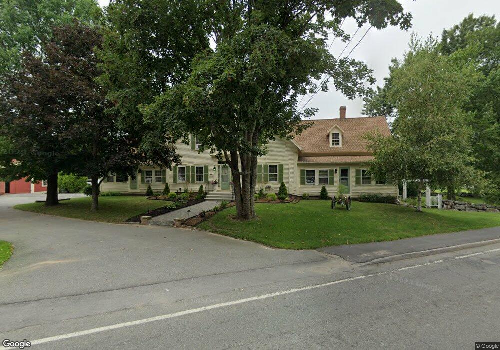
15 Wyman Rd Billerica, MA 01821
Estimated Value: $860,000 - $990,697
4
Beds
4
Baths
3,738
Sq Ft
$250/Sq Ft
Est. Value
About This Home
This home is located at 15 Wyman Rd, Billerica, MA 01821 and is currently estimated at $933,566, approximately $249 per square foot. 15 Wyman Rd is a home located in Middlesex County with nearby schools including Billerica Memorial High School.
Ownership History
Date
Name
Owned For
Owner Type
Purchase Details
Closed on
Oct 19, 2017
Sold by
Mackay Penelope A and Mackay Eric J
Bought by
R Penelope
Current Estimated Value
Purchase Details
Closed on
Sep 1, 2017
Sold by
Mackay Richard H
Bought by
Mackay Eric J and Mackay Penelope A
Purchase Details
Closed on
Nov 22, 1985
Bought by
Mackay Richard H
Create a Home Valuation Report for This Property
The Home Valuation Report is an in-depth analysis detailing your home's value as well as a comparison with similar homes in the area
Home Values in the Area
Average Home Value in this Area
Purchase History
| Date | Buyer | Sale Price | Title Company |
|---|---|---|---|
| R Penelope | -- | -- | |
| Mackay Eric J | -- | -- | |
| Mackay Richard H | -- | -- |
Source: Public Records
Mortgage History
| Date | Status | Borrower | Loan Amount |
|---|---|---|---|
| Previous Owner | Mackay Richard H | $10,385 | |
| Previous Owner | Mackay Richard H | $30,000 |
Source: Public Records
Tax History Compared to Growth
Tax History
| Year | Tax Paid | Tax Assessment Tax Assessment Total Assessment is a certain percentage of the fair market value that is determined by local assessors to be the total taxable value of land and additions on the property. | Land | Improvement |
|---|---|---|---|---|
| 2025 | -- | $796,356 | $339,856 | $456,500 |
| 2024 | -- | $704,800 | $307,500 | $397,300 |
| 2023 | $0 | $657,880 | $260,580 | $397,300 |
| 2022 | $0 | $595,790 | $239,790 | $356,000 |
| 2021 | $0 | $572,610 | $224,810 | $347,800 |
| 2020 | $0 | $563,810 | $216,010 | $347,800 |
| 2019 | $0 | $503,580 | $190,180 | $313,400 |
| 2018 | $0 | $474,140 | $176,340 | $297,800 |
| 2017 | $0 | $441,500 | $168,100 | $273,400 |
| 2016 | -- | $433,860 | $165,960 | $267,900 |
| 2015 | -- | $427,860 | $159,960 | $267,900 |
| 2014 | -- | $386,260 | $150,460 | $235,800 |
Source: Public Records
Map
Nearby Homes
- 30 Wyman Rd
- 88 Lexington Rd
- 86 Lexington Rd
- 10 Scroxton Dr
- 10 Pearl Rd
- 10 Wentworth Dr
- 17 Ravine Rd
- 56 Glad Valley Dr
- 32 Marshall St
- 8 Water St
- 110 Friendship St
- 37 Porter St
- 463 Middlesex Turnpike
- 454 Middlesex Turnpike
- 300 Albion Rd Unit 306
- 14 Kenmar Dr Unit 111
- 22 Kenmar Dr Unit 194Y
- 11 Autumn St
- 5 Day St
- 2 Karen Cir Unit 2