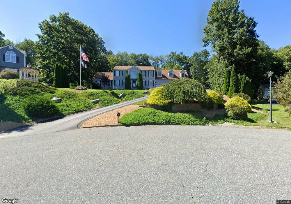
15 Yeoman Rd Charlton, MA 01507
Estimated Value: $663,000 - $742,000
3
Beds
3
Baths
2,200
Sq Ft
$321/Sq Ft
Est. Value
About This Home
This home is located at 15 Yeoman Rd, Charlton, MA 01507 and is currently estimated at $705,177, approximately $320 per square foot. 15 Yeoman Rd is a home located in Worcester County with nearby schools including Shepherd Hill Regional High School.
Ownership History
Date
Name
Owned For
Owner Type
Purchase Details
Closed on
Aug 25, 2000
Sold by
Mutual Bldrs Inc
Bought by
Cook Susan M and Dagnese Steven R
Current Estimated Value
Create a Home Valuation Report for This Property
The Home Valuation Report is an in-depth analysis detailing your home's value as well as a comparison with similar homes in the area
Home Values in the Area
Average Home Value in this Area
Purchase History
| Date | Buyer | Sale Price | Title Company |
|---|---|---|---|
| Cook Susan M | $226,000 | -- | |
| Cook Susan M | $226,000 | -- |
Source: Public Records
Mortgage History
| Date | Status | Borrower | Loan Amount |
|---|---|---|---|
| Open | Cook Susan M | $265,000 | |
| Closed | Cook Susan M | $60,000 | |
| Closed | Cook Susan M | $21,000 |
Source: Public Records
Tax History Compared to Growth
Tax History
| Year | Tax Paid | Tax Assessment Tax Assessment Total Assessment is a certain percentage of the fair market value that is determined by local assessors to be the total taxable value of land and additions on the property. | Land | Improvement |
|---|---|---|---|---|
| 2025 | $7,193 | $646,300 | $105,600 | $540,700 |
| 2024 | $6,958 | $613,600 | $99,900 | $513,700 |
| 2023 | $6,842 | $562,200 | $99,900 | $462,300 |
| 2022 | $6,676 | $502,300 | $88,500 | $413,800 |
| 2021 | $6,654 | $443,300 | $79,900 | $363,400 |
| 2020 | $6,574 | $440,000 | $75,900 | $364,100 |
| 2019 | $6,189 | $419,000 | $75,900 | $343,100 |
| 2018 | $5,657 | $419,000 | $75,900 | $343,100 |
| 2017 | $5,572 | $395,200 | $75,900 | $319,300 |
| 2016 | $5,446 | $395,200 | $75,900 | $319,300 |
| 2015 | $5,304 | $395,200 | $75,900 | $319,300 |
| 2014 | $4,579 | $361,700 | $80,900 | $280,800 |
Source: Public Records
Map
Nearby Homes
- 49 Jennings Rd
- Lot 0 N Sturbridge Rd
- 3 Cranberry Meadow Shore Rd
- 45 Jennings Rd
- 204 Brookfield Rd
- 86 Jolicoeur Ave
- 216 Brookfield Rd
- 208 Sunset Dr
- Lot 3 0 N Sullivan Rd
- Lot 6 0 N Sullivan Rd
- Lot 5 0 N Sullivan Rd
- Lot 4 0 N Sullivan Rd
- 38 N Sullivan Rd
- 9 Hebert Rd
- 38 Stevens Park Rd
- 199 Center Depot Rd
- 29, 31, 33 Ladd Rd
- 6 S Sullivan Rd
- 68 - 74 Sturbridge Rd
- 65 Old Spencer Rd
- 13 Yeoman Rd
- 16 Yeoman Rd
- 14 Yeoman Rd
- 239 N Sturbridge Rd
- 11 Yeoman Rd
- 12 Yeoman Rd
- 235 N Sturbridge Rd
- 9 Yeoman Rd
- 10 Yeoman Rd
- 2 Nelson Rd
- 231 N Sturbridge Rd
- 105 Fitzgerald Rd
- 245 N Sturbridge Rd
- 4 Nelson Rd
- 232 N Sturbridge Rd
- 227 N Sturbridge Rd
- 5 Yeoman Rd
- 107 Fitzgerald Rd
- 246 N Sturbridge Rd
- 117 Fitzgerald Rd