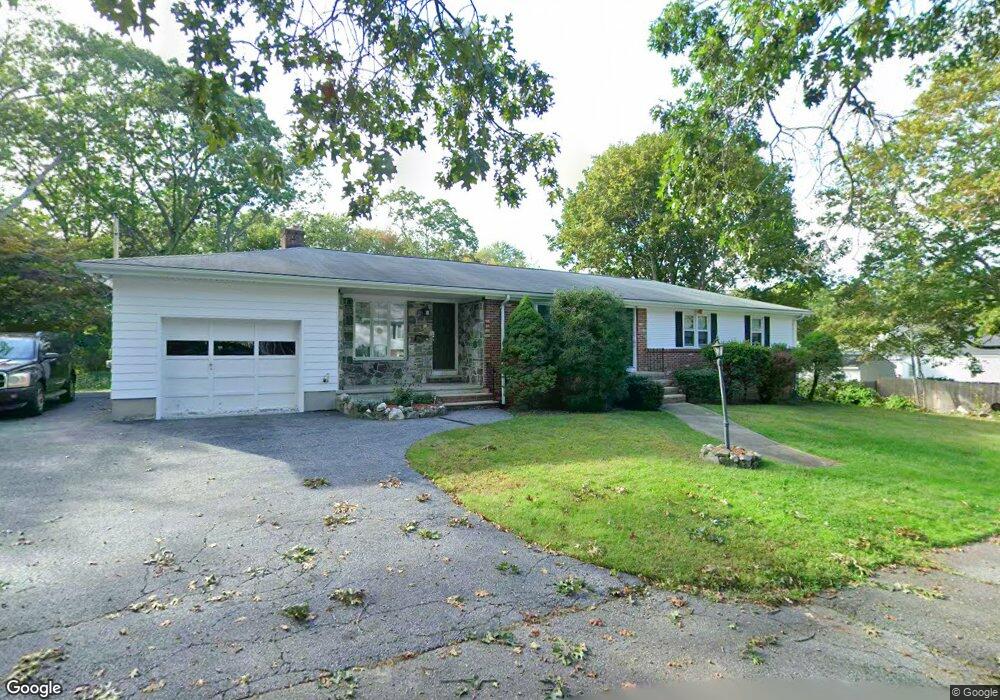
150 Brookfield Rd Riverside, RI 02915
Kent Heights NeighborhoodEstimated Value: $514,000 - $686,349
3
Beds
3
Baths
2,806
Sq Ft
$222/Sq Ft
Est. Value
About This Home
This home is located at 150 Brookfield Rd, Riverside, RI 02915 and is currently estimated at $622,087, approximately $221 per square foot. 150 Brookfield Rd is a home located in Providence County with nearby schools including East Providence High School, St Mary Academy-Bay View, and The Gordon School.
Ownership History
Date
Name
Owned For
Owner Type
Purchase Details
Closed on
May 30, 2014
Sold by
Briganti Joseph A and Briganti Alejandra
Bought by
George Brad and George Jacqueline M
Current Estimated Value
Home Financials for this Owner
Home Financials are based on the most recent Mortgage that was taken out on this home.
Original Mortgage
$289,656
Interest Rate
4.4%
Mortgage Type
FHA
Purchase Details
Closed on
Jul 5, 2011
Sold by
Briganti Joseph and Briganti Dorothy
Bought by
Briganti Ft
Create a Home Valuation Report for This Property
The Home Valuation Report is an in-depth analysis detailing your home's value as well as a comparison with similar homes in the area
Home Values in the Area
Average Home Value in this Area
Purchase History
| Date | Buyer | Sale Price | Title Company |
|---|---|---|---|
| George Brad | $25,000 | -- | |
| Briganti Ft | $325,000 | -- |
Source: Public Records
Mortgage History
| Date | Status | Borrower | Loan Amount |
|---|---|---|---|
| Open | Briganti Ft | $288,664 | |
| Closed | George Brad | $289,656 | |
| Previous Owner | Briganti Ft | $175,000 | |
| Previous Owner | Briganti Ft | $33,000 |
Source: Public Records
Tax History
| Year | Tax Paid | Tax Assessment Tax Assessment Total Assessment is a certain percentage of the fair market value that is determined by local assessors to be the total taxable value of land and additions on the property. | Land | Improvement |
|---|---|---|---|---|
| 2025 | $7,990 | $611,300 | $185,400 | $425,900 |
| 2024 | $7,723 | $503,800 | $154,600 | $349,200 |
| 2023 | $7,436 | $503,800 | $154,600 | $349,200 |
| 2022 | $8,176 | $374,000 | $126,400 | $247,600 |
| 2021 | $8,041 | $374,000 | $115,500 | $258,500 |
| 2020 | $7,701 | $374,000 | $115,500 | $258,500 |
| 2019 | $7,487 | $374,000 | $115,500 | $258,500 |
| 2018 | $7,406 | $323,700 | $90,500 | $233,200 |
| 2017 | $7,241 | $323,700 | $90,500 | $233,200 |
| 2016 | $7,206 | $323,700 | $90,500 | $233,200 |
| 2015 | $6,871 | $299,400 | $83,600 | $215,800 |
| 2014 | $6,871 | $299,400 | $83,600 | $215,800 |
Source: Public Records
Map
Nearby Homes
- 2941 Pawtucket Ave
- 53 Wampanoag Trail
- 14 Waterview Ave Unit 16
- 34 Commack Rd
- 106 Wannamoisett Rd
- 50 Kettle Point Ave Unit 50
- 29 Ide Ave
- 6 Fuller Ave
- 74 Brookhaven Dr
- 25 Bullocks Point Ave Unit 5C
- 151 Dover Ave
- 43 Bullocks Point Ave Unit 4A
- 33 Bullocks Point Ave Unit 5C
- 26 Callender Ave
- 151 Willett Ave Unit 2
- 158 S Rose St
- 191 S Spruce St
- 25 Arnold St
- 103 Burnside Ave
- 28 Jefferson Ave
- 107 Merritt Rd
- 103 Merritt Rd
- 157 Brookfield Rd
- 104 Brookfield Rd
- 97 Merritt Rd
- 153 Brookfield Rd
- 96 Brookfield Rd
- 115 Merritt Rd
- 93 Merritt Rd
- 88 Brookfield Rd
- 149 Brookfield Rd
- 83 Merritt Rd
- 115 Brookfield Rd
- 96 Merritt Rd
- 95 Brookfield Rd
- 104 Merritt Rd
- 89 Brookfield Rd
- 110 Merritt Rd
- 90 Merritt Rd
- 139 Brookfield Rd
Your Personal Tour Guide
Ask me questions while you tour the home.