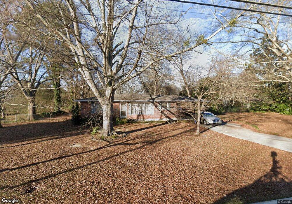
150 Burnside St Jonesboro, GA 30236
Estimated Value: $182,000 - $198,000
3
Beds
2
Baths
1,292
Sq Ft
$146/Sq Ft
Est. Value
About This Home
This home is located at 150 Burnside St, Jonesboro, GA 30236 and is currently estimated at $188,501, approximately $145 per square foot. 150 Burnside St is a home located in Clayton County with nearby schools including Suder Elementary School, Mundys Mill Middle School, and Jonesboro High School.
Ownership History
Date
Name
Owned For
Owner Type
Purchase Details
Closed on
Sep 8, 2020
Sold by
Mcneely Edward C
Bought by
Denson Deiana
Current Estimated Value
Home Financials for this Owner
Home Financials are based on the most recent Mortgage that was taken out on this home.
Original Mortgage
$109,890
Outstanding Balance
$97,040
Interest Rate
3%
Mortgage Type
New Conventional
Estimated Equity
$91,461
Purchase Details
Closed on
Aug 30, 2012
Sold by
Piner Lawrence R
Bought by
Ncneely Edward C and Mcneely Barbara H
Purchase Details
Closed on
Sep 12, 2000
Sold by
Piner Mary M
Bought by
Piner Lawrence R and Piner Mary M
Purchase Details
Closed on
May 25, 1999
Sold by
Cole William C
Bought by
Piner Mary M
Home Financials for this Owner
Home Financials are based on the most recent Mortgage that was taken out on this home.
Original Mortgage
$72,000
Interest Rate
6.94%
Mortgage Type
New Conventional
Create a Home Valuation Report for This Property
The Home Valuation Report is an in-depth analysis detailing your home's value as well as a comparison with similar homes in the area
Home Values in the Area
Average Home Value in this Area
Purchase History
| Date | Buyer | Sale Price | Title Company |
|---|---|---|---|
| Denson Deiana | $115,000 | -- | |
| Ncneely Edward C | $32,500 | -- | |
| Piner Lawrence R | -- | -- | |
| Piner Mary M | $80,000 | -- | |
| Cole William C | -- | -- |
Source: Public Records
Mortgage History
| Date | Status | Borrower | Loan Amount |
|---|---|---|---|
| Open | Denson Deiana | $109,890 | |
| Previous Owner | Cole William C | $72,000 |
Source: Public Records
Tax History
| Year | Tax Paid | Tax Assessment Tax Assessment Total Assessment is a certain percentage of the fair market value that is determined by local assessors to be the total taxable value of land and additions on the property. | Land | Improvement |
|---|---|---|---|---|
| 2025 | $2,751 | $63,640 | $7,200 | $56,440 |
| 2024 | $2,043 | $62,360 | $7,200 | $55,160 |
| 2023 | $1,919 | $53,160 | $7,200 | $45,960 |
| 2022 | $1,510 | $48,480 | $7,200 | $41,280 |
| 2021 | $1,272 | $42,200 | $7,200 | $35,000 |
| 2020 | $1,204 | $30,103 | $7,200 | $22,903 |
| 2019 | $1,040 | $25,606 | $5,600 | $20,006 |
| 2018 | $1,003 | $24,696 | $5,600 | $19,096 |
| 2017 | $907 | $22,302 | $5,600 | $16,702 |
| 2016 | $820 | $20,149 | $5,600 | $14,549 |
| 2015 | $806 | $0 | $0 | $0 |
| 2014 | $617 | $15,525 | $5,600 | $9,925 |
Source: Public Records
Map
Nearby Homes
- US 19 41
- 192 Cloud St
- 115 Burnside St
- 0 State Highway 54
- 120 South Ave
- 7559 Tara Blvd
- 776 Jeb Stuart Dr
- 761 Robert e Lee Pkwy
- 181 Dean St
- 109 Stockbridge Rd
- 755 Dunaire Way
- 657 Utoy Ct
- 624 Robert e Lee Pkwy
- 656 Sycamore Dr
- 605 Robert e Lee Pkwy
- 626 Sycamore Dr
- 8506 Kaden Dr
- 8431 Magnolia Dr
- 242 Lake Jodeco Rd
- 597 Wilmont Dr
- 158 Burnside St
- 146 Burnside St
- 151 College St
- 149 Burnside St
- 145 College St
- 147 Burnside Unit 2 St Unit 2
- 147 Burnside Unit 2 St
- 157 Burnside St Unit B
- 157 Burnside St
- 157 Burnside St Unit A
- 161 College St
- 147 Burnside St Unit 3
- 147 Burnside St Unit 4
- 147 Burnside St Unit 1
- 147 Burnside St Unit 2
- 147 Burnside St Unit 1
- 147 Burnside St
- 159 Burnside St
- 168 Fayette Ave
- 168 Fayette Ave Unit 241
Your Personal Tour Guide
Ask me questions while you tour the home.