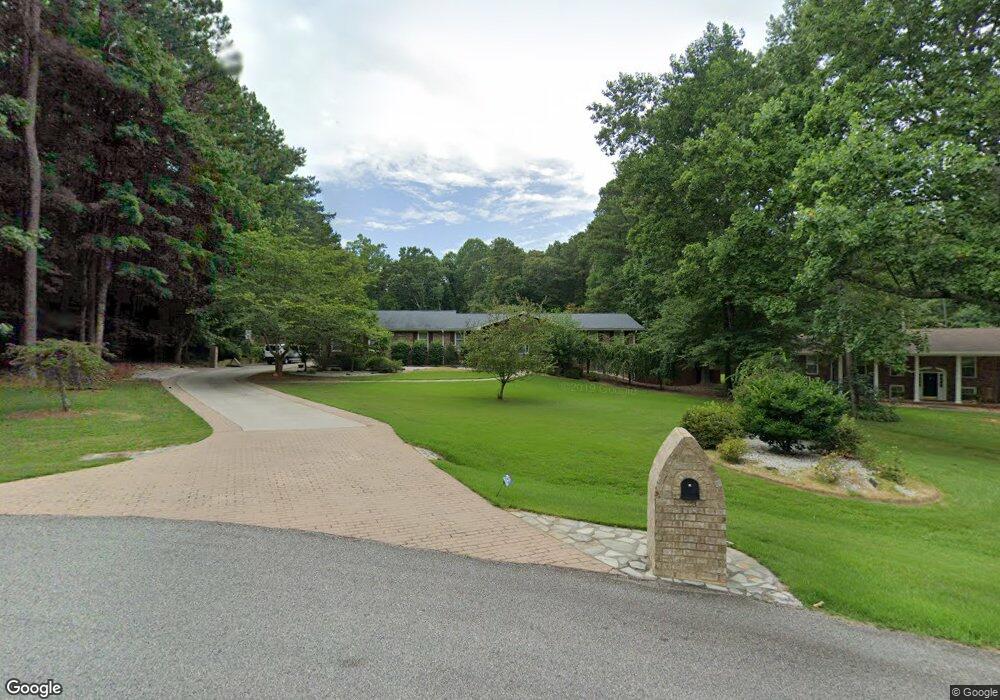
150 Cedar Cir Fayetteville, GA 30214
Estimated Value: $481,000 - $548,000
4
Beds
3
Baths
5,390
Sq Ft
$96/Sq Ft
Est. Value
About This Home
This home is located at 150 Cedar Cir, Fayetteville, GA 30214 and is currently estimated at $519,859, approximately $96 per square foot. 150 Cedar Cir is a home located in Fayette County with nearby schools including Bennett's Mill Middle School, Fayette County High School, and Rising Star Montessori School.
Ownership History
Date
Name
Owned For
Owner Type
Purchase Details
Closed on
Jun 28, 2012
Sold by
Edwards George C
Bought by
Hazell Bernard T and Walton-Hazell Lenora E
Current Estimated Value
Purchase Details
Closed on
Sep 15, 2004
Sold by
Sample Robert J and Sample Joan
Bought by
Edwards George C and Edwards Debra
Home Financials for this Owner
Home Financials are based on the most recent Mortgage that was taken out on this home.
Original Mortgage
$260,000
Interest Rate
5.72%
Mortgage Type
New Conventional
Create a Home Valuation Report for This Property
The Home Valuation Report is an in-depth analysis detailing your home's value as well as a comparison with similar homes in the area
Home Values in the Area
Average Home Value in this Area
Purchase History
| Date | Buyer | Sale Price | Title Company |
|---|---|---|---|
| Hazell Bernard T | $263,000 | -- | |
| Edwards George C | $325,000 | -- |
Source: Public Records
Mortgage History
| Date | Status | Borrower | Loan Amount |
|---|---|---|---|
| Previous Owner | Edwards George C | $260,000 |
Source: Public Records
Tax History Compared to Growth
Tax History
| Year | Tax Paid | Tax Assessment Tax Assessment Total Assessment is a certain percentage of the fair market value that is determined by local assessors to be the total taxable value of land and additions on the property. | Land | Improvement |
|---|---|---|---|---|
| 2024 | $1,510 | $198,924 | $25,600 | $173,324 |
| 2023 | $1,624 | $191,480 | $25,600 | $165,880 |
| 2022 | $1,995 | $179,480 | $25,600 | $153,880 |
| 2021 | $1,995 | $145,440 | $15,000 | $130,440 |
| 2020 | $2,417 | $132,560 | $15,000 | $117,560 |
| 2019 | $2,331 | $126,400 | $15,000 | $111,400 |
| 2018 | $2,216 | $119,120 | $15,000 | $104,120 |
| 2017 | $1,704 | $107,040 | $15,000 | $92,040 |
| 2016 | $1,631 | $84,720 | $15,000 | $69,720 |
| 2015 | $1,556 | $79,160 | $15,000 | $64,160 |
| 2014 | $2,234 | $73,800 | $15,000 | $58,800 |
| 2013 | -- | $69,640 | $0 | $0 |
Source: Public Records
Map
Nearby Homes
- 190 Rolison Way
- 140 Rolison Way
- 150 Rolison Way
- 235 Rolison Way
- 170 Liberty Dr
- 150 Reese St
- 140 Bartow St Unit LOT 4
- 130 Bartow St Unit LOT 3
- 145 Woodsong Dr
- 0 Highway 92 N Unit 10594507
- 0 Highway 92 N Unit 7570733
- 560 Hawthorne Dr
- 115 Westside Way
- E OF 118 Stanley Rd
- 145 Heritage Way
- 230 White Rd
- 615 New Hope Rd
- 615 New Hope Rd Unit NO SUBDIVISION
- 550 Ginger Cake Rd
- 671 Ginger Cake Rd
- 150 Cedar Cir
- 160 Cedar Cir
- 140 Cedar Cir
- 170 Cedar Cir
- 170 Cedar Cir Unit 170
- 125 Cedar Cir
- 130 Cedar Cir
- 155 Madison Place
- 165 Madison Place
- 175 Madison Place
- 180 Cedar Circle Circlestudio
- 180 Cedar Cir Unit STUDIO APT
- 180 Cedar Cir
- 180 Cedar Cir
- 180 Cedar Cir Unit 9
- 180 Cedar Cir Unit Acres
- 185 Madison Place
- 135 Cedar Cir
- 115 Cedar Cir
- 145 Madison Place