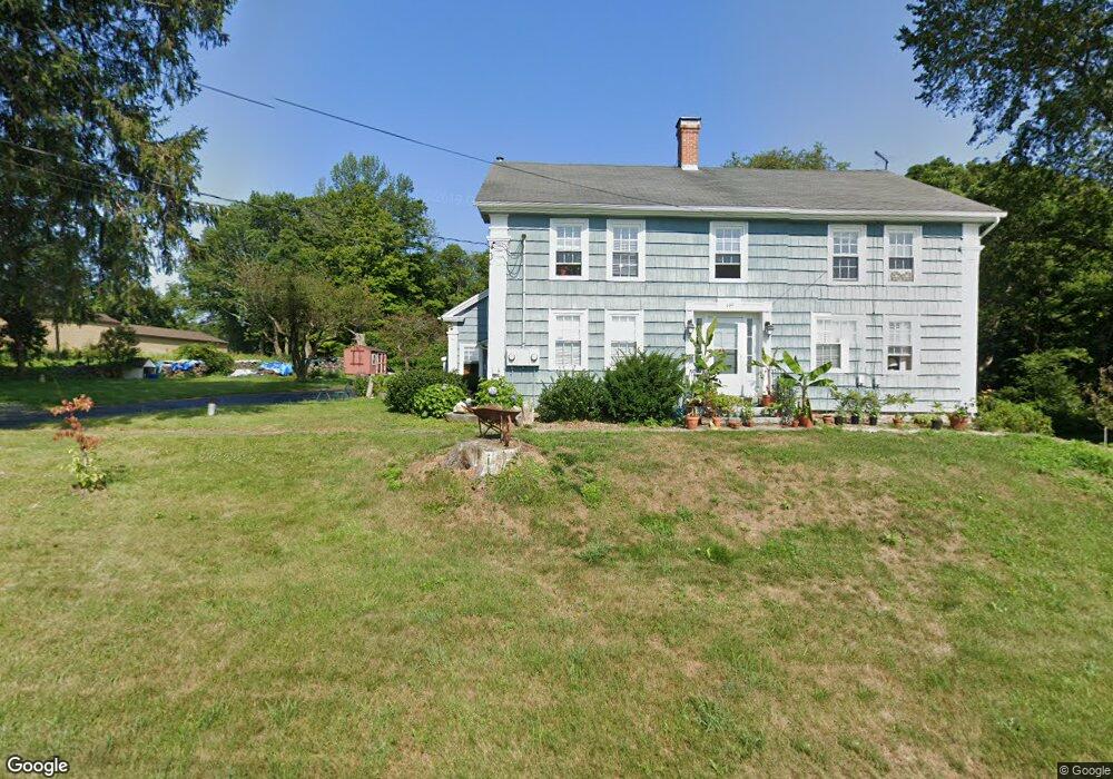
150 Crane Hill Rd Unit UPPER Storrs Mansfield, CT 06268
Estimated Value: $423,000 - $630,000
2
Beds
1
Bath
3,006
Sq Ft
$180/Sq Ft
Est. Value
About This Home
This home is located at 150 Crane Hill Rd Unit UPPER, Storrs Mansfield, CT 06268 and is currently estimated at $542,504, approximately $180 per square foot. 150 Crane Hill Rd Unit UPPER is a home located in Tolland County with nearby schools including Mansfield Elementary School, Mansfield Middle School, and E.O. Smith High School.
Ownership History
Date
Name
Owned For
Owner Type
Purchase Details
Closed on
Nov 16, 2020
Sold by
Morse David E
Bought by
David E Morse Lt
Current Estimated Value
Purchase Details
Closed on
Apr 14, 2015
Sold by
Chappa Susan Est
Bought by
Morse David E
Purchase Details
Closed on
Oct 31, 2011
Sold by
Dasilva-Matos Samuel
Bought by
Matos R Susan
Purchase Details
Closed on
Nov 28, 1989
Sold by
Mccomber Mark
Bought by
Matos R Susan
Purchase Details
Closed on
Dec 28, 1987
Sold by
Doyon Johanne
Bought by
Mccomber Mark
Create a Home Valuation Report for This Property
The Home Valuation Report is an in-depth analysis detailing your home's value as well as a comparison with similar homes in the area
Home Values in the Area
Average Home Value in this Area
Purchase History
| Date | Buyer | Sale Price | Title Company |
|---|---|---|---|
| David E Morse Lt | -- | None Available | |
| David E Morse Lt | -- | None Available | |
| Morse David E | $170,000 | -- | |
| Morse David E | $170,000 | -- | |
| Matos R Susan | -- | -- | |
| Matos R Susan | -- | -- | |
| Matos R Susan | $26,392 | -- | |
| Mccomber Mark | $14,000 | -- |
Source: Public Records
Mortgage History
| Date | Status | Borrower | Loan Amount |
|---|---|---|---|
| Previous Owner | Mccomber Mark | $49,605 | |
| Previous Owner | Mccomber Mark | $80,000 | |
| Previous Owner | Mccomber Mark | $90,000 |
Source: Public Records
Tax History Compared to Growth
Tax History
| Year | Tax Paid | Tax Assessment Tax Assessment Total Assessment is a certain percentage of the fair market value that is determined by local assessors to be the total taxable value of land and additions on the property. | Land | Improvement |
|---|---|---|---|---|
| 2025 | $7,090 | $354,500 | $55,500 | $299,000 |
| 2024 | $6,412 | $210,100 | $52,000 | $158,100 |
| 2023 | $6,622 | $210,100 | $52,000 | $158,100 |
| 2022 | $6,383 | $210,100 | $52,000 | $158,100 |
| 2021 | $6,593 | $210,100 | $52,000 | $158,100 |
| 2020 | $6,593 | $210,100 | $52,000 | $158,100 |
| 2019 | $6,241 | $198,900 | $52,000 | $146,900 |
| 2018 | $6,105 | $197,700 | $54,500 | $143,200 |
| 2017 | $5,085 | $166,000 | $54,500 | $111,500 |
| 2016 | $4,952 | $165,700 | $54,500 | $111,200 |
| 2015 | $4,952 | $165,800 | $55,000 | $110,800 |
| 2014 | $5,183 | $185,430 | $55,370 | $130,060 |
Source: Public Records
Map
Nearby Homes
- 0 Mansfield City Rd Unit LOT 2
- 39 Jacobs Hill Rd
- 2 Pequot Square Unit 2
- 1 Heritage Square Unit 1
- 23 Liberty Dr Unit 23
- 31 Adeline Place
- 54 Meadowbrook Ln
- 23 Circle Dr
- 408 Storrs Rd
- 19 Eastbrook Heights Unit C
- 29 Eastbrook Heights Unit A
- 58 Candide Ln
- 76 Highland Rd
- 0 Oak Dr Unit LOT 33
- 00 Sheffield Dr
- 0 Storrs Rd Unit 2 170571015
- 378 Mansfield Ave
- 124 Spring Hill Rd
- 77 Woods Rd
- 29 Wyllys Farm Rd
- 150 Crane Hill Rd
- 170 Crane Hill Rd
- 140 Crane Hill Rd
- 144 Crane Hill Rd
- 124 Crane Hill Rd
- 108 Crane Hill Rd
- 111 Crane Hill Rd
- 206 Crane Hill Rd
- 205 Crane Hill Rd
- 84 Crane Hill Rd
- 219 Crane Hill Rd
- 73 Crane Hill Rd
- 72 Crane Hill Rd
- 0 Stearns Rd
- 339 Mansfield City Rd
- 0 Crane Hill Rd
- 440 Mansfield City Rd
- 435 Mansfield City Rd
- 75 Crane Hill Rd
- 62 Crane Hill Rd