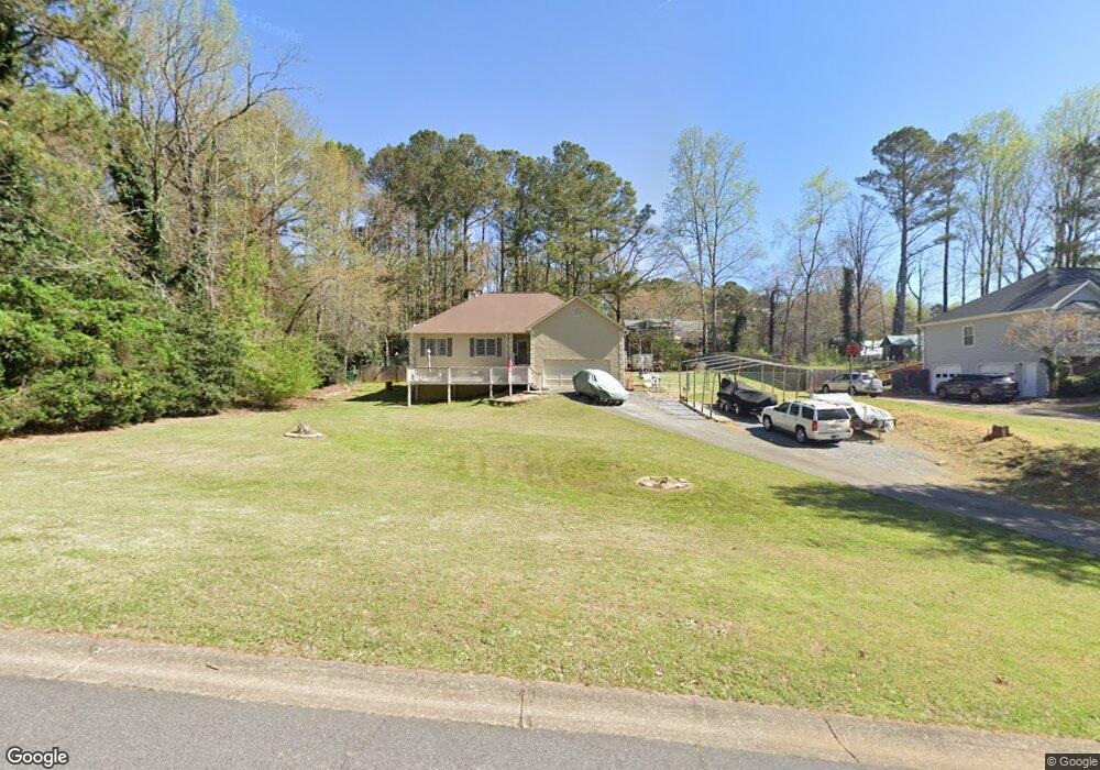
150 Dockside Downs Dr Unit 2 Woodstock, GA 30189
Sutallee NeighborhoodEstimated Value: $365,105 - $382,000
3
Beds
2
Baths
1,636
Sq Ft
$228/Sq Ft
Est. Value
About This Home
This home is located at 150 Dockside Downs Dr Unit 2, Woodstock, GA 30189 and is currently estimated at $373,553, approximately $228 per square foot. 150 Dockside Downs Dr Unit 2 is a home located in Cherokee County with nearby schools including Boston Elementary School, E. T. Booth Middle School, and Etowah High School.
Ownership History
Date
Name
Owned For
Owner Type
Purchase Details
Closed on
Jun 1, 2006
Sold by
Powell John C and Powell Beverly D
Bought by
Mchan David and Mchan Linda
Current Estimated Value
Home Financials for this Owner
Home Financials are based on the most recent Mortgage that was taken out on this home.
Original Mortgage
$130,320
Outstanding Balance
$75,537
Interest Rate
6.51%
Mortgage Type
New Conventional
Estimated Equity
$298,016
Create a Home Valuation Report for This Property
The Home Valuation Report is an in-depth analysis detailing your home's value as well as a comparison with similar homes in the area
Home Values in the Area
Average Home Value in this Area
Purchase History
| Date | Buyer | Sale Price | Title Company |
|---|---|---|---|
| Mchan David | $162,900 | -- |
Source: Public Records
Mortgage History
| Date | Status | Borrower | Loan Amount |
|---|---|---|---|
| Open | Mchan David | $130,320 |
Source: Public Records
Tax History Compared to Growth
Tax History
| Year | Tax Paid | Tax Assessment Tax Assessment Total Assessment is a certain percentage of the fair market value that is determined by local assessors to be the total taxable value of land and additions on the property. | Land | Improvement |
|---|---|---|---|---|
| 2025 | $695 | $134,744 | $32,000 | $102,744 |
| 2024 | $670 | $127,104 | $28,000 | $99,104 |
| 2023 | $556 | $134,944 | $28,000 | $106,944 |
| 2022 | $704 | $126,744 | $28,000 | $98,744 |
| 2021 | $647 | $95,024 | $23,520 | $71,504 |
| 2020 | $612 | $84,944 | $20,800 | $64,144 |
| 2019 | $573 | $74,640 | $18,600 | $56,040 |
| 2018 | $570 | $71,080 | $16,800 | $54,280 |
| 2017 | $565 | $165,600 | $16,000 | $50,240 |
| 2016 | $575 | $160,400 | $16,000 | $48,160 |
| 2015 | $572 | $151,000 | $16,000 | $44,400 |
| 2014 | $536 | $141,200 | $16,000 | $40,480 |
Source: Public Records
Map
Nearby Homes
- 0 Black Oak Trail Unit 7303191
- 0 Black Oak Trail Unit 10267626
- 406 Ballymore Pass Unit III
- 234 Ascott Ln
- 416 Ballymore Pass
- 104 Rose Cottage Ln Unit 65
- 1413 Reed Ln
- 1020 Braelin Ct
- 1001 Ashfern Walk
- 923 Pine Cir
- 1001 Deer Hollow Dr
- 2006 Hawthorne Way
- 507 Huntgate Rd
- 7119 Big Woods Dr
- 812 Willow Oak Dr
- 313 Maltibe Dr
- 1516 Shadow Ridge Cir
- 146 Sunset Ln
- 442 Colonial Walk
- 522 Huntgate Rd Unit 4
- 148 Dockside Downs Dr Unit 2
- 152 Dockside Downs Dr
- 135 Black Oak Trail
- 146 Dockside Downs Dr
- 374 Walnut Dr
- 154 Dockside Downs Dr
- 151 Dockside Downs Dr
- 137 Black Oak Trail
- 137 Black Oak Trail Unit 3
- 153 Dockside Downs Dr Unit 2
- 149 Dockside Downs Dr
- 144 Dockside Downs Dr
- 144 Dockside Downs Dr
- 128 Black Oak Trail Unit 3
- 147 Dockside Downs Dr
- 156 Dockside Downs Dr
- 304 Mainsail Ln
- 155 Dockside Downs Dr
- 385 Walnut Dr Unit 3
- 303 Mainsail Ln