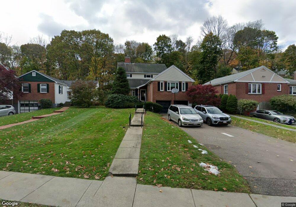
150 Eliot St Chestnut Hill, MA 02467
Chestnut Hill NeighborhoodEstimated Value: $1,876,000 - $4,587,000
6
Beds
5
Baths
5,663
Sq Ft
$520/Sq Ft
Est. Value
About This Home
This home is located at 150 Eliot St, Chestnut Hill, MA 02467 and is currently estimated at $2,943,361, approximately $519 per square foot. 150 Eliot St is a home located in Norfolk County with nearby schools including Heath Elementary School, Brookline High School, and Brimmer & May School.
Ownership History
Date
Name
Owned For
Owner Type
Purchase Details
Closed on
Aug 13, 2003
Sold by
Witkin Kenneth J and Edbril Susan D
Bought by
Wasserman Noam and Wasserman Chana
Current Estimated Value
Home Financials for this Owner
Home Financials are based on the most recent Mortgage that was taken out on this home.
Original Mortgage
$900,000
Outstanding Balance
$391,703
Interest Rate
5.46%
Mortgage Type
Purchase Money Mortgage
Estimated Equity
$2,551,658
Purchase Details
Closed on
Jul 16, 1999
Sold by
Gee Mcihael
Bought by
Witkin Kenneth J
Home Financials for this Owner
Home Financials are based on the most recent Mortgage that was taken out on this home.
Original Mortgage
$400,000
Interest Rate
7.39%
Mortgage Type
Purchase Money Mortgage
Purchase Details
Closed on
Sep 29, 1993
Sold by
Spund Donald I and Spund Margaret
Bought by
Gee Michael
Create a Home Valuation Report for This Property
The Home Valuation Report is an in-depth analysis detailing your home's value as well as a comparison with similar homes in the area
Home Values in the Area
Average Home Value in this Area
Purchase History
| Date | Buyer | Sale Price | Title Company |
|---|---|---|---|
| Wasserman Noam | $950,000 | -- | |
| Witkin Kenneth J | $639,000 | -- | |
| Gee Michael | $273,000 | -- |
Source: Public Records
Mortgage History
| Date | Status | Borrower | Loan Amount |
|---|---|---|---|
| Open | Gee Michael | $900,000 | |
| Previous Owner | Gee Michael | $400,000 | |
| Previous Owner | Gee Michael | $387,000 | |
| Previous Owner | Gee Michael | $335,000 |
Source: Public Records
Tax History
| Year | Tax Paid | Tax Assessment Tax Assessment Total Assessment is a certain percentage of the fair market value that is determined by local assessors to be the total taxable value of land and additions on the property. | Land | Improvement |
|---|---|---|---|---|
| 2025 | $21,401 | $2,168,300 | $1,139,600 | $1,028,700 |
| 2024 | $20,301 | $2,077,900 | $1,095,700 | $982,200 |
| 2023 | $18,513 | $1,856,900 | $899,800 | $957,100 |
| 2022 | $18,021 | $1,768,500 | $857,000 | $911,500 |
| 2021 | $16,664 | $1,700,400 | $824,000 | $876,400 |
| 2020 | $15,215 | $1,610,000 | $749,100 | $860,900 |
| 2019 | $14,367 | $1,533,300 | $713,400 | $819,900 |
| 2018 | $15,336 | $1,621,100 | $711,200 | $909,900 |
| 2017 | $15,110 | $1,529,400 | $670,900 | $858,500 |
| 2016 | $14,893 | $1,429,300 | $627,000 | $802,300 |
| 2015 | $14,266 | $1,335,800 | $586,000 | $749,800 |
| 2014 | $13,723 | $1,204,800 | $532,700 | $672,100 |
Source: Public Records
Map
Nearby Homes
- 160 Reservoir Rd
- 142 Crafts Rd
- 520 Clinton Rd
- 55 Reservoir Rd Unit 2
- 55 Penniman Rd
- 2420 Beacon St Unit 401
- 355 Buckminster Rd
- 8 Penniman Rd
- 401 Clinton Rd
- 130 Cabot St
- 1014 Boylston St
- 2400 Beacon St Unit 102
- 2400 Beacon St Unit 409
- 331 Heath St
- 188 Heath St
- 9 Singletree Rd
- 282 Buckminster Rd
- 120 Seaver St Unit C-102
- 40 Heath Hill
- 34 Hyslop Rd
- 154 Eliot St
- 149 Eliot St
- 146 Eliot St
- 140 Eliot St
- 136 Eliot St
- 319 Dean Rd
- 247 Crafts Rd
- 132 Eliot St
- 132 Eliot St Unit 4
- 132 Eliot St Unit 2
- 132 Eliot St Unit 3
- 171 Reservoir Rd
- 177 Reservoir Rd
- 312 Dean Rd
- 241 Crafts Rd
- 183 Reservoir Rd
- 167 Reservoir Rd
- 161 Reservoir Rd
- 187 Reservoir Rd
- 311 Dean Rd
Your Personal Tour Guide
Ask me questions while you tour the home.