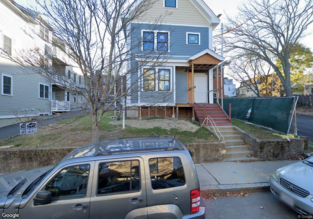
150 Hudson St Unit R2 Somerville, MA 02144
Spring Hill NeighborhoodEstimated Value: $1,542,000 - $1,737,000
3
Beds
3
Baths
1,866
Sq Ft
$893/Sq Ft
Est. Value
About This Home
This home is located at 150 Hudson St Unit R2, Somerville, MA 02144 and is currently estimated at $1,666,789, approximately $893 per square foot. 150 Hudson St Unit R2 is a home located in Middlesex County with nearby schools including Somerville High School, St. Clement Elementary School, and Saint Theresa School.
Ownership History
Date
Name
Owned For
Owner Type
Purchase Details
Closed on
Nov 8, 2022
Sold by
Santangelo Michael
Bought by
Zhang Simon and Zhang Priscilla E
Current Estimated Value
Home Financials for this Owner
Home Financials are based on the most recent Mortgage that was taken out on this home.
Original Mortgage
$975,000
Outstanding Balance
$941,303
Interest Rate
6.7%
Mortgage Type
Purchase Money Mortgage
Estimated Equity
$725,486
Create a Home Valuation Report for This Property
The Home Valuation Report is an in-depth analysis detailing your home's value as well as a comparison with similar homes in the area
Home Values in the Area
Average Home Value in this Area
Purchase History
| Date | Buyer | Sale Price | Title Company |
|---|---|---|---|
| Zhang Simon | $1,575,000 | None Available | |
| Zhang Simon | $1,575,000 | None Available |
Source: Public Records
Mortgage History
| Date | Status | Borrower | Loan Amount |
|---|---|---|---|
| Open | Zhang Simon | $975,000 | |
| Closed | Zhang Simon | $975,000 |
Source: Public Records
Tax History Compared to Growth
Tax History
| Year | Tax Paid | Tax Assessment Tax Assessment Total Assessment is a certain percentage of the fair market value that is determined by local assessors to be the total taxable value of land and additions on the property. | Land | Improvement |
|---|---|---|---|---|
| 2025 | $16,897 | $1,548,800 | $0 | $1,548,800 |
| 2024 | $15,606 | $1,483,500 | $0 | $1,483,500 |
| 2023 | $31,300 | $3,027,100 | $778,500 | $2,248,600 |
| 2022 | $13,079 | $1,284,800 | $741,500 | $543,300 |
| 2021 | $10,058 | $987,000 | $706,200 | $280,800 |
| 2020 | $11,310 | $1,120,900 | $679,000 | $441,900 |
| 2019 | $10,479 | $973,900 | $590,400 | $383,500 |
| 2018 | $9,948 | $879,600 | $536,800 | $342,800 |
| 2017 | $9,770 | $837,200 | $506,400 | $330,800 |
| 2016 | $8,319 | $663,900 | $463,100 | $200,800 |
| 2015 | $8,320 | $659,800 | $460,600 | $199,200 |
Source: Public Records
Map
Nearby Homes
- 156 Albion St Unit A
- 156 Albion St Unit B
- 13 Warwick St
- 8 Albion Terrace
- 3 Fairlee St
- 80 Hudson St
- 27 Boston Ave
- 12 Windsor Rd Unit 1
- 23 Highland Rd
- 125 Lowell St Unit 4C
- 125 Lowell St Unit 203
- 125 Lowell St Unit 5A
- 125 Lowell St Unit 301
- 125 Lowell St Unit 7B
- 125 Lowell St Unit 201
- 125 Lowell St Unit 503
- 125 Lowell St Unit 302
- 125 Lowell St Unit 402
- 125 Lowell St Unit 202
- 125 Lowell St Unit 3C
- 150 Hudson St
- 150 Hudson St Unit 1
- 148 Hudson St Unit A
- 148 Hudson St Unit 2
- 148 Hudson St Unit B
- 146 Hudson St Unit 2
- 146 Hudson St
- 146 Hudson St Unit 1
- 261 Highland Ave Unit 4
- 261 Highland Ave Unit 3
- 261 Highland Ave Unit 2
- 261 Highland Ave Unit 1
- 140 Hudson St Unit 302
- 140 Hudson St Unit 301
- 140 Hudson St Unit 202
- 140 Hudson St Unit 201
- 140 Hudson St Unit 102
- 140 Hudson St Unit 101
- 140 Hudson St Unit 140 Hudson St Somerv
- 156 Hudson St