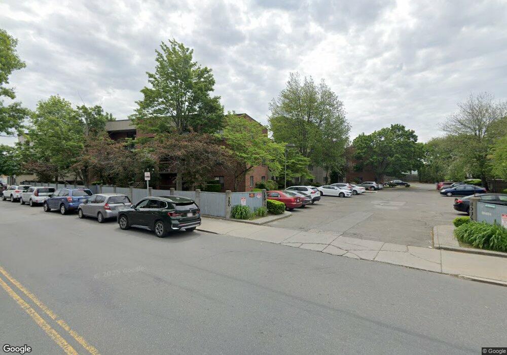
150 Lewis St Unit 111 Lynn, MA 01902
Diamond District NeighborhoodEstimated Value: $273,000 - $308,000
1
Bed
1
Bath
710
Sq Ft
$411/Sq Ft
Est. Value
About This Home
This home is located at 150 Lewis St Unit 111, Lynn, MA 01902 and is currently estimated at $292,047, approximately $411 per square foot. 150 Lewis St Unit 111 is a home located in Essex County with nearby schools including Brickett Elementary School, William R. Fallon School, and Marshall Middle School.
Ownership History
Date
Name
Owned For
Owner Type
Purchase Details
Closed on
Oct 15, 2007
Sold by
Est Bollen James W and Bollen Jeffrey A
Bought by
Brown Ruth E
Current Estimated Value
Home Financials for this Owner
Home Financials are based on the most recent Mortgage that was taken out on this home.
Original Mortgage
$121,600
Interest Rate
6.49%
Mortgage Type
Purchase Money Mortgage
Purchase Details
Closed on
May 31, 1996
Sold by
Gannon Elaine E
Bought by
Bollen James W
Create a Home Valuation Report for This Property
The Home Valuation Report is an in-depth analysis detailing your home's value as well as a comparison with similar homes in the area
Home Values in the Area
Average Home Value in this Area
Purchase History
| Date | Buyer | Sale Price | Title Company |
|---|---|---|---|
| Brown Ruth E | $128,000 | -- | |
| Bollen James W | $42,000 | -- |
Source: Public Records
Mortgage History
| Date | Status | Borrower | Loan Amount |
|---|---|---|---|
| Open | Bollen James W | $117,700 | |
| Closed | Bollen James W | $121,600 | |
| Previous Owner | Bollen James W | $20,000 |
Source: Public Records
Tax History Compared to Growth
Tax History
| Year | Tax Paid | Tax Assessment Tax Assessment Total Assessment is a certain percentage of the fair market value that is determined by local assessors to be the total taxable value of land and additions on the property. | Land | Improvement |
|---|---|---|---|---|
| 2025 | $2,524 | $243,600 | $0 | $243,600 |
| 2024 | $2,364 | $224,500 | $0 | $224,500 |
| 2023 | $2,281 | $204,600 | $0 | $204,600 |
| 2022 | $2,075 | $166,900 | $0 | $166,900 |
| 2021 | $2,421 | $185,800 | $0 | $185,800 |
| 2020 | $2,021 | $150,800 | $0 | $150,800 |
| 2019 | $2,314 | $161,800 | $0 | $161,800 |
| 2018 | $2,185 | $144,200 | $0 | $144,200 |
| 2017 | $2,042 | $130,900 | $0 | $130,900 |
| 2016 | $1,912 | $118,200 | $0 | $118,200 |
| 2015 | $1,876 | $112,000 | $0 | $112,000 |
Source: Public Records
Map
Nearby Homes
- 38 Cherry St Unit 1
- 42 Basset St
- 38 Chestnut St
- 7 Sidney Ave
- 2 Peirce Rd
- 13 Portland St Unit 4
- 24 Parrott St
- 46 Wardwell Ave
- 285 Lynn Shore Dr Unit 308
- 285 Lynn Shore Dr Unit 508
- 285 Lynn Shore Dr Unit 203
- 14-16 Dexter St
- 300 Lynn Shore Dr Unit 612
- 26 Groveland St
- 13 Nahant St Unit 2D
- 13 Nahant St Unit 4A
- 13 Nahant St Unit 3A
- 13 Nahant St Unit 4C
- 13 Nahant St Unit 3B
- 13 Nahant St Unit 4B
- 150 Lewis St Unit 314
- 150 Lewis St Unit 312
- 150 Lewis St Unit 311
- 150 Lewis St Unit 310
- 150 Lewis St Unit 214
- 150 Lewis St Unit 213
- 150 Lewis St Unit 212
- 150 Lewis St Unit 211
- 150 Lewis St Unit 210
- 150 Lewis St Unit 209
- 150 Lewis St Unit 112
- 150 Lewis St Unit 110
- 150 Lewis St Unit 109
- 150 Lewis St Unit 108
- 150 Lewis St Unit 107
- 150 Lewis St Unit 308
- 150 Lewis St Unit 307
- 150 Lewis St Unit 306
- 150 Lewis St Unit 305
- 150 Lewis St Unit 304