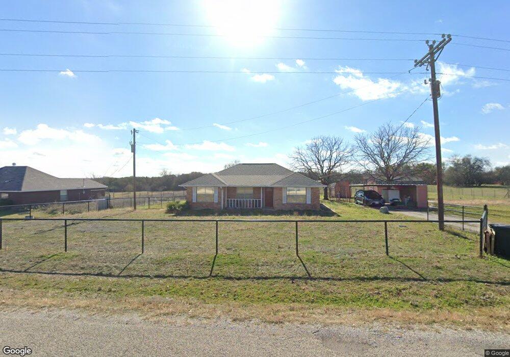
150 Mcfarland Ln Weatherford, TX 76088
Estimated Value: $309,000 - $386,000
--
Bed
--
Bath
1,257
Sq Ft
$270/Sq Ft
Est. Value
About This Home
This home is located at 150 Mcfarland Ln, Weatherford, TX 76088 and is currently estimated at $339,185, approximately $269 per square foot. 150 Mcfarland Ln is a home located in Parker County with nearby schools including Seguin Elementary School, Tison Middle School, and Weatherford High School.
Ownership History
Date
Name
Owned For
Owner Type
Purchase Details
Closed on
Dec 12, 2001
Sold by
Sunday Marvin K
Bought by
Wilson Jeanine R
Current Estimated Value
Purchase Details
Closed on
Jul 28, 2000
Sold by
Roemer Dale
Bought by
Wilson Jeanine R
Purchase Details
Closed on
Feb 11, 2000
Sold by
Cooper Joseph A and Cooper Bea
Bought by
Wilson Jeanine R
Purchase Details
Closed on
Jan 1, 1901
Bought by
Wilson Jeanine R
Create a Home Valuation Report for This Property
The Home Valuation Report is an in-depth analysis detailing your home's value as well as a comparison with similar homes in the area
Home Values in the Area
Average Home Value in this Area
Purchase History
| Date | Buyer | Sale Price | Title Company |
|---|---|---|---|
| Wilson Jeanine R | -- | -- | |
| Wilson Jeanine R | -- | -- | |
| Wilson Jeanine R | -- | -- | |
| Wilson Jeanine R | -- | -- |
Source: Public Records
Tax History Compared to Growth
Tax History
| Year | Tax Paid | Tax Assessment Tax Assessment Total Assessment is a certain percentage of the fair market value that is determined by local assessors to be the total taxable value of land and additions on the property. | Land | Improvement |
|---|---|---|---|---|
| 2025 | $2,392 | $301,500 | $119,190 | $182,310 |
| 2024 | $2,392 | $276,342 | -- | -- |
| 2023 | $2,392 | $251,220 | $0 | $0 |
| 2022 | $4,252 | $252,180 | $80,500 | $171,680 |
| 2021 | $4,191 | $252,180 | $80,500 | $171,680 |
| 2020 | $3,828 | $208,440 | $55,340 | $153,100 |
| 2019 | $3,713 | $208,440 | $55,340 | $153,100 |
| 2018 | $3,393 | $157,580 | $30,500 | $127,080 |
| 2017 | $3,148 | $157,580 | $30,500 | $127,080 |
| 2016 | $2,862 | $128,920 | $30,500 | $98,420 |
| 2015 | $2,454 | $128,920 | $30,500 | $98,420 |
| 2014 | $2,449 | $125,100 | $30,500 | $94,600 |
Source: Public Records
Map
Nearby Homes
- 3004 Greg Allen Dr
- 2124 Pepperdine Dr
- 905 Zion Hill Rd
- 1301 Zion Hill Loop
- 105 Oxford Ct
- Lot 11 Pepperdine Dr
- Lot 12 Pepperdine Dr
- Lot 10 Pepperdine Dr
- 2117 Pepperdine Dr
- 2016 Vanderbilt Dr
- 2020 Vanderbilt Dr
- 3004 Parker Meadows Ct
- 2000 Vanderbilt Dr
- 125 Odel Dr
- 104 Lagrange Ct
- 109 Odel Dr
- 107 Hall St
- 2211 Zion Hill Rd Unit 4
- 2211 Zion Hill Rd Unit 8
- 2211 Zion Hill Rd Unit 6
- 180 Mcfarland Ln
- 200 Mcfarland Ln
- 250 Mcfarland Ln
- 650 Zion Hill Loop
- 590 Zion Hill Loop
- 105 Christopher Ct
- 322 Mcfarland Ln
- 570 Zion Hill Loop
- 910 Zion Hill Loop
- 384 Mcfarland Ln
- 109 Christopher Ct
- 406 Mcfarland Ln
- 113 Christopher Ct
- 458 Mcfarland Ln
- 129 Christopher Ct
- 100 Christopher Ct
- 000 Mcfarland Ln
- 0000 Mcfarland Ln
- 500 Mcfarland Ln
- 391 Mcfarland Ln