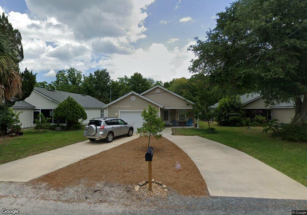
150 Nesmith Ave Saint Augustine, FL 32084
West Augustine NeighborhoodEstimated Value: $284,000 - $330,000
3
Beds
2
Baths
1,255
Sq Ft
$246/Sq Ft
Est. Value
About This Home
This home is located at 150 Nesmith Ave, Saint Augustine, FL 32084 and is currently estimated at $308,667, approximately $245 per square foot. 150 Nesmith Ave is a home located in St. Johns County with nearby schools including Crookshank Elementary School, Sebastian Middle School, and St. Augustine High School.
Ownership History
Date
Name
Owned For
Owner Type
Purchase Details
Closed on
Oct 8, 2004
Sold by
Covenant Homes Of St Augustine Inc
Bought by
Peterson Joyce R
Current Estimated Value
Home Financials for this Owner
Home Financials are based on the most recent Mortgage that was taken out on this home.
Original Mortgage
$95,262
Outstanding Balance
$46,989
Interest Rate
5.71%
Mortgage Type
Purchase Money Mortgage
Estimated Equity
$261,678
Create a Home Valuation Report for This Property
The Home Valuation Report is an in-depth analysis detailing your home's value as well as a comparison with similar homes in the area
Home Values in the Area
Average Home Value in this Area
Purchase History
| Date | Buyer | Sale Price | Title Company |
|---|---|---|---|
| Peterson Joyce R | $119,100 | Land Title Of America |
Source: Public Records
Mortgage History
| Date | Status | Borrower | Loan Amount |
|---|---|---|---|
| Open | Peterson Joyce R | $95,262 |
Source: Public Records
Tax History
| Year | Tax Paid | Tax Assessment Tax Assessment Total Assessment is a certain percentage of the fair market value that is determined by local assessors to be the total taxable value of land and additions on the property. | Land | Improvement |
|---|---|---|---|---|
| 2025 | $514 | $99,627 | -- | -- |
| 2024 | $514 | $96,819 | -- | -- |
| 2023 | $514 | $93,999 | $0 | $0 |
| 2022 | $491 | $91,261 | $0 | $0 |
| 2021 | $497 | $88,603 | $0 | $0 |
| 2020 | $499 | $87,380 | $0 | $0 |
| 2019 | $498 | $85,415 | $0 | $0 |
| 2018 | $481 | $83,822 | $0 | $0 |
| 2017 | $469 | $82,098 | $0 | $0 |
| 2016 | $471 | $82,821 | $0 | $0 |
| 2015 | $507 | $82,246 | $0 | $0 |
| 2014 | $511 | $81,446 | $0 | $0 |
Source: Public Records
Map
Nearby Homes
- 121 Palmer St
- 236 Nesmith Ave
- 0 Masters Dr
- 69 Josiah St
- 50 Florida Ave
- 87 Josiah St
- 100 Spring St
- 4129 Serena Cir
- 243 Ravenswood Dr
- 29 & 27A Florida Ave
- 29-27A Florida Ave
- 1030 Francis St
- 0 Bruen St Unit 261490
- 0 Bruen St Unit 2137072
- 4815 Serena Cir
- 4811 Serena Cir
- 1064 Hibiscus St
- 2521 Vista Cove Rd
- 1125 Vista Cove Rd
- 4604 Serena Cir
- 152 Nesmith Ave
- 148 Nesmith Ave
- 154 Nesmith Ave
- 146 Nesmith Ave
- 151 Nesmith Ave
- 149 Nesmith Ave
- 156 Nesmith Ave
- 0 Avery St
- 0 Avery St Unit 453782
- 0 Avery St Unit 425507
- 143 Nesmith Ave
- 153 Nesmith Ave
- 12 Avery St
- 158 Nesmith Ave
- 913 LOT 10 Avery St
- 160 Nesmith Ave
- 30 Avery St
- 24 Avery St
- 164 Nesmith Ave
- 151 Palmer St
Your Personal Tour Guide
Ask me questions while you tour the home.