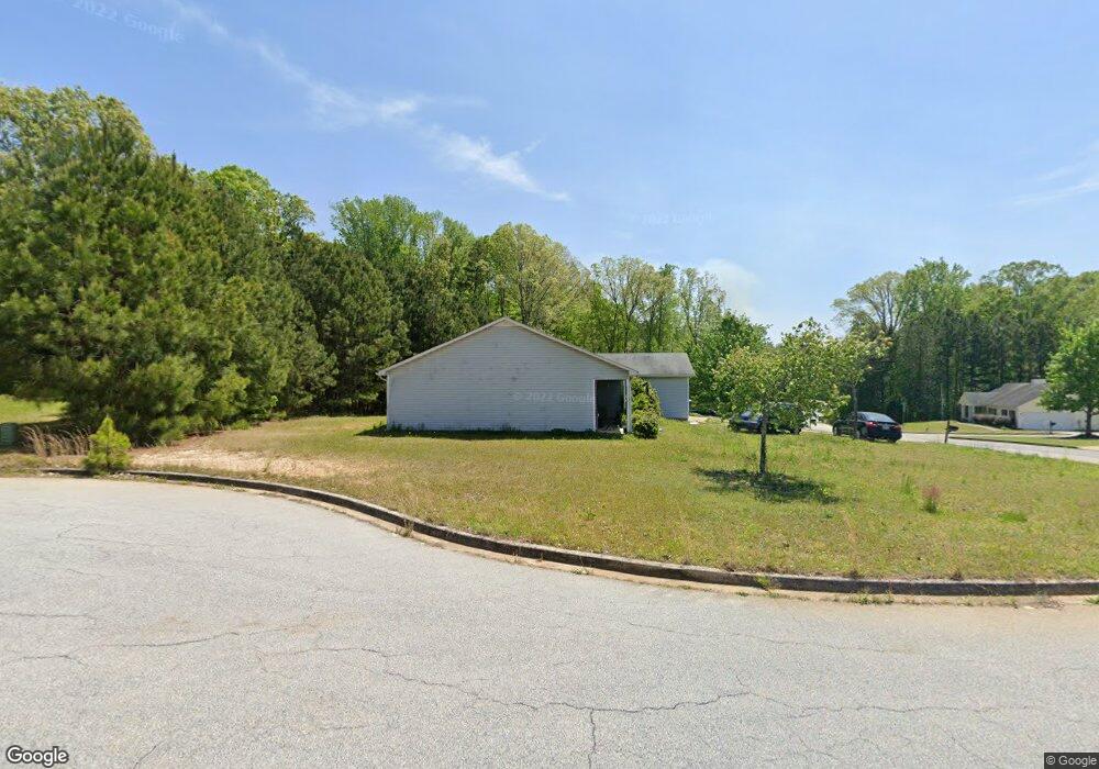
150 Railside Dr Covington, GA 30014
Estimated Value: $227,000 - $300,000
3
Beds
2
Baths
1,400
Sq Ft
$189/Sq Ft
Est. Value
About This Home
This home is located at 150 Railside Dr, Covington, GA 30014 and is currently estimated at $265,029, approximately $189 per square foot. 150 Railside Dr is a home located in Newton County with nearby schools including Heard-Mixon Elementary School, Cousins Middle School, and Eastside High School.
Ownership History
Date
Name
Owned For
Owner Type
Purchase Details
Closed on
Nov 29, 2023
Sold by
Tah 2017 1 Borrower Llc
Bought by
Tricon Sfr 2023 2 Borrower Llc
Current Estimated Value
Purchase Details
Closed on
Mar 11, 2016
Sold by
Mlb Brokers Llc
Bought by
Tah Holding Lp
Purchase Details
Closed on
Mar 9, 2016
Sold by
Covington Realty Investments Llc
Bought by
Mla Brokers Llc
Purchase Details
Closed on
Sep 8, 2011
Sold by
Rbc Real Estate Finance In
Bought by
Kadosh Maurice
Create a Home Valuation Report for This Property
The Home Valuation Report is an in-depth analysis detailing your home's value as well as a comparison with similar homes in the area
Home Values in the Area
Average Home Value in this Area
Purchase History
| Date | Buyer | Sale Price | Title Company |
|---|---|---|---|
| Tricon Sfr 2023 2 Borrower Llc | -- | -- | |
| Tah Holding Lp | $937,000 | -- | |
| Mla Brokers Llc | $767,100 | -- | |
| Kadosh Maurice | $462,000 | -- |
Source: Public Records
Tax History
| Year | Tax Paid | Tax Assessment Tax Assessment Total Assessment is a certain percentage of the fair market value that is determined by local assessors to be the total taxable value of land and additions on the property. | Land | Improvement |
|---|---|---|---|---|
| 2025 | $2,968 | $116,360 | $15,200 | $101,160 |
| 2024 | $2,797 | $107,560 | $15,200 | $92,360 |
| 2023 | $2,735 | $98,120 | $6,400 | $91,720 |
| 2022 | $2,078 | $73,920 | $6,400 | $67,520 |
| 2021 | $1,968 | $62,520 | $6,400 | $56,120 |
| 2020 | $1,715 | $48,960 | $6,400 | $42,560 |
| 2019 | $1,489 | $41,600 | $6,400 | $35,200 |
| 2018 | $1,181 | $32,360 | $5,000 | $27,360 |
| 2017 | $1,121 | $30,600 | $3,800 | $26,800 |
| 2016 | $1,096 | $29,880 | $3,710 | $26,170 |
| 2015 | $1,095 | $29,880 | $3,200 | $26,680 |
| 2014 | $1,091 | $29,880 | $0 | $0 |
Source: Public Records
Map
Nearby Homes
- 25 Scarlett Ct
- 324 Piper Rd
- 0 Piper Rd Unit 7693971
- 0 Piper Rd Unit 10659921
- 13268 Tolstoy Ln
- 10717 Highway 36
- 20 Kestrel Cir
- 370 Granary Walk
- 18 River Walk Farm Pkwy
- 7713 Fawn Cir
- 7713 Fawn Cir Unit 51
- 85 Bellerive Ln SE
- 7703 Fawn Cir
- 35 Crossbill Trail
- 10184 Malcolm Dr
- 60 Laurie Ln
- 10110 Malcolm Ct
- 0 Briarpatch Dr Unit 10562648
- 295 River Walk Farm Pkwy
- 344 Riverwalk Pkwy
- 140 Railside Dr
- 20 Scarlett Ct
- 155 Railside Dr
- 160 Railside Dr
- 130 Railside Dr
- 20 Carver Dr
- 175 Railside Dr
- 170 Railside Dr
- 15 Carver Dr
- 30 Carver Dr
- 120 Railside Dr
- 180 Railside Dr
- 35 Carver Dr
- 195 Railside Dr
- 30 Boxcar Ln
- 25 Sunbelt Pkwy Unit 25B, C; 35 B
- 25 Sunbelt Pkwy
- 110 Railside Dr
- 190 Railside Dr
- 45 Carver Dr
Your Personal Tour Guide
Ask me questions while you tour the home.