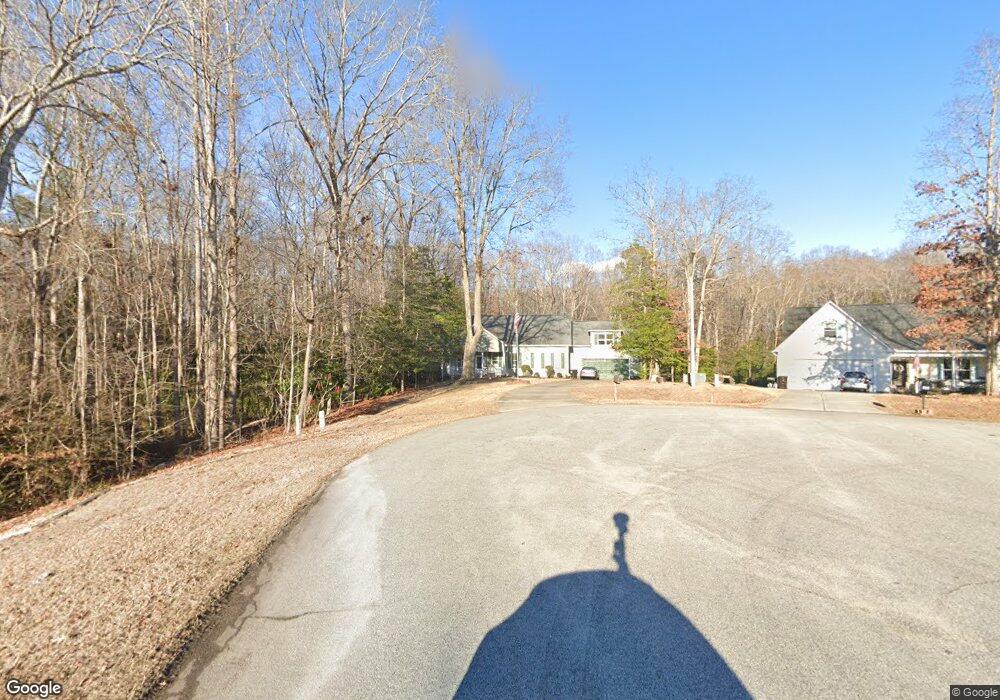
150 Robert Branch Cir Fuquay Varina, NC 27526
Estimated Value: $380,288 - $461,000
3
Beds
3
Baths
2,399
Sq Ft
$175/Sq Ft
Est. Value
About This Home
This home is located at 150 Robert Branch Cir, Fuquay Varina, NC 27526 and is currently estimated at $420,822, approximately $175 per square foot. 150 Robert Branch Cir is a home located in Harnett County with nearby schools including LaFayette Year-Round Elementary School, Harnett Central Middle School, and Harnett Central High School.
Ownership History
Date
Name
Owned For
Owner Type
Purchase Details
Closed on
Aug 7, 2020
Sold by
Carroll Brian Charles and Ridge Christine Rae
Bought by
Ridge Lisa
Current Estimated Value
Home Financials for this Owner
Home Financials are based on the most recent Mortgage that was taken out on this home.
Original Mortgage
$290,030
Outstanding Balance
$257,752
Interest Rate
3.1%
Mortgage Type
New Conventional
Estimated Equity
$163,070
Purchase Details
Closed on
Jun 25, 2009
Sold by
Hughes Gary Lynn and Hughes Barbara Gardner
Bought by
Carroll Brian Charles and Carroll Christine Rae
Home Financials for this Owner
Home Financials are based on the most recent Mortgage that was taken out on this home.
Original Mortgage
$223,300
Interest Rate
4.79%
Mortgage Type
VA
Create a Home Valuation Report for This Property
The Home Valuation Report is an in-depth analysis detailing your home's value as well as a comparison with similar homes in the area
Home Values in the Area
Average Home Value in this Area
Purchase History
| Date | Buyer | Sale Price | Title Company |
|---|---|---|---|
| Ridge Lisa | $299,000 | None Available | |
| Carroll Brian Charles | $240,000 | -- |
Source: Public Records
Mortgage History
| Date | Status | Borrower | Loan Amount |
|---|---|---|---|
| Open | Ridge Lisa | $290,030 | |
| Previous Owner | Carroll Brian Charles | $223,300 |
Source: Public Records
Tax History Compared to Growth
Tax History
| Year | Tax Paid | Tax Assessment Tax Assessment Total Assessment is a certain percentage of the fair market value that is determined by local assessors to be the total taxable value of land and additions on the property. | Land | Improvement |
|---|---|---|---|---|
| 2025 | $1,986 | $283,361 | $0 | $0 |
| 2024 | $1,986 | $283,361 | $0 | $0 |
| 2023 | $1,986 | $283,361 | $0 | $0 |
| 2022 | $1,887 | $283,361 | $0 | $0 |
| 2021 | $1,887 | $217,120 | $0 | $0 |
| 2020 | $15 | $217,120 | $0 | $0 |
| 2019 | $1,872 | $217,120 | $0 | $0 |
| 2018 | $1,872 | $217,120 | $0 | $0 |
| 2017 | $1,872 | $217,120 | $0 | $0 |
| 2016 | $1,982 | $230,350 | $0 | $0 |
| 2015 | $1,982 | $230,350 | $0 | $0 |
| 2014 | $1,982 | $230,350 | $0 | $0 |
Source: Public Records
Map
Nearby Homes
- 330 John Stark Dr
- 50 Artemas Ward Dr
- 47 Hadleigh Way
- 403 Saint Clair Dr
- 333 S Breeze Way
- 319 S Breeze Way
- 287 S Breeze Way
- 305 S Breeze Way
- 49 Brodhead Dr
- The Apex Plan at Ballard Road
- 645 Thomas Gage Dr
- 28 Saintsbury Dr
- 1891 Ballard Rd Unit 192
- Plan 1910 Modeled at Birchwood Trails
- Plan 2939 at Birchwood Trails
- Plan 2338 Modeled at Birchwood Trails
- Plan 2115 at Birchwood Trails
- Plan 1773 Modeled at Birchwood Trails
- Plan 3147 at Birchwood Trails
- Plan 2539 at Birchwood Trails
- 140 Robert Branch Cir
- 140 Robert Branch Cir Unit 20
- 125 Robert Branch Cir
- 120 Robert Branch Cir
- 90 Robert Branch Cir
- 95 Robert Branch Cir
- 74 Robert Branch Cir
- 5758 Us 401 N
- 5732 Us 401 N
- 278 Robert Howe Dr
- 54 Robert Branch Cir
- 5796 Us 401 N
- 5710 Us 401 N
- 71 Robert Branch Cir
- 5684 Us 401 N
- 34 Robert Branch Cir
- 205 Mill Branch Cir
- 51 Robert Branch Cir
- 5664 Us 401 N
- 12 Robert Branch Cir