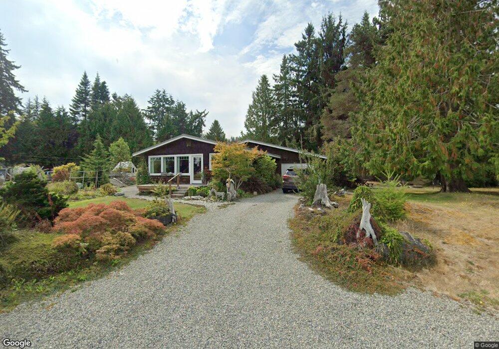
150 Shore Dr Port Ludlow, WA 98365
Estimated Value: $387,000 - $550,000
2
Beds
1
Bath
1,370
Sq Ft
$347/Sq Ft
Est. Value
About This Home
This home is located at 150 Shore Dr, Port Ludlow, WA 98365 and is currently estimated at $474,996, approximately $346 per square foot. 150 Shore Dr is a home located in Jefferson County with nearby schools including Chimacum Creek Primary School, Chimacum School Pi Program, and Chimacum Elementary School.
Ownership History
Date
Name
Owned For
Owner Type
Purchase Details
Closed on
Jan 29, 2009
Sold by
Deutsche Bank National Trust Co
Bought by
Read Keith and Read Katherine
Current Estimated Value
Purchase Details
Closed on
May 30, 2008
Sold by
Chadwick Michael Wayne
Bought by
Deutsche Bank Trust Co Americas
Create a Home Valuation Report for This Property
The Home Valuation Report is an in-depth analysis detailing your home's value as well as a comparison with similar homes in the area
Home Values in the Area
Average Home Value in this Area
Purchase History
| Date | Buyer | Sale Price | Title Company |
|---|---|---|---|
| Read Keith | -- | None Available | |
| Deutsche Bank Trust Co Americas | -- | None Available |
Source: Public Records
Tax History Compared to Growth
Tax History
| Year | Tax Paid | Tax Assessment Tax Assessment Total Assessment is a certain percentage of the fair market value that is determined by local assessors to be the total taxable value of land and additions on the property. | Land | Improvement |
|---|---|---|---|---|
| 2024 | $2,362 | $312,032 | $127,050 | $184,982 |
| 2023 | $2,362 | $292,573 | $116,000 | $176,573 |
| 2022 | $2,101 | $287,573 | $111,000 | $176,573 |
| 2021 | $2,226 | $224,364 | $93,600 | $130,764 |
| 2020 | $2,071 | $224,364 | $93,600 | $130,764 |
| 2019 | $1,968 | $201,476 | $85,800 | $115,676 |
| 2018 | $2,054 | $192,547 | $81,900 | $110,647 |
| 2017 | $2,004 | $178,588 | $78,000 | $100,588 |
| 2016 | $1,994 | $178,588 | $78,000 | $100,588 |
| 2015 | $1,965 | $177,268 | $73,000 | $104,268 |
| 2014 | -- | $177,268 | $73,000 | $104,268 |
| 2013 | -- | $177,270 | $73,000 | $104,270 |
Source: Public Records
Map
Nearby Homes
- 24 W Spruce St
- 0 Hill St
- 15 White Rock Ln
- 13 White Rock Ln
- 54 Ship View Ct
- 54 Ship View Ct Unit Port Ludlow WA 98365
- 90 Mccartney Ln
- 61 McCartney Peak Ln
- 61 McCartney Peak Ln Unit 73
- 0 xxx E Tala Shore Dr
- 644 & 634 Bywater Way
- 21 Mount Lena Ln
- 11 McCartney Peak Ln Unit 78
- 71 Mccartney Ln
- 51 McCartney Peak Ln Unit 74
- 306 Crestview Dr
- 71 McCartney Peak Ln Unit 72
- 90 McCartney Peak Ln Unit 70
- 60 McCartney Peak Ln Unit 67
- 713 Olympic Ridge Dr