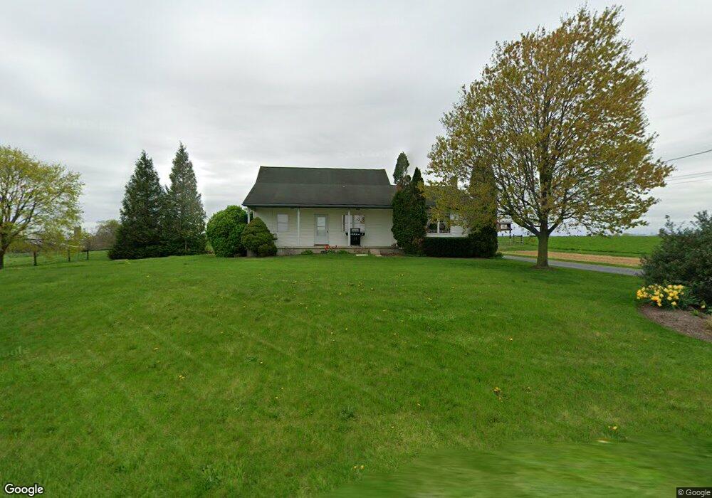
150 Snyder Dr New Holland, PA 17557
Estimated Value: $478,758 - $758,000
3
Beds
1
Bath
1,998
Sq Ft
$297/Sq Ft
Est. Value
About This Home
This home is located at 150 Snyder Dr, New Holland, PA 17557 and is currently estimated at $592,440, approximately $296 per square foot. 150 Snyder Dr is a home located in Lancaster County with nearby schools including Garden Spot Middle School, Garden Spot Senior High School, and Hinkletown Mennonite School.
Ownership History
Date
Name
Owned For
Owner Type
Purchase Details
Closed on
Oct 6, 2020
Sold by
Martin Noah S and Martin Minerva B
Bought by
Burkholder Elvin N and Burkholder Elva J
Current Estimated Value
Home Financials for this Owner
Home Financials are based on the most recent Mortgage that was taken out on this home.
Original Mortgage
$352,500
Outstanding Balance
$315,486
Interest Rate
3.25%
Mortgage Type
New Conventional
Estimated Equity
$276,954
Purchase Details
Closed on
Feb 8, 2007
Sold by
Hoover David M and Hoover Anna Z
Bought by
Martin Noah S and Martin Minerva B
Purchase Details
Closed on
Mar 21, 2006
Sold by
Martin Noah S and Martin Minerva B
Bought by
Hoover David M and Hoover Anna Z
Home Financials for this Owner
Home Financials are based on the most recent Mortgage that was taken out on this home.
Original Mortgage
$50,000
Interest Rate
6.32%
Mortgage Type
Seller Take Back
Create a Home Valuation Report for This Property
The Home Valuation Report is an in-depth analysis detailing your home's value as well as a comparison with similar homes in the area
Home Values in the Area
Average Home Value in this Area
Purchase History
| Date | Buyer | Sale Price | Title Company |
|---|---|---|---|
| Burkholder Elvin N | $470,000 | Land Transfer Co Inc | |
| Martin Noah S | $135,787 | None Available | |
| Hoover David M | $1,035,000 | None Available |
Source: Public Records
Mortgage History
| Date | Status | Borrower | Loan Amount |
|---|---|---|---|
| Open | Burkholder Elvin N | $352,500 | |
| Previous Owner | Hoover David M | $50,000 |
Source: Public Records
Tax History Compared to Growth
Tax History
| Year | Tax Paid | Tax Assessment Tax Assessment Total Assessment is a certain percentage of the fair market value that is determined by local assessors to be the total taxable value of land and additions on the property. | Land | Improvement |
|---|---|---|---|---|
| 2025 | $4,962 | $288,700 | $95,000 | $193,700 |
| 2024 | $4,962 | $288,700 | $95,000 | $193,700 |
| 2023 | $4,887 | $288,700 | $95,000 | $193,700 |
| 2022 | $4,833 | $288,700 | $95,000 | $193,700 |
| 2021 | $4,752 | $288,700 | $95,000 | $193,700 |
| 2020 | $4,752 | $288,700 | $95,000 | $193,700 |
| 2019 | $4,698 | $288,700 | $95,000 | $193,700 |
| 2018 | $7,023 | $288,700 | $95,000 | $193,700 |
| 2017 | $4,087 | $204,100 | $55,300 | $148,800 |
| 2016 | $4,087 | $204,100 | $55,300 | $148,800 |
| 2015 | $1,017 | $204,100 | $55,300 | $148,800 |
| 2014 | $2,877 | $204,100 | $55,300 | $148,800 |
Source: Public Records
Map
Nearby Homes
- 220 Sycamore Ln
- 41 Ashlea Village
- 322 Wissler Rd
- 144 W Conestoga St
- 148 E Broad St
- 20 N Kinzer Ave
- 227 Locust St
- 80 Diller Ave Unit 9
- 391 E Jackson St
- 385 Valley View Dr
- 406 Brimmer Ave
- 753 Walnut St
- 529 Ranck Rd Unit 1
- 529 Ranck Rd Unit 2
- 529 Ranck Rd Unit 3
- 529 Ranck Rd Unit 4
- 529 Ranck Rd Unit 5
- 529 Ranck Rd Unit 9
- 529 Ranck Rd Unit 6
- 529 Ranck Rd Unit 8
- 618 N Railroad Ave
- 653 N Railroad Ave
- 657 N Railroad Ave
- 661 N Railroad Ave
- 654 N Railroad Ave
- 663 N Railroad Ave
- 665 N Railroad Ave
- 574 N Railroad Ave
- 568 N Railroad Ave
- 703 N Railroad Ave
- 718 N Railroad Ave
- 525 N Railroad Ave
- 471 N Shirk Rd
- 449 N Shirk Rd
- 115 E Huyard Rd
- 521 N Railroad Ave
- 533 N Shirk Rd
- 519 N Railroad Ave
- 474 N Shirk Rd
- 528 N Shirk Rd